| Listing 1 - 10 of 35 | << page >> |
Sort by
|


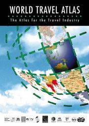
ISBN: 0946393958 0946393370 0946393486 0946393796 1902221168 1902221354 1902221567 1902221796 1902221931 Year: 2003 Publisher: Swanley Highbury Columbus Publishing
Abstract | Keywords | Export | Availability | Bookmark
 Loading...
Choose an application
- Reference Manager
- EndNote
- RefWorks (Direct export to RefWorks)
Tourism --- Geography --- atlassen --- toerisme --- 910 --- 912 <100> --- afstandentabellen en atlassen --- Cartografie. Kaarten. Plattegronden. Atlassen--Wereld. Internationaal. Alle landen gezamenlijk --- Annual reports --- Atlassen. --- Landen --- Toerisme. --- Encyclopediën. --- Reizen --- Atlassen --- Aardrijkskunde --- Politiek --- Atlas --- Maatschappij --- Film --- Ziekte --- Vliegen (werkwoord) --- Reizen (werkwoord)
Book
ISBN: 9059200845 Year: 2003 Publisher: Utrecht : Veltman,
Abstract | Keywords | Export | Availability | Bookmark
 Loading...
Choose an application
- Reference Manager
- EndNote
- RefWorks (Direct export to RefWorks)
"De wereld in kaart gebracht" beschrijft de zoektocht van de mensheid om de wereld in beeld te brengen aan de hand van ruim zeventig historische en moderne kaarten. Er zijn middeleeuwse kaarten die de locatie van het paradijs aanduiden en routekaarten voor pelgrims of kruisvaarders, kaarten die de eerste pogingen onthullen om grenzen tussen landen aan te geven en kaarten die de groeiende kennis van de wereld van de Europeanen in de zestiende en zeventiende eeuw weerspiegelen. Koloniale imperia werden in kaart gebracht. Tegenwoordig staat de cartografie voor nieuwe uitdagingen zoals: de London Underground map, het digitaal orthografisch project van New York State, de ozonlaag, El Niño, de oceaanbodem, topografie van Mars.
cartografie --- Geodesy. Cartography --- 912 <036> --- 912 <09> --- 528.9 --- geschiedenis --- kaarten --- aardrijkskunde --- Cartografie. Kaarten. Plattegronden. Atlassen--Gidsen. Inleidingen --- Cartografie. Kaarten. Plattegronden. Atlassen--Geschiedenis van ... --- Cartography. Mapping (textual documents) --- Geografie --- Cartografie --- Historische Cartografie. --- 528.9 Cartography. Mapping (textual documents) --- Cartografie. Kaarten. Plattegronden. Atlassen--Geschiedenis van .. --- Cartografie. Kaarten. Plattegronden. Atlassen--Geschiedenis van . --- Cartografie. Kaarten. Plattegronden. Atlassen--Geschiedenis van

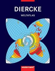
ISBN: 3141006008 Year: 1988 Publisher: Braunschweig : Westermann,
Abstract | Keywords | Export | Availability | Bookmark
 Loading...
Choose an application
- Reference Manager
- EndNote
- RefWorks (Direct export to RefWorks)
Atlases --- Atlas --- (084.4) --- 094239.jpg --- Tourism --- Atlases, German. --- #WAAR:didaktiek --- Atlassen
Multi
ISBN: 9020948539 9789020948530 Year: 2002 Publisher: Brussel Nationaal Geografisch Instituut
Abstract | Keywords | Export | Availability | Bookmark
 Loading...
Choose an application
- Reference Manager
- EndNote
- RefWorks (Direct export to RefWorks)
De cartografie die in dit boek gebruikt wordt verwierf in 2001 de prijs van de beste topografische kaarten ter wereld, uit handen van de International Cartographic Association. De echte stafkaarten bieden een overvloed aan uiterst precieze informatie: van autosnelwegen tot paden, beekjes, boomgaarden, hoogtelijnen en zelfs de exacte locatie van huizen... Voor het eerst in atlasvorm: de gloednieuwe, digitale 1:50.000-cartografie (1 cm = 500 m) van het Nationaal Geografisch Instituut van België.
Belgium --- Cartographie --- Topographie --- Belgique --- België --- Aardrijkskunde --- Atlassen. --- Atlas --- Géographie --- topography [image-making] --- België ; topografische kaarten --- 528.93 --- 912 <493> --- C3 --- België [land - BE] --- topografie --- atlassen --- 912 --- Topografie --- 910 --- toeristische topografie --- 528 ) Apparaten voor topografie --- 980.6 --- België - atlas --- België: atlassen --- België: topografie --- 528.93 Topographic cartography. Chorographic cartography (landscape cartography). Representation of place and space --- Topographic cartography. Chorographic cartography (landscape cartography). Representation of place and space --- Cartografie. Kaarten. Plattegronden. Atlassen--België --- Kunst en cultuur --- Atlassen --- Topografische kaarten --- afstandentabellen en atlassen --- Topographic maps --- Cartes topographiques --- Maps --- Cartes --- 983.5 --- topografie (ler) --- Topografische kaaart --- Belgium - Maps, Topographic --- België ; topografische kaarten --- Géographie --- Topografische kaart

ISBN: 0812104218 Year: 1975 Publisher: Philadelphia Lea and Febiger
Abstract | Keywords | Export | Availability | Bookmark
 Loading...
Choose an application
- Reference Manager
- EndNote
- RefWorks (Direct export to RefWorks)
Histology --- Histologie --- Atlases --- Atlas --- 611-018 --- 114 Original Color Plates and 207 Figures --- histochemistry --- histology (XIII.) MEDICINE (XIX.) --- histology (XIII.) --- Note --- Prim --- Sect --- Human histology. Human cytology --- Atlases. --- atlassen. --- Atlassen.
Book
ISBN: 0723002657 9780723002659 Year: 1987 Publisher: London : London : Bartholomew & Son, Times books,
Abstract | Keywords | Export | Availability | Bookmark
 Loading...
Choose an application
- Reference Manager
- EndNote
- RefWorks (Direct export to RefWorks)
#C9302 --- Atlases, British. --- Atlases --- Atlases, British --- Atlases. --- Atlas --- Aardrijkskunde (Wereld-). Atlas. --- Géographie. Atlas. --- Géographie universelle. Atlas. --- Aardrijkskunde. Atlassen.
Book
ISBN: 9068252089 9061526108 9058261344 9068252666 9058262294 Year: 1998 Publisher: Leuven Davidsfonds
Abstract | Keywords | Export | Availability | Bookmark
 Loading...
Choose an application
- Reference Manager
- EndNote
- RefWorks (Direct export to RefWorks)
World history --- Geschiedenis ; atlassen --- Historical geography --- Cartes --- #GGSB: Geschiedenis (Europa) --- #GGSB: Geschiedenis (Moderne Tijd) --- #GGSB: Geschiedenis (niet Europees) --- #GGSB: Geschiedenis (oudheid) --- 900.6 --- Geschiedenis --- Atlassen --- Internationalisering --- Geschiedenis: algemeen --- geschiedenis --- 930.9 --- 912 --- geschiedenisatlassen --- wereldgeschiedenis --- atlassen --- historische atlas (ler) --- historische atlassen, kaarten en plattegronden --- Wereldgeschiedenis --- geschiedenis: atlas --- Atlas --- Geneeskunde --- Techniek (wetenschap) --- Museum --- Geschiedenis (Europa) --- Geschiedenis (Moderne Tijd) --- Geschiedenis (niet Europees) --- Geschiedenis (oudheid) --- overzicht --- #A0212H --- 900 --- historische atlas --- geschiedenis algemeen --- histoire généralités --- C3 --- Kunst en cultuur --- geschiedenis.
Periodical
ISSN: 03085694 14797801 Publisher: Amsterdam : Imago mundi,
Abstract | Keywords | Export | Availability | Bookmark
 Loading...
Choose an application
- Reference Manager
- EndNote
- RefWorks (Direct export to RefWorks)
Imago Mundi is the only English-language scholarly periodical devoted exclusively to the history of pre-modern maps, mapping, and map-related ideas from anywhere in the world. It was founded in Berlin in 1935 by the Russian émigré Leo Bagrow as an annual publication, although only five volumes appeared between 1935 and 1948. From 1975 to 2003 publication was regular. In 2004 Imago Mundi became a biannual publication. The first volume was in German. Thereafter English was used with, very occasionally, French. After 2002 (volume 54) Imago Mundi publishes exclusively in English with foreign language abstracts (currently French, German, and Spanish). A multi-disciplinary approach was adopted in 1995. All articles represent original research, are refereed, and are well illustrated (recent volumes have included color plates). Since 1977 each volume has contained a full complement of scholarly aids in the form of book reviews, bibliography, and chronicles, all of which have made Imago Mundi a valuable journal of record as well as scholarship.
cartografie --- Cartography --- Early maps --- Cartographie --- Cartes anciennes --- Architecture, Fine and Decorative Arts. --- Arts and Humanities. --- Arts and Humanities --- Earth Sciences --- Architecture, Fine and Decorative Arts --- History --- Geodesy. Cartography --- 912 <09> --- 912 <05> --- Cartografie. Kaarten. Plattegronden. Atlassen--Geschiedenis van ... --- Cartografie. Kaarten. Plattegronden. Atlassen--Tijdschriften --- Periodicals --- Cartography. --- Early maps. --- History (General) --- Geography & Cartography. --- Maps, Early --- Geography --- Cartography, Primitive --- Chartography --- Map-making --- Mapmaking --- Mapping (Cartography) --- Mathematical geography --- Surveying --- Map projection --- Maps --- cartography [discipline] --- Cartografie. Kaarten. Plattegronden. Atlassen--Geschiedenis van .. --- Cartografie. Kaarten. Plattegronden. Atlassen--Geschiedenis van . --- Cartografie. Kaarten. Plattegronden. Atlassen--Geschiedenis van --- Cartography - Periodicals. --- Early maps - Periodicals. --- Cartographie - Périodiques. --- Cartes anciennes - Périodiques.
Book
ISBN: 9780956606600 0956606601 Year: 2010 Publisher: Bromley : Columbus travel media,
Abstract | Keywords | Export | Availability | Bookmark
 Loading...
Choose an application
- Reference Manager
- EndNote
- RefWorks (Direct export to RefWorks)
Now in its eleventh edition and available worldwide, the World Travel Atlas is designed for those who want to learn more about our world, as well as those in the travel trade who require the ultimate training publication. It is an invaluable reference tool for anyone looking for clear, accurate and topical global information. A conventional set of world map plates is augmented by numerous focus maps showing areas of particular interest to tourists, letting you zoom in on the regions where detailed coverage is needed. There are also more than 70 thematic maps, many statistical charts and tables, appendices and a comprehensive index, together with a new 'Countries A-Z' section. Every page has been revised and updated since the 2006 edition, with many maps being redrawn. From the team that publish www.worldtravelguide.net
Tourism --- Geography --- Atlassen --- Landen --- Reisgidsen --- encyclopedieën --- Atlassen. --- Reisgidsen. --- encyclopedieën. --- Encyclopedieën. --- Travel --- Tourist maps --- Atlases --- Atlases as Topic --- 375.1 --- atlas --- wereld --- Atlases as Topics --- Geographic atlases --- Geographical atlases --- World atlases --- World geographic atlases --- Cartographic materials --- Reference books --- Maps, Tourist --- Maps --- Voyages and travels --- toerisme - recht --- 910 --- afstandentabellen en atlassen --- toerisme - duurzaamheid, ethiek, geschiedenis, geografie, geotoerisme, globalisering, invloeden, klimaatverandering, recreatie, reismotivatie, toerisme beleid, toeristisch Engels, toeristisch recht, toerisme theorie, toerisme en armoede, toeristische woordenboeken en transport in toerisme

ISBN: 0898625890 Year: 1995 Publisher: New York, N.Y. Guilford
Abstract | Keywords | Export | Availability | Bookmark
 Loading...
Choose an application
- Reference Manager
- EndNote
- RefWorks (Direct export to RefWorks)
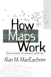
This book is the first systematic integration of cognitive and semiotic approaches to understanding maps as powerful, abstract, and synthetic spatial representations. Presenting a perspective built on four decades of cartographic research, it explores how maps work at multiple levels--from the cognitive to the societal--and provides a cohesive picture of how the many representational choices inherent in mapping interact with the processing of information and construction of knowledge. «MDUL»«MDNM»Utilizing this complex perspective, the author shows how the insights derived from a better understanding of maps can be used in future map design. Although computers now provide the graphic tools to produce maps of similar or better quality than previous manual techniques, they seldom incorporate the conceptual tools needed to make informed symbolization and design decisions. The search for these conceptual tools is the basis for «MDUL»How Maps Work«MDNM».
Geodesy. Cartography --- Cartography. --- Cartographie --- 912 --- Cartography --- Cartography, Primitive --- Chartography --- Map-making --- Mapmaking --- Mapping (Cartography) --- Mathematical geography --- Surveying --- Map projection --- Maps --- Cartografie. Kaarten. Plattegronden. Atlassen --- Geografie --- Cartografie --- Thematische Visualisatie.
| Listing 1 - 10 of 35 | << page >> |
Sort by
|

 Search
 Feedback
 About UniCat
  Help
Help News
News