| Listing 1 - 10 of 26 | << page >> |
Sort by
|
Periodical
ISSN: 10599630 Publisher: Materials Park, Ohio ASM International
Abstract | Keywords | Export | Availability | Bookmark
 Loading...
Choose an application
- Reference Manager
- EndNote
- RefWorks (Direct export to RefWorks)
Chemical technology --- Thermodynamics --- Fluid mechanics --- Metal spraying --- Plasma spraying --- Métallisation au pistolet --- Projection au plasma --- Periodicals. --- Périodiques --- Métallisation au pistolet. --- Projection au plasma. --- Periodicals --- Material Science and Metallurgy --- Coatings and Films --- Treatment & Finishing --- thermodynamica
Book
ISBN: 9026309473 9789026309472 Year: 1989 Publisher: Baarn: Ambo,
Abstract | Keywords | Export | Availability | Bookmark
 Loading...
Choose an application
- Reference Manager
- EndNote
- RefWorks (Direct export to RefWorks)
Affective and dynamic functions --- Social perception --- Projection (Psychology) --- Interpersonal relations --- Self-realization --- #GSDBP --- Psychologie : algemeen --- Relatie / relatievorming
Book
ISBN: 0853127263 0853127220 Year: 1986 Publisher: New York Wiley
Abstract | Keywords | Export | Availability | Bookmark
 Loading...
Choose an application
- Reference Manager
- EndNote
- RefWorks (Direct export to RefWorks)
Differential geometry. Global analysis --- Geometry, Descriptive --- Géométrie descriptive --- Projection --- Géométrie descriptive --- Descriptive geometry --- Geometrical drawing

ISBN: 0898625890 Year: 1995 Publisher: New York, N.Y. Guilford
Abstract | Keywords | Export | Availability | Bookmark
 Loading...
Choose an application
- Reference Manager
- EndNote
- RefWorks (Direct export to RefWorks)
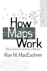
This book is the first systematic integration of cognitive and semiotic approaches to understanding maps as powerful, abstract, and synthetic spatial representations. Presenting a perspective built on four decades of cartographic research, it explores how maps work at multiple levels--from the cognitive to the societal--and provides a cohesive picture of how the many representational choices inherent in mapping interact with the processing of information and construction of knowledge. «MDUL»«MDNM»Utilizing this complex perspective, the author shows how the insights derived from a better understanding of maps can be used in future map design. Although computers now provide the graphic tools to produce maps of similar or better quality than previous manual techniques, they seldom incorporate the conceptual tools needed to make informed symbolization and design decisions. The search for these conceptual tools is the basis for «MDUL»How Maps Work«MDNM».
Geodesy. Cartography --- Cartography. --- Cartographie --- 912 --- Cartography --- Cartography, Primitive --- Chartography --- Map-making --- Mapmaking --- Mapping (Cartography) --- Mathematical geography --- Surveying --- Map projection --- Maps --- Cartografie. Kaarten. Plattegronden. Atlassen --- Geografie --- Cartografie --- Thematische Visualisatie.
Periodical
ISSN: 00802085 26633981 Year: 1952 Publisher: Buenos Aires : Instituto Panamericano de Geografía e Historia
Abstract | Keywords | Export | Availability | Bookmark
 Loading...
Choose an application
- Reference Manager
- EndNote
- RefWorks (Direct export to RefWorks)
Cartography --- Cartography. --- CARTOGRAFIA --- CARTOGRAPHY. --- MEXICO. --- PUBLICACIONES PERIODICAS. --- Earth Sciences --- Geography --- Periodicals --- cartography --- maps --- geodesy --- geographic information --- geographic information technologies --- geographic data --- Cartography, Primitive --- Chartography --- Map-making --- Mapmaking --- Mapping (Cartography) --- Mathematical geography --- Surveying --- Map projection --- Maps
Book
ISBN: 9780273722793 0273722794 9781138138261 1138138266 Year: 2015 Publisher: London: Routledge,
Abstract | Keywords | Export | Availability | Bookmark
 Loading...
Choose an application
- Reference Manager
- EndNote
- RefWorks (Direct export to RefWorks)
Information systems --- Geodesy. Cartography --- GIS --- cartografie --- geodata --- gis --- topografie (landmeetkunde) --- geovisualisatie --- (zie ook: geografisch informatiesysteem) --- Thematische Visualisatie. --- Cartography. --- Geografie --- Cartografie --- Cartography --- Cartography, Primitive --- Chartography --- Map-making --- Mapmaking --- Mapping (Cartography) --- Mathematical geography --- Surveying --- Map projection --- Maps

ISBN: 0679738258 Year: 1991 Publisher: New York Pantheon Books
Abstract | Keywords | Export | Availability | Bookmark
 Loading...
Choose an application
- Reference Manager
- EndNote
- RefWorks (Direct export to RefWorks)
Economic policy and planning (general) --- Economic forecasting --- Economische vooruitzichten --- Perspective économique --- Projection économique --- Prévision économique --- Prévisions économiques --- Economic history --- -World politics --- -Colonialism --- Global politics --- International politics --- Political history --- Political science --- World history --- Eastern question --- Geopolitics --- International organization --- International relations --- Economic conditions --- History, Economic --- Economics --- Forecasting --- Economic indicators --- Economic forecasting. --- World politics --- -Economic forecasting --- -Economics --- Colonialism --- 1971 --- 1985-1995
Book
ISBN: 9022202747 Year: 1981 Publisher: Amsterdam Van Hoeve
Abstract | Keywords | Export | Availability | Bookmark
 Loading...
Choose an application
- Reference Manager
- EndNote
- RefWorks (Direct export to RefWorks)
Cartography --- -Cartography, Primitive --- Chartography --- Map-making --- Mapmaking --- Mapping (Cartography) --- Mathematical geography --- Surveying --- Map projection --- Maps --- History --- Amsterdam (Netherlands) --- -Amsterdam (Netherlands) --- -Amesterdão (Netherlands) --- Amstelodamum (Netherlands) --- Amstelaedamum (Netherlands) --- Amstelredamum (Netherlands) --- Amsterodamum (Netherlands) --- Amstelrodamum (Netherlands) --- Biography --- -Early works to 1800 --- Geodesy. Cartography --- Garde civique --- anno 1600-1699 --- anno 1700-1799 --- Amsterdam --- -History --- -Biography
Book
ISBN: 9780226591452 Year: 2020 Publisher: Chicago London The University of Chicago Press
Abstract | Keywords | Export | Availability | Bookmark
 Loading...
Choose an application
- Reference Manager
- EndNote
- RefWorks (Direct export to RefWorks)
"Rome may be renowned for individual sites like the Colosseum and St. Peter's Basilica, but its most captivating feature is its many overlapping-and surviving-layers of history. Over nearly 3,000 years, the Rome of the Caesars has given way to the Rome of the Popes, the Rome of the Grand Tourists, and several more incarnations down to the present. Along the way, it has also become perhaps the most frequently mapped city on the planet. This book is the first ever published to English to tell the story of Rome through its maps. Each chapter begins with a brief historical overview of one key era and features a selection of maps, details, digitizations, and other images-all produced in full color-that illuminate the themes of that era. From the city's first walls through its master plan for its third millennium, the Romes depicted in these maps all live on in the city that millions still visit and inhabit today"--
Geodesy. Cartography --- Iconography --- History of Italy --- Rome --- Cartography --- Rome (Italy) --- Geography. --- Environmental planning --- Rome (Italy : Commune) --- Rome (Italy : Governatorato) --- Rūmah (Italy) --- Roma (Italy) --- Rom (Italy) --- Rím (Italy) --- Rzym (Italy) --- Comune di Roma (Italy) --- Cartography, Primitive --- Chartography --- Map-making --- Mapmaking --- Mapping (Cartography) --- Mathematical geography --- Surveying --- Map projection --- Maps --- Rome (Italy : Comune)
Periodical
ISSN: 03085694 14797801 Publisher: Amsterdam : Imago mundi,
Abstract | Keywords | Export | Availability | Bookmark
 Loading...
Choose an application
- Reference Manager
- EndNote
- RefWorks (Direct export to RefWorks)
Imago Mundi is the only English-language scholarly periodical devoted exclusively to the history of pre-modern maps, mapping, and map-related ideas from anywhere in the world. It was founded in Berlin in 1935 by the Russian émigré Leo Bagrow as an annual publication, although only five volumes appeared between 1935 and 1948. From 1975 to 2003 publication was regular. In 2004 Imago Mundi became a biannual publication. The first volume was in German. Thereafter English was used with, very occasionally, French. After 2002 (volume 54) Imago Mundi publishes exclusively in English with foreign language abstracts (currently French, German, and Spanish). A multi-disciplinary approach was adopted in 1995. All articles represent original research, are refereed, and are well illustrated (recent volumes have included color plates). Since 1977 each volume has contained a full complement of scholarly aids in the form of book reviews, bibliography, and chronicles, all of which have made Imago Mundi a valuable journal of record as well as scholarship.
cartografie --- Cartography --- Early maps --- Cartographie --- Cartes anciennes --- Architecture, Fine and Decorative Arts. --- Arts and Humanities. --- Arts and Humanities --- Earth Sciences --- Architecture, Fine and Decorative Arts --- History --- Geodesy. Cartography --- 912 <09> --- 912 <05> --- Cartografie. Kaarten. Plattegronden. Atlassen--Geschiedenis van ... --- Cartografie. Kaarten. Plattegronden. Atlassen--Tijdschriften --- Periodicals --- Cartography. --- Early maps. --- History (General) --- Geography & Cartography. --- Maps, Early --- Geography --- Cartography, Primitive --- Chartography --- Map-making --- Mapmaking --- Mapping (Cartography) --- Mathematical geography --- Surveying --- Map projection --- Maps --- cartography [discipline] --- Cartografie. Kaarten. Plattegronden. Atlassen--Geschiedenis van .. --- Cartografie. Kaarten. Plattegronden. Atlassen--Geschiedenis van . --- Cartografie. Kaarten. Plattegronden. Atlassen--Geschiedenis van --- Cartography - Periodicals. --- Early maps - Periodicals. --- Cartographie - Périodiques. --- Cartes anciennes - Périodiques.
| Listing 1 - 10 of 26 | << page >> |
Sort by
|

 Search
 Feedback
 About UniCat
  Help
Help News
News