| Listing 1 - 5 of 5 |
Sort by
|
Book
ISBN: 0128191538 012819152X 9780128191538 9780128191521 Year: 2022 Publisher: Amsterdam : Elsevier,
Abstract | Keywords | Export | Availability | Bookmark
 Loading...
Choose an application
- Reference Manager
- EndNote
- RefWorks (Direct export to RefWorks)
Artificial satellites in earth sciences. --- Artificial satellites in remote sensing. --- Atmosphere --- Remote sensing. --- Atmospheric science --- Remote sensing --- Earth sciences
Book
Year: 1994 Publisher: Brussels : Federal office for scientific, technical and cultural affairs,
Abstract | Keywords | Export | Availability | Bookmark
 Loading...
Choose an application
- Reference Manager
- EndNote
- RefWorks (Direct export to RefWorks)
Astronautics --- Aerospace engineering --- Space sciences --- Research in reduced gravity environments. --- Astrophysics --- Image processing. --- Artificial satellites in earth sciences. --- Research --- Research.

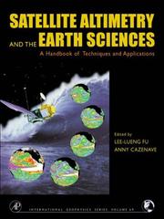
ISBN: 9780122695452 0122695453 9786611059040 1281059048 0080516580 9780080516585 Year: 2001 Publisher: San Diego, CA : Academic,
Abstract | Keywords | Export | Availability | Bookmark
 Loading...
Choose an application
- Reference Manager
- EndNote
- RefWorks (Direct export to RefWorks)
The new level of precision and global coverage provided by satellite altimetry is rapidly advancing studies of ocean circulation. It allows for new insights into marine geodesy, ice sheet movements, plate tectonics, and for the first time provides high-resolution bathymetry for previously unmapped regions of our watery planet and crucial information on the large-scale ocean features on intra-season to interannual time scales. Satellite Altimetry and Earth Sciences has integrated the expertise of the leading international researchers to demonstrate the techniques, missions, and accuracy
Altitudes --- Measurement --- Remote sensing --- Satellite geodesy --- Technique --- Earth sciences --- Artificial satellites in earth sciences. --- Satellite geodesy. --- Oceanography --- Artificial satellites in geodesy --- Geodesy --- Geodetic satellites --- Remote sensing.

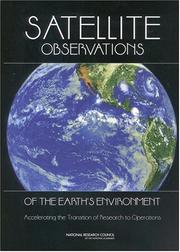
ISBN: 030908749X 9786610180073 1280180072 0309524628 9780309524629 0309507820 9780309507820 9780309087490 0309168260 9780309168267 9781280180071 6610180075 Year: 2003 Publisher: Washington, D.C. National Academies Press
Abstract | Keywords | Export | Availability | Bookmark
 Loading...
Choose an application
- Reference Manager
- EndNote
- RefWorks (Direct export to RefWorks)
Artificial satellites in earth sciences. --- Artificial satellites in remote sensing. --- Environmental sciences --- Environmental Sciences and Forestry. Remote Sensing and Geographical Information Systems --- Remote sensing --- Technological innovations. --- Remote Sensing --- Remote Sensing. --- Environmental science --- Earth sciences --- Science
Book
ISBN: 3030570851 3030570843 Year: 2021 Publisher: Springer International Publishing
Abstract | Keywords | Export | Availability | Bookmark
 Loading...
Choose an application
- Reference Manager
- EndNote
- RefWorks (Direct export to RefWorks)
This book summarizes the author’s research resulted in developing the satellite radiothermovision approach which allows retrieving dynamical and energy characteristics of atmospheric mesoscale and synoptic-scale processes based on a close scheme of satellite passive radiometry data processing. The book introduces new applications of the satellite passive microwave observations to detailed systematic study of tropical cyclones’ evolution, climatology and characteristics of atmospheric river, parameters of global atmospheric circulation and their variations on climatically significant scales. The results presented in the book demonstrate a clear relation between the convergence/divergence of latent heat from the lower atmosphere to the center of tropical cyclone with variations of its intensity and provide a better insight into the tropical cyclone dynamical energy balance based on remote data. .
Remote sensing. --- Geophysics. --- Environmental monitoring. --- Remote Sensing/Photogrammetry. --- Geophysics and Environmental Physics. --- Monitoring/Environmental Analysis. --- Biomonitoring (Ecology) --- Ecological monitoring --- Environmental quality --- Monitoring, Environmental --- Applied ecology --- Environmental engineering --- Pollution --- Geological physics --- Terrestrial physics --- Earth sciences --- Physics --- Remote-sensing imagery --- Remote sensing systems --- Remote terrain sensing --- Sensing, Remote --- Terrain sensing, Remote --- Aerial photogrammetry --- Aerospace telemetry --- Detectors --- Space optics --- Measurement --- Monitoring --- Satellite meteorology. --- Artificial satellites in earth sciences. --- Artificial satellites in meteorology --- Meteorology --- Meteorological satellites
| Listing 1 - 5 of 5 |
Sort by
|

 Search
 Feedback
 About UniCat
  Help
Help News
News