| Listing 1 - 6 of 6 |
Sort by
|
Book
ISBN: 9781589482074 Year: 2011 Publisher: Redlands, Calif. ESRI Press
Abstract | Keywords | Export | Availability | Bookmark
 Loading...
Choose an application
- Reference Manager
- EndNote
- RefWorks (Direct export to RefWorks)
Computer. Automation --- ArcGIS. --- Geographic information systems. --- Spatial analysis (Statistics). --- PHL-Bio 13 --- informatica --- Geographical information systems --- ArcGIS

ISBN: 158948083X Year: 2004 Publisher: Redlands, Calif. : ESRI Press,
Abstract | Keywords | Export | Availability | Bookmark
 Loading...
Choose an application
- Reference Manager
- EndNote
- RefWorks (Direct export to RefWorks)
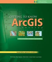
With revised material and new exercises based on ArcGIS version 9, this updated work acquaints geographers and GIS professionals with the principles of GIS as it teaches the mechanics of using ArcGIS software. Conceptual material is followed by scripted software exercises. Necessary GIS skills are presented in a variety of areas--map symbology, data overlay, map projection, and data conversion--as the making of maps and the analysis of geographic data is conceptualized. Spatial modeling exercises using the Model Builder technology of ArcGIS version 9 are also provided. Other topics covered include organizing data, planning a GIS project, creating derived data, and presenting results.

ISBN: 1589480740 Year: 2004 Publisher: Redlands (Calif.) : ESRI,
Abstract | Keywords | Export | Availability | Bookmark
 Loading...
Choose an application
- Reference Manager
- EndNote
- RefWorks (Direct export to RefWorks)
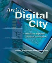
Both a textbook for GIS classes in urban planning and a workbook for local governments, this book shows how to do real tasks that are required when a city decides to go digital and use geographic information systems (GIS) to store and access information. With this book, planners, analysts, and other local government staff use data from a real city to perform tasks such as creating buildings and parcels, setting coordinate systems, and building geodatabase topology. After creating a geodatabase, working with attribute data, and geocoding data, planners will be able to perform spatial analysis to find possible drug houses near playgrounds, find buildable vacant lots, produce land use reports, and more.
City planning --- Geografie --- Geographic information systems. --- Graphical user interfaces (Computer systems). --- Local government --- Data processing. --- Geografische Informatie Systemen --- Toepassingen. --- ArcGIS.
Book
ISBN: 9781589484993 1589484991 Year: 2020 Publisher: Redlands, California : Esri Press,
Abstract | Keywords | Export | Availability | Bookmark
 Loading...
Choose an application
- Reference Manager
- EndNote
- RefWorks (Direct export to RefWorks)
"The definitive, easy-to-follow guide to writing Python code with spatial data in ArcGIS Pro, whether you're new to programming or not. This book starts with the basics, then covers how to write scripts that work with spatial data in ArcGIS Pro, including executing tools in Python, describing data, and manipulating and creating data, as well as a number of more specialized tasks. Lastly, you will learn how to create a tool out of your script and how to share your tool with others. By the end, you will be able to create custom tools that use Python scripting to automate basic tasks in ArcGIS Pro. Helpful review questions, keywords, and "points to remember" are included at the end of each chapter. Corresponding data and exercises are available online. This comprehensive, hands-on book is a must for learning the versatility of Python coding as an approach to solving problems. Some of the key topics in this book include: Python language fundamentals Automating geoprocessing tasks Exploring and manipulating spatial and tabular data Working with Geometries and rasters Map scripting Debugging and error handling Creating functions and classes Creating and sharing script tools ArcGIS API for Python"--
Geographic information systems --- Graphical user interfaces (Computer systems) --- Python (Computer program language) --- 528.8 --- Geographical information systems --- GIS (Information systems) --- Information storage and retrieval systems --- Scripting languages (Computer science) --- GUIs (Computer systems) --- User interfaces (Computer systems) --- Geography --- ArcGIS. --- Geographic information systems. --- Graphical user interfaces (Computer systems). --- Python (Computer program language). --- Système d'information géographique. --- Interfaces graphiques (informatique) --- Python (langage de programmation) --- ArcGIS
Book
ISBN: 3038979554 3038979546 Year: 2019 Publisher: MDPI - Multidisciplinary Digital Publishing Institute
Abstract | Keywords | Export | Availability | Bookmark
 Loading...
Choose an application
- Reference Manager
- EndNote
- RefWorks (Direct export to RefWorks)
Geomorphometry is the science of quantitative terrain characterization and analysis, and has traditionally focused on the investigation of terrestrial and planetary landscapes. However, applications of marine geomorphometry have now moved beyond the simple adoption of techniques developed for terrestrial studies, driven by the rise in the acquisition of high-resolution seafloor data and by the availability of user-friendly spatial analytical tools. Considering that the seafloor represents 71% of the surface of our planet, this is an important step towards understanding the Earth in its entirety.This volume is the first one dedicated to marine applications of geomorphometry. It showcases studies addressing the five steps of geomorphometry: sampling a surface (e.g., the seafloor), generating a Digital Terrain Model (DTM) from samples, preprocessing the DTM for subsequent analyses (e.g., correcting for errors and artifacts), deriving terrain attributes and/or extracting terrain features from the DTM, and using and explaining those terrain attributes and features in a given context. Throughout these studies, authors address a range of challenges and issues associated with applying geomorphometric techniques to the complex marine environment, including issues related to spatial scale, data quality, and linking seafloor topography with physical, geological, biological, and ecological processes. As marine geomorphometry becomes increasingly recognized as a sub-discipline of geomorphometry, this volume brings together a collection of research articles that reflect the types of studies that are helping to chart the course for the future of marine geomorphometry.
geomorphology --- simulation --- accuracy --- spatial scale --- marine geomorphology --- surface roughness --- forage fish --- satellite imagery --- thalwegs --- digital elevation models (DEMs) --- Seabed 2030 --- Pacific sand lance --- Acoustic applications --- python --- Nippon Foundation/GEBCO --- Oceanic Shoals Australian Marine Park --- submarine topography --- multi beam echosounder --- sedimentation --- bedforms --- carbonate banks --- polychaete --- cold-water coral --- multiscale --- automated-mapping --- semi-automated mapping --- sediment habitats --- Atlantic Ocean --- Northwestern Australia --- random forest --- benthic habitat mapping --- paleoclimate --- submerged glacial bedforms --- seafloor --- currents --- Cenomanian–Turonian --- Multibeam bathymetry --- geomorphometry --- ArcGIS --- filter --- seabed mapping --- coral reefs --- eastern Brazilian shelf --- digital terrain analysis --- multibeam spatial resolution --- multibeam --- multibeam sonar --- Timor Sea --- seafloor geomorphometry --- shelf-slope-rise --- terrain analysis --- seafloor mapping technologies --- spatial analysis --- Canary Basin --- paleobathymetry --- Bonaparte Basin --- pockmarks --- benthic habitats --- Malin Basin --- geographic object-based image analysis --- seafloor mapping standards and protocols --- GIS --- Bering Sea --- object segmentation --- Barents Sea --- bathymetry --- carbonate mound --- underwater acoustics --- integration artefacts --- multibeam echosounder --- domes --- global bathymetry --- Random Forests --- North Sea --- spatial prediction --- Glaciated Margin --- marine geology --- image segmentation --- shelf morphology --- Alaska --- paleoceanography --- confidence --- swath geometry --- volcanoes --- deglaciation --- Cretaceous --- DEM --- habitat mapping --- marine remote sensing --- reconstruction --- acoustic-seismic profiling --- canyons
Book
ISBN: 3036557148 303655713X Year: 2022 Publisher: Basel MDPI - Multidisciplinary Digital Publishing Institute
Abstract | Keywords | Export | Availability | Bookmark
 Loading...
Choose an application
- Reference Manager
- EndNote
- RefWorks (Direct export to RefWorks)
This special issue aims to contribute to the climate actions which called for the need to address Greenhouse Gas (GHG) emissions, keeping global warming to well below 2°C through various means, including accelerating renewables, clean fuels, and clean technologies into the entire energy system. As long as fossil fuels (coal, gas and oil) are still used in the foreseeable future, it is vital to ensure that these fossil fuels are used cleanly through abated technologies. Financing the clean and energy transition technologies is vital to ensure the smooth transition towards net zero emission by 2050 or beyond. The lack of long‐term financing, the low rate of return, the existence of various risks, and the lack of capacity of market players are major challenges to developing sustainable energy systems.This special collected 17 high-quality empirical studies that assess the challenges for developing secure and sustainable energy systems and provide practical policy recommendations. The editors of this special issue wish to thank the Economic Research Institute for ASEAN and East Asia (ERIA) for funding several papers that were published in this special issue.
Research & information: general --- Physics --- industrial energy intensity --- pollution emission intensity --- quantile DID method --- Beijing–Tianjin–Hebei coordinated development --- China --- environmental Kuznets curve --- CO2 emission --- energy efficiency --- economic growth --- panel ARDL --- DEA --- energy transition --- renewables --- hydrogen --- fossil fuels --- emissions --- FDIA --- blockchain --- data exchanging --- under-operating agents --- ISO --- electricity market --- Saudi Arabia --- energy sustainability --- world energy trilemma index --- Bayesian Belief Network --- green technology --- sustainability --- climate change --- Southeast Asia --- energy policy --- high-efficiency --- low-emission --- carbon dioxide emissions --- carbon pricing --- subcritical --- desulphurization --- denitrification --- cost–benefit analysis --- levelized cost of electricity --- energy supply security --- energy dependence --- energy diversity --- business as usual (BAU) --- Alternative Policy Scenarios (APSs) --- clean technologies --- and resiliency --- multi plant firms --- environmental assessment --- local-global performance --- wind energy --- power trade --- counterfactual scenario --- ASEAN --- natural gas --- multi-objective --- goal programming --- optimization --- allocation --- connectivity --- energy infrastructure --- Mekong Subregion --- green bonds --- post-COVID-19 era --- Asia and the Pacific --- green finance --- sustainable development --- thermal energy storage (TES) --- latent heat thermal energy storage (LHTES) --- circular economy --- environmental sustainability --- life cycle assessment (LCA) --- physico-chemical characterization --- Coats–Redfern model --- flammability --- integral model --- iso-conversional --- wind farm site selection --- multi-criteria decision-making system --- Analytic Hierarchy Process --- Semnan province --- ArcGIS
| Listing 1 - 6 of 6 |
Sort by
|

 Search
 Feedback
 About UniCat
  Help
Help News
News