| Listing 1 - 6 of 6 |
Sort by
|
Book
ISBN: 1000087900 3731508680 Year: 2019 Publisher: KIT Scientific Publishing
Abstract | Keywords | Export | Availability | Bookmark
 Loading...
Choose an application
- Reference Manager
- EndNote
- RefWorks (Direct export to RefWorks)
An efficient highway capacity design is becoming an increasingly important topic, thanks to recurring congestions and unreliable travel times in the German highway network. This work provides a new methodology for the analysis of oversaturated freeway facilities. A Cell Transmission Model was used as an underlying traffic flow model for modeling oversaturated freeway facilities and tailor-fitted to represent the HBS manual faithfully.
freeway --- Bundesautobahn --- HCM --- traffic flow model --- Verkehrsqualität --- HBS --- level of service --- Cell Transmission Model --- Verkehrsflussmodell --- Zellenmodell
Periodical
ISSN: 23124571 Year: 2014 Publisher: Paris : OECD Publishing
Abstract | Keywords | Export | Availability | Bookmark
 Loading...
Choose an application
- Reference Manager
- EndNote
- RefWorks (Direct export to RefWorks)
The International Traffic Safety Data and Analysis Group (IRTAD) is a permanent working group of the International Transport Forum at the OECD. It is composed of road safety experts and statisticians from renowned safety research institutes, national road and transport administrations, international organisations, universities, automobile associations, the automobile industry, and others from OECD and non-OECD countries. IRTAD’s Road Safety Annual Report series provides a yearly overview of road safety performance in member and observer countries. It presents a synthesis of the latest trends in member countries as well as detailed reports for each country, outlining the crash data collection process, the road safety strategies and targets in place. It also provides detailed safety data by road user, location and age together with information on recent trends in speeding, drink-driving and other aspects of road user behaviour.
Transport --- Traffic safety --- Traffic fatalities --- Traffic accidents --- Traffic fatalities. --- Traffic accidents. --- Traffic safety. --- Deaths, Traffic --- Fatalities, Traffic --- Freeway deaths --- Freeway fatalities --- Highway deaths --- Highway fatalities --- Road deaths --- Road fatalities --- Traffic deaths --- Automobile driving --- Highway safety --- Road safety --- Automobile accidents --- Automobiles --- Car accidents --- Collisions, Automobile --- Crashes, Automobile --- Highway accidents --- Motor vehicle accidents --- Motor vehicle crashes --- Road accidents --- Transportation, Automotive --- Vehicle accidents --- Vehicles --- Vehicular accidents --- Wrecks, Automobile --- Safety measures --- Prevention --- Accidents --- Violent deaths --- Roadside memorials --- Public safety --- Traffic engineering --- Transportation accidents --- Traffic conflicts --- Vehicle extrication --- Collision avoidance systems

ISBN: 1281307769 9786611307769 1593322186 9781593321390 1593321392 9781593322182 1593321392 9781281307767 6611307761 Year: 2006 Publisher: New York LFB Scholarly Pub.
Abstract | Keywords | Export | Availability | Bookmark
 Loading...
Choose an application
- Reference Manager
- EndNote
- RefWorks (Direct export to RefWorks)
Road rage. --- Automobile drivers --- Traffic safety. --- Aggressiveness. --- Aggression (Psychology) --- Aggressive behavior --- Aggressiveness (Psychology) --- Psychology --- Defensiveness (Psychology) --- Fighting (Psychology) --- Toughness (Personality trait) --- Automobile driving --- Highway safety --- Road safety --- Traffic accidents --- Public safety --- Traffic engineering --- Transportation, Automotive --- Automobiles --- Automotive medicine --- Freeway violence --- Highway violence --- Rage, Road --- Traffic violence --- Violence in traffic --- Violence --- Aggressive driving --- Psychology. --- Safety measures --- Prevention --- Collision avoidance systems

ISBN: 1282758705 9786612758706 0520914902 1597345431 9781597345439 9780520914902 9780520086050 0520086058 0520086058 Year: 2002 Publisher: Berkeley University of California Press
Abstract | Keywords | Export | Availability | Bookmark
 Loading...
Choose an application
- Reference Manager
- EndNote
- RefWorks (Direct export to RefWorks)
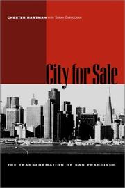
San Francisco is perhaps the most exhilarating of all American cities--its beauty, cultural and political avant-gardism, and history are legendary, while its idiosyncrasies make front-page news. In this revised edition of his highly regarded study of San Francisco's economic and political development since the mid-1950s, Chester Hartman gives a detailed account of how the city has been transformed by the expansion--outward and upward--of its downtown. His story is fueled by a wide range of players and an astonishing array of events, from police storming the International Hotel to citizens forcing the midair termination of a freeway. Throughout, Hartman raises a troubling question: can San Francisco's unique qualities survive the changes that have altered the city's skyline, neighborhoods, and economy? Hartman was directly involved in many of the events he chronicles and thus had access to sources that might otherwise have been unavailable. A former activist with the National Housing Law Project, San Franciscans for Affordable Housing, and other neighborhood organizations, he explains how corporate San Francisco obtained the necessary cooperation of city and federal governments in undertaking massive redevelopment. He illustrates the rationale that produced BART, a subway system that serves upper-income suburbs but few of the city's poor neighborhoods, and cites the environmental effects of unrestrained highrise development, such as powerful wind tunnels and lack of sunshine. In describing the struggle to keep housing affordable in San Francisco and the seemingly intractable problem of homelessness, Hartman reveals the human face of the city's economic transformation.
City planning --- Urban renewal --- Cities and towns --- Civic planning --- Land use, Urban --- Model cities --- Redevelopment, Urban --- Slum clearance --- Town planning --- Urban design --- Urban development --- Urban planning --- Land use --- Planning --- Art, Municipal --- Civic improvement --- Regional planning --- Urban policy --- Renewal, Urban --- Urban redevelopment --- Urban renewal projects --- Government policy --- Management --- San Francisco (Calif.) --- San Francisco County (Calif.) --- San Francisco --- San Francisco City & County (Calif.) --- San Francisco City and County (Calif.) --- City & County of San Francisco (Calif.) --- City and County of San Francisco (Calif.) --- Saint Francisco (Calif.) --- Yerba Buena (Calif.) --- Urban renewal -- California -- San Francisco.. --- City planning -- California -- San Francisco.. --- San Francisco (Calif.). --- affordable housing. --- american cities. --- american studies. --- bart. --- bay area. --- california. --- city life. --- city planning. --- city politics. --- city. --- downtown. --- economy. --- environmental effects. --- environmentalism. --- freeway. --- highrise. --- homelessness. --- housing development. --- housing. --- international hotel. --- national housing law project. --- nonfiction. --- political economy. --- poverty. --- redevelopment. --- san francisco. --- skyline. --- social issues. --- tenants rights. --- urban development. --- urban experience. --- urban planning. --- urban. --- urbanism. --- wind tunnels.
Book
Year: 2021 Publisher: Basel, Switzerland MDPI - Multidisciplinary Digital Publishing Institute
Abstract | Keywords | Export | Availability | Bookmark
 Loading...
Choose an application
- Reference Manager
- EndNote
- RefWorks (Direct export to RefWorks)
The advent of Internet of Things offers a scalable and seamless connection of physical objects, including human beings and devices. This, along with artificial intelligence, has moved transportation towards becoming intelligent transportation. This book is a collection of eleven articles that have served as examples of the success of internet of things and artificial intelligence deployment in transportation research. Topics include collision avoidance for surface ships, indoor localization, vehicle authentication, traffic signal control, path-planning of unmanned ships, driver drowsiness and stress detection, vehicle density estimation, maritime vessel flow forecast, and vehicle license plate recognition. High-performance computing services have become more affordable in recent years, which triggered the adoption of deep-learning-based approaches to increase the performance standards of artificial intelligence models. Nevertheless, it has been pointed out by various researchers that traditional shallow-learning-based approaches usually have an advantage in applications with small datasets. The book can provide information to government officials, researchers, and practitioners. In each article, the authors have summarized the limitations of existing works and offered valuable information on future research directions.
decision-making --- autonomous navigation --- collision avoidance --- scene division --- deep reinforcement learning --- maritime autonomous surface ships --- internet of things --- crowdsourcing --- indoor localization --- data fusion --- security --- authentication --- Inertial Measurement Units --- road transportation --- traffic signal control --- speed guidance --- vehicle arrival time --- connected vehicle --- unmanned ships --- DDPG --- autonomous path planning --- end-to-end --- at-risk driving --- deep support vector machine --- driver drowsiness --- driver stress --- multi-objective genetic algorithm --- multiple kernel learning --- urban freeway --- hybrid dynamic system --- state transition --- unknown inputs observer --- vehicle density --- maritime vessel flows --- intelligent transportation systems --- deep learning --- automatic license plate recognition --- intelligent vehicle access --- histogram of oriented gradients --- artificial neural networks --- convolutional neural networks --- time-frequency --- Inertial Measurement Unit (IMU) --- road anomalies --- n/a
Book
Year: 2022 Publisher: Basel MDPI - Multidisciplinary Digital Publishing Institute
Abstract | Keywords | Export | Availability | Bookmark
 Loading...
Choose an application
- Reference Manager
- EndNote
- RefWorks (Direct export to RefWorks)
We present three main research fields in which multimedia cartography and the study of the effectiveness of multimedia maps are currently taking place. In each of these fields, we describe how published research is embedded in the broader context of map design and user studies. The research refers to contemporary technological trends such as web HTML5 standards, virtual reality, eye tracking, or 3D printing. Efficiency, performance, and usability studies of multimedia maps were also included. The research published in this issue is interdisciplinary. They combine traditional mapping methods with new technologies. They are searching for new places for cartography in, e.g., the environment of computer games. They combine the design of the map with its perception by users.
cartographic design --- animated map --- people gathering presentation --- orthophoto --- dot distribution map --- buffer map --- drone image --- expert opinion --- objective effectiveness --- multiperspective cartographic visualization --- usefulness of visualizations --- pedestrian tracks --- complementary visualizations --- time–spatial behavior --- space–time paths --- trajectories --- set of visualizations --- sightseeing spot recommendation system --- social networking service (SNS) --- web-geographic information systems (GIS) --- recommendation system --- visiting frequency --- sightseeing spot information --- multimedia cartography --- web map --- graphical user interface --- eye-tracking --- UI/UX --- freeway junction --- topographic maps from the 19th century --- interactive web map --- Leaflet --- GeoJSON --- dashboard --- spatiotemporal analysis --- usability --- evaluation of cartographic multimedia --- gamer opinion --- immersion way --- graphical enrichment --- medieval stronghold --- virtual reality --- design process --- historico-geographical space --- cultural heritage --- engineering education --- image stitching --- information technology --- multimedia --- panorama --- thematic map --- mapping techniques transformation --- land use --- UAV --- geometric representation --- pedestrian --- chorochromatic maps --- dot map --- heat map --- mini-map --- virtual stronghold --- walking --- teleportation --- medium effectiveness --- Unity --- topographical space --- gamer --- gameplay --- eye tracking --- 3D printing --- topography --- terrain --- elevation --- geoscience education --- web --- Python --- Earth Engine --- open source --- effectiveness --- responsive GUI --- GUI effectiveness index --- road map --- route memorizing --- cartography --- choropleth map animation --- local outliers --- generalization --- animation --- spatial visualization --- multimedia cartographic product --- medium efficiency --- medium attractiveness
| Listing 1 - 6 of 6 |
Sort by
|

 Search
 Feedback
 About UniCat
  Help
Help News
News