| Listing 1 - 9 of 9 |
Sort by
|

ISBN: 9781412913133 1412913136 9781849725385 1849725381 9781452265605 1452265607 9781412953962 1412953960 1322416818 1412956226 9781322416816 9781412956222 Year: 2008 Publisher: Los Angeles, [Calif.] ; London : SAGE,
Abstract | Keywords | Export | Availability | Bookmark
 Loading...
Choose an application
- Reference Manager
- EndNote
- RefWorks (Direct export to RefWorks)
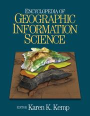
The 'Encyclopedia of Geographical Information Science' provides details about the key foundations of GIS, no matter what their disciplinary origins, and is, therefore, an important resource for both academic and corporate libraries.
Geographic information systems --- Systèmes d'information géographique --- Encyclopedias --- Encyclopédies --- Geografie --- Geografische Informatie Systemen --- Algemeen. --- Systèmes d'information géographique --- Encyclopédies --- Geographical information systems --- GIS (Information systems) --- Information storage and retrieval systems --- Geography --- Geospatial data
Book
ISBN: 1536134384 Year: 2018 Publisher: New York : Nova Science Publishers, Inc.,
Abstract | Keywords | Export | Availability | Bookmark
 Loading...
Choose an application
- Reference Manager
- EndNote
- RefWorks (Direct export to RefWorks)
This collection begins with a chapter that links human and ecological systems research to analyze resource management decisions for Alaska's first submerged aquatic invasive plant, Elodea spp. A case study is presented which may aid other countries in management of Elodea by outlining steps for future policy-making with the goal of retaining the ecological integrity and economic value of Alaska's vast freshwater resources. The second chapter makes use of the De Martonne aridity index and the UNEP Index to determine the humidity of Alaska's Prince William Sound. The indices for climate variability indicate higher humidity in the western sides and lower humidity in the eastern sides. These results highlight the spatial distribution of the climate variables in Prince William Sound from Southcentral Alaska. The third chapter analyzes the Bering Glacier in southern Alaska for its size resultant from complexities of geographical position, accumulation area, and climate conditions. The results of the analysis illustrate the high variation of the Bering Glacier movements in response to climate change. The concluding chapter examines the beginning of orderly social policy in Russian America in 1784, when well-known merchant G.I. Shelikhov founded the first permanent Russian settlement on Kodiak Island off the southern coast of Alaska. A certain impetus to social policy was created by the monopoly Russian-American Company after naval officers came to power in Russian colonies in 1818. The Russian-American Company abolished slavery, increased payments for furs, supplied natives with food during hunger strikes, and conducted mass vaccinations. Thus, the life of the Aleuts and dependent Eskimos improved slowly, but gradually.
Elodea --- Introduced freshwater organisms --- Humidity --- Glaciers --- Organismes d'eau douce introduits --- Air --- Geographic information systems --- Humidité --- Systèmes d'information géographique --- Rossiĭsko-amerikanskai︠a︡ kompanii︠a︡ --- History. --- 1700-1899 --- Alaska --- Social conditions.
Book
ISBN: 1283848902 1461445051 9781461445043 1461445043 9781461445050 9781283848909 Year: 2013 Publisher: New York : Springer,
Abstract | Keywords | Export | Availability | Bookmark
 Loading...
Choose an application
- Reference Manager
- EndNote
- RefWorks (Direct export to RefWorks)
Major international historical archives of declassified military reconnaissance photographs and satellite images, combined with a range of national collections of vertical photographs, offer considerable potential for archaeological and historical landscape research. They provide a unique insight into the character of the landscape as it was over half a century or more ago, before the destructive impact of intensive land use and development. Millions of such images are held in archives around the world, yet their research potential goes largely untapped. Archaeology from Historical Aerial and Satellite Archives draws attention to the existence and scope of these historical photographs to encourage their use in archaeological and landscape research. Not only do they provide a high-quality photographic record of the pre-modern landscape, but they also offer the prospect of the better survival of archaeological remains surviving as earthworks or cropmarks. These sources of imagery also provide an opportunity to examine areas of Europe and beyond whose skies are still not open to archaeological aerial reconnaissance. Featured in the coverage: The archaeological potential of The Aerial Reconnaissance Archives in Edinburgh and the archive of declassified intelligence satellite photographs of the United States Geological Survey. First World War aerial photography and medieval landscapes. Second World War and post-war aerial photography in multi-period archaeological research in Britain, Hungary, Italy, Jordan, Portugal, Romania, Russia, Spain and Uruguay The archaeological exploitation of declassified US satellite photography in Armenia and Syria. The integration of historical aerial and satellite photography for archaeological landscape research in Cambodia and Romania. By describing this massive resource, providing examples of its application to archaeological/landscape questions, and offering advice on access, Archaeology from Historical Aerial and Satellite Archives demonstrates its huge potential and encourages its further use, stimulating a new approach to archaeological survey and the study of landscape evolution among archaeologists, historians, social scientists, preservationists, and cultural heritage specialists.
Aerial photography in archaeology. --- Archaeology --- Remote sensing. --- Antiquities --- Remote sensing --- Geographic information systems. --- Aerial photography in archaeology --- Landscape archaeology. --- Geographic information systems --- Photographie aérienne en archéologie --- Archéologie --- Archéologie du paysage --- Systèmes d'information géographique --- Archival resources --- Fonds d'archives --- Télédétection --- EPUB-LIV-FT LIVHUMAI SPRINGER-B --- Archival resources.
Book
ISBN: 3642192130 3642192149 Year: 2011 Publisher: Berlin : Springer-Verlag,
Abstract | Keywords | Export | Availability | Bookmark
 Loading...
Choose an application
- Reference Manager
- EndNote
- RefWorks (Direct export to RefWorks)
This book is comprised of a selection of the best papers presented during the 25th International Cartography Conference which was held in Paris between 3rd and 8th July 2011. The scope of the conference covers all fields of relevant GIS and Mapping research subjects, such as geovisualization, semiotics, SDI, standards, data quality, data integration, generalization, use and user issues, spatio-temporal modelling and analysis, open source technologies and web services, digital representation of historical maps, history of GIS and cartography as well as cartography for school children and education.
Cartographie -- Congrès. --- Cartography -- Congresses. --- Geographic information systems -- Congresses. --- Systèmes d''information géographique -- Congrès. --- Geography --- Earth & Environmental Sciences --- Cartography --- Geographic information systems --- Geography. --- Earth sciences. --- Geographical information systems. --- Geographical Information Systems/Cartography. --- Earth Sciences, general. --- Geographical information systems --- GIS (Information systems) --- Information storage and retrieval systems --- Geosciences --- Environmental sciences --- Physical sciences --- Cosmography --- Earth sciences --- World history
Book
ISBN: 1282794779 9786612794773 1847197515 9781847197511 9781847197504 1847197507 9781282794771 6612794771 Year: 2010 Publisher: Birmingham [U.K.] : ©2010 Packt Pub.,
Abstract | Keywords | Export | Availability | Bookmark
 Loading...
Choose an application
- Reference Manager
- EndNote
- RefWorks (Direct export to RefWorks)
Be your own cartographer
Digital mapping. --- Geospatial data. --- Geographic information systems. --- Geographical information systems --- GIS (Information systems) --- Information storage and retrieval systems --- Data, Geospatial --- Geographic information systems --- Computer cartography --- Computer mapping --- Digitized mapping --- Cartography --- Geography --- Cartographie par ordinateur --- Données géospatiales --- Systèmes d'information géographique

ISBN: 0761959475 0761959483 9780761959489 9780761959472 1446228339 1849209758 9786611240332 1281240338 1847876412 9781847876416 9781849209755 9781281240330 9781446228333 6611240330 Year: 2000 Publisher: London ; Thousand Oaks, Calif. : Sage Publications,
Abstract | Keywords | Export | Availability | Bookmark
 Loading...
Choose an application
- Reference Manager
- EndNote
- RefWorks (Direct export to RefWorks)
Quantitative Geography is a comprehensive and accessible discussion of the diversity of recent thinking on the use of quantitative methods in spatial data analysis.
681.3*G3 --- Geography --- -Spatial analysis (Statistics) --- Geographic information systems --- Geographical information systems --- GIS (Information systems) --- Analysis, Spatial (Statistics) --- 681.3*G3 Probability and statistics: probabilistic algorithms (including Monte Carlo)random number generation statistical computing statistical software (Mathematics of computing) --- Probability and statistics: probabilistic algorithms (including Monte Carlo)random number generation statistical computing statistical software (Mathematics of computing) --- Statistical methods --- Systèmes d'information géographique --- Spatial analysis (Statistics) --- Information storage and retrieval systems --- Correlation (Statistics) --- Spatial systems --- 681.3*G3 Probability and statistics: probabilistic algorithms (including Monte Carlo);random number generation; statistical computing; statistical software (Mathematics of computing) --- Probability and statistics: probabilistic algorithms (including Monte Carlo);random number generation; statistical computing; statistical software (Mathematics of computing) --- Mathematics --- Economic geography --- Geographic information systems. --- Spatial analysis (Statistics). --- Statistical methods. --- Géographie --- Analyse spatiale (Statistique) --- Méthodes statistiques --- Geography - Statistical methods

ISBN: 9783540741664 3540741666 3642093493 9786611355289 1281355283 3540741674 Year: 2008 Publisher: Berlin ; New York : Springer,
Abstract | Keywords | Export | Availability | Bookmark
 Loading...
Choose an application
- Reference Manager
- EndNote
- RefWorks (Direct export to RefWorks)
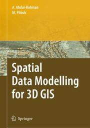
This book covers fundamental aspects of spatial data modelling specifically on the aspect of three-dimensional (3D) modelling and structuring. Realisation of "true" 3D GIS spatial system needs a lot of efforts, and the process is taking place in various research centres and universities in some countries. The development of spatial data modelling for 3D objects is the focus of this book. The book begins with some problems and motivations, the fundamental theories, the implementation, and some applications developed based on the concepts. The book is intended for various geoinformation related professionals like GIS engineers, GIS software developers, photogrammetrists, land surveyors, mapping specialists, researchers, postgraduate students, and lecturers.
Geographic information systems. --- Three-dimensional display systems. --- Information storage and retrieval systems --- Systèmes d'information géographique --- Affichage tridimensionnel --- Systèmes d'information --- Geography. --- Géographie --- Information storage and retrieval systems --Geography. --- Geographic information systems --- Three-dimensional display systems --- Cartography --- Geography-General --- Geography --- Earth & Environmental Sciences --- Systèmes d'information géographique --- Systèmes d'information --- Géographie --- EPUB-LIV-FT LIVGEOGR SPRINGER-B --- 3-D display systems --- 3D display systems --- Display systems, Three-dimensional --- Geographical information systems --- GIS (Information systems) --- Geophysics. --- Computers. --- Geographical information systems. --- Remote sensing. --- Regional planning. --- Urban planning. --- Physical geography. --- Geographical Information Systems/Cartography. --- Information Systems and Communication Service. --- Geophysics/Geodesy. --- Remote Sensing/Photogrammetry. --- Physical Geography. --- Landscape/Regional and Urban Planning. --- Information display systems --- Three-dimensional imaging --- Information systems. --- Regional development --- Regional planning --- State planning --- Human settlements --- Land use --- Planning --- City planning --- Landscape protection --- Government policy --- Cities and towns --- Civic planning --- Land use, Urban --- Model cities --- Redevelopment, Urban --- Slum clearance --- Town planning --- Urban design --- Urban development --- Urban planning --- Art, Municipal --- Civic improvement --- Urban policy --- Urban renewal --- Remote-sensing imagery --- Remote sensing systems --- Remote terrain sensing --- Sensing, Remote --- Terrain sensing, Remote --- Aerial photogrammetry --- Aerospace telemetry --- Detectors --- Space optics --- Geological physics --- Terrestrial physics --- Earth sciences --- Physics --- Automatic computers --- Automatic data processors --- Computer hardware --- Computing machines (Computers) --- Electronic brains --- Electronic calculating-machines --- Electronic computers --- Hardware, Computer --- Computer systems --- Cybernetics --- Machine theory --- Calculators --- Cyberspace --- Management

ISBN: 9780387357676 038735767X 1441942068 9786611087463 1281087467 038768574X 9780387685748 Year: 2008 Publisher: New York (N.Y.): Springer,
Abstract | Keywords | Export | Availability | Bookmark
 Loading...
Choose an application
- Reference Manager
- EndNote
- RefWorks (Direct export to RefWorks)
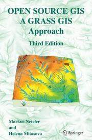
With this third edition of Open Source GIS: A GRASS GIS Approach, we enter the new era of GRASS6, the first release that includes substantial new code developed by the International GRASS Development Team. The dramatic growth in open source software libraries has made GRASS6 development more efficient, and has enhanced GRASS interoperability with a wide range of open source and proprietary geospatial tools. Thoroughly updated with material related to GRASS6, the third edition includes new sections on attribute database management and SQL support, vector networks analysis, lidar data processing and new graphical user interfaces. All chapters are updated with numerous practical examples using the first release of a comprehensive, state-of-the-art geospatial data set. Open Source GIS: A GRASS GIS Approach, Third Edition preserves the continuity of previous editions by maintaining the book's proven structure. This volume is structured for a professional audience composed of researchers and practitioners in government and industry, as well as graduate students interested in geospatial analysis and modeling.
Geographic information systems --- GRASS (Electronic computer system) --- Open source software --- Systèmes d'information géographique --- GRASS (Système informatique) --- Logiciels libres --- Geographic information systems. --- GRASS (Electronic computer system). --- Open source software. --- Geography --- Earth & Environmental Sciences --- Geography-General --- Cartography --- Systèmes d'information géographique --- GRASS (Système informatique) --- EPUB-LIV-FT LIVGEOGR SPRINGER-B --- Free software (Open source software) --- Open code software --- Opensource software --- Graphical Remote Access Support System --- Geographical information systems --- GIS (Information systems) --- Geography. --- Earth sciences. --- Image processing. --- Geographical information systems. --- Remote sensing. --- Geographical Information Systems/Cartography. --- Earth Sciences, general. --- Remote Sensing/Photogrammetry. --- Information Systems Applications (incl. Internet). --- Image Processing and Computer Vision. --- Environmental Monitoring/Analysis. --- Computer software --- Computer graphics --- Online data processing --- Information storage and retrieval systems --- Computer vision. --- Monitoring/Environmental Analysis. --- Machine vision --- Vision, Computer --- Artificial intelligence --- Image processing --- Pattern recognition systems --- Cosmography --- Earth sciences --- World history --- Application software. --- Optical data processing. --- Environmental monitoring. --- Optical computing --- Visual data processing --- Bionics --- Electronic data processing --- Integrated optics --- Photonics --- Computers --- Application computer programs --- Application computer software --- Applications software --- Apps (Computer software) --- Remote-sensing imagery --- Remote sensing systems --- Remote terrain sensing --- Sensing, Remote --- Terrain sensing, Remote --- Aerial photogrammetry --- Aerospace telemetry --- Detectors --- Space optics --- Geosciences --- Environmental sciences --- Physical sciences --- Biomonitoring (Ecology) --- Ecological monitoring --- Environmental quality --- Monitoring, Environmental --- Applied ecology --- Environmental engineering --- Pollution --- Optical equipment --- Measurement --- Monitoring
Periodical
Abstract | Keywords | Export | Availability | Bookmark
 Loading...
Choose an application
- Reference Manager
- EndNote
- RefWorks (Direct export to RefWorks)
Navigation --- Remote sensing --- Geographic information systems --- Global Positioning System --- Earth sciences --- Environmental monitoring --- Navigation. --- Télédétection. --- Systèmes d'information géographique. --- GPS. --- Sciences de la terre. --- Environnement --- Earth sciences. --- Environmental monitoring. --- Geographic information systems. --- Global Positioning System. --- Remote sensing. --- Surveillance. --- Remote-sensing imagery --- Remote sensing systems --- Remote terrain sensing --- Sensing, Remote --- Terrain sensing, Remote --- Navigation, Primitive --- Global Navigation Satellite System --- GNSS (Navigational system) --- GPS (Navigational system) --- Navigation Satellite Timing and Ranging Global Positioning System --- NAVSTAR GPS --- Geographical information systems --- GIS (Information systems) --- Biomonitoring (Ecology) --- Ecological monitoring --- Environmental quality --- Monitoring, Environmental --- Geosciences --- Measurement --- Monitoring --- Télédétection. --- Systèmes d'information géographique. --- Aerial photogrammetry --- Aerospace telemetry --- Detectors --- Space optics --- Locomotion --- Orientation --- Nautical astronomy --- Naval art and science --- Pilots and pilotage --- Artificial satellites in navigation --- Mobile geographic information systems --- Information storage and retrieval systems --- Applied ecology --- Environmental engineering --- Pollution --- Environmental sciences --- Physical sciences --- Geography --- Geography-General --- Remote Sensing Technology --- Geographic Information Systems --- Environmental Monitoring --- Télédétection --- Systèmes d'information géographique --- GPS --- Sciences de la terre --- geographic information systems. --- earth sciences. --- Surveillance --- Environmental Surveillance --- Surveillance, Environmental --- Wastewater-Based Epidemiological Monitoring --- Environmental Restoration and Remediation --- Ecological Parameter Monitoring --- Geographical Information Systems --- Global Positioning Systems --- Geographic Information System --- Geographical Information System --- Information System, Geographic --- Information System, Geographical --- Information Systems, Geographic --- Information Systems, Geographical --- Positioning System, Global --- Positioning Systems, Global --- System, Geographical Information --- System, Global Positioning --- Systems, Geographical Information --- Systems, Global Positioning --- Spatial Analysis --- Geographic Mapping --- Satellite Imagery --- Remote Sensing Technologies --- Technologies, Remote Sensing --- Technology, Remote Sensing --- Radio Frequency Identification Device --- Remote Sensing Technology. --- Geographic Information Systems. --- Environmental Monitoring.
| Listing 1 - 9 of 9 |
Sort by
|

 Search
 Feedback
 About UniCat
  Help
Help News
News