| Listing 1 - 1 of 1 |
Sort by
|

ISBN: 1281981702 9786611981709 3540927255 3540927247 3642445179 9783642445170 9783540927242 9783540927259 3540291520 9783540291527 9786610609598 1280609591 3540291539 Year: 2006 Publisher: Berlin : Springer,
Abstract | Keywords | Export | Availability | Bookmark
 Loading...
Choose an application
- Reference Manager
- EndNote
- RefWorks (Direct export to RefWorks)
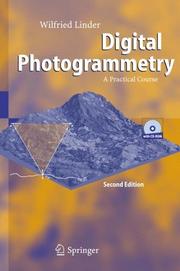
Potential readers/users are students of Photogrammetry, Geodesy, Geography and other sciences, but also all who are interested in this topic. No prior knowledge is necessary, except the handling of standard PCs. Theory is presented true to the motto "as little as possible, but as much as necessary". The main part of the book contains several tutorials. In increasing complexity, accompanied by texts explaining further theory, the reader can proceed step by step through the particular working parts. Most of the standard work in Digital Photogrammetry is shown and trained for example scanning, image orientation, mono and stereo plotting, aerial triangulation measurement (manual and automatic), block adjustment, automatic creation of surface models via image matching, creation of ortho images and mosaics, and others. Not only standard situations are dealt with but also more complex ones, such as unknown camera data, extreme relief or areas with very low contrast. Examples of both aerial and close-range photogrammetry present the power of these type of measurement techniques. The software is not limited to the example data included but may be used for personal projects. Part of the book comprises a complete description of the software.
Photogrammetry --- Image processing --- Digital techniques. --- Digital image processing --- Digital electronics --- Digital photogrammetric systems --- Digital photogrammetry --- DP (Digital photogrammetry) --- DPS (Digital photogrammetric systems) --- Geographical information systems. --- Physical geography. --- Information systems. --- Regional planning. --- Geographical Information Systems/Cartography. --- Remote Sensing/Photogrammetry. --- Geophysics/Geodesy. --- Information Systems and Communication Service. --- Landscape/Regional and Urban Planning. --- Geography --- Geographical information systems --- GIS (Information systems) --- Information storage and retrieval systems --- Regional development --- Regional planning --- State planning --- Human settlements --- Land use --- Planning --- City planning --- Landscape protection --- Government policy --- Photogrammetry. --- Photography --- Digital photography --- Photographic measurements --- Stereophotogrammetry --- Image analysis --- Digital techniques --- Remote sensing. --- Geophysics. --- Computers. --- Urban planning. --- Cities and towns --- Civic planning --- Land use, Urban --- Model cities --- Redevelopment, Urban --- Slum clearance --- Town planning --- Urban design --- Urban development --- Urban planning --- Art, Municipal --- Civic improvement --- Urban policy --- Urban renewal --- Automatic computers --- Automatic data processors --- Computer hardware --- Computing machines (Computers) --- Electronic brains --- Electronic calculating-machines --- Electronic computers --- Hardware, Computer --- Computer systems --- Cybernetics --- Machine theory --- Calculators --- Cyberspace --- Geological physics --- Terrestrial physics --- Earth sciences --- Physics --- Remote-sensing imagery --- Remote sensing systems --- Remote terrain sensing --- Sensing, Remote --- Terrain sensing, Remote --- Aerial photogrammetry --- Aerospace telemetry --- Detectors --- Space optics --- Management --- Fotogrammetrie
| Listing 1 - 1 of 1 |
Sort by
|

 Search
 Feedback
 About
About Help
Help News
News