| Listing 1 - 10 of 11 | << page >> |
Sort by
|
Book
ISBN: 9782855574530 2855574536 Year: 2017 Publisher: Paris : France agricole,
Abstract | Keywords | Export | Availability | Bookmark
 Loading...
Choose an application
- Reference Manager
- EndNote
- RefWorks (Direct export to RefWorks)
Au moment où l’agriculture moderne “de précision”, soucieuse d’économie, de rentabilité et de l’environnement, s’appuie de plus en plus sur la télédétection, l’observation de proximité et la maîtrise des nouvelles technologies, les drones offrent une source immense et des outils majeurs de progrès.Notre ouvrage, le premier exclusivement consacré à l’usage des drones dans l’agriculture et la sylviculture, vous propose un panorama exhaustif largement illustré et d’un abord très didactique de toutes les utilisations et fonctionnalités professionnelles :- Surveillance des cultures et massifs forestiers- Optimisation des traitements par lutte biologique, solutions phytosanitaires spécifiques ou modulations de fertilisants- Agriculture de précision- Assistance à la conduite de troupeaux dans les champs- Lutte contre les espèces animales envahissantes- Repérage d’animaux malades- Réalisation et surveillance d’ouvrages et chantiers- Surveillance des exploitations des bâtiments.
Drones --- Photographie aérienne en agriculture --- Photo-interprétation --- Photo-interprétation. --- Drones. --- Photographie aérienne en agriculture.
Book
ISBN: 9782351251874 2351251873 Year: 2020 Publisher: Strasbourg Musées de Strasbourg
Abstract | Keywords | Export | Availability | Bookmark
 Loading...
Choose an application
- Reference Manager
- EndNote
- RefWorks (Direct export to RefWorks)
Le spectacle des fantasmagories fascine dès la fin du XVIIIe siècle. D'abord expérimentations techniques, ils deviennent rapidement l'occasion d'expériences occultes qui fascinent le public. Puisant leurs sources dans le gothique noir, les fantasmagories mènent au pré-cinéma. L'exposition qui se tiendra au Musée alsacien de Strasbourg ainsi que le catalogue qui l'accompagne explorent le contexte historique de l'apparition des fantasmagories. Le phénomène des fantasmagories se trouve à la jonction de la physique, de l'engouement de la société pour l'occulte et d'un contexte politique mouvementé. Les schémas de fonctionnement du fantascope sont présents dans les manuels de physique optique, à la pointe de la technologie de la fin du XVIIIe siècle et du début du XIXe mais également dans les brochures à destination des apprentis magiciens. Robertson, figure centrale de l'exposition est l'un des fantasmagores les plus célèbres. Il occupe une place de choix dans le propos grâce à ses mémoires publiés en deux volumes et son procès lors duquel, accusé de plagiat, il est obligé de dévoiler ses tours. D'une fabrication soignée, ce catalogue grand public fait la part belle aux illustrations et met en valeur le fonds de plaques de verre originales conservées au Musée alsacien et dans d'autres collections, publiques et privées, notamment celle de la Cinémathèque française.
Lantern projection --- Fear in art --- fear --- projections [visual works] --- magic lanterns --- Esotérisme --- Photo-interprétation --- Lumière
Book
ISBN: 9782843012976 284301297X 284301297X Year: 2011 Publisher: Lyon : Aleas,
Abstract | Keywords | Export | Availability | Bookmark
 Loading...
Choose an application
- Reference Manager
- EndNote
- RefWorks (Direct export to RefWorks)
Cinéma --- Cartes --- Cartographie et art --- Point de vue (cinéma) --- Photo-interprétation --- Thèmes, motifs --- Au cinéma
Periodical
Abstract | Keywords | Export | Availability | Bookmark
 Loading...
Choose an application
- Reference Manager
- EndNote
- RefWorks (Direct export to RefWorks)
Remote sensing --- Photointerpretation --- Photogrammétrie --- Photogrammetry --- Periodicals --- Photographic interpretation --- Luchtfotografie. --- Arts and Humanities --- Architecture, Fine and Decorative Arts --- Aerial photograph reading --- Interpretation, Photographic --- Photo interpretation --- Photographic interpretation.
Book
ISBN: 2130353118 9782130353119 Year: 1978 Volume: 1700 Publisher: Paris PUF
Abstract | Keywords | Export | Availability | Bookmark
 Loading...
Choose an application
- Reference Manager
- EndNote
- RefWorks (Direct export to RefWorks)
Photography --- Space research --- Geodesy. Cartography --- Aerial photography --- Space photography --- Remote sensing --- Photographie --- Photointerpretation --- luchtvaart --- 528 --- 77 --- Désherbage --- Photography in astronautics --- Spaceborne photography --- Astronomical photography --- Aerophotography --- Air photography --- Airborne photography --- Balloon photography --- Photography, Aerial --- transport aerien --- Deselectie --- Photo-Interpretation --- Teledetection --- Aerial photography. --- Space photography. --- Photo-Interpretation. --- Teledetection. --- Photographie aerienne
Book
ISBN: 213050423X 9782130504238 Year: 2000 Volume: 1700 Publisher: Paris : PUF - Presses Universitaires de France,
Abstract | Keywords | Export | Availability | Bookmark
 Loading...
Choose an application
- Reference Manager
- EndNote
- RefWorks (Direct export to RefWorks)
Aerial photography --- Space photography --- Photographic interpretation --- Photographie aérienne --- Photographie spatiale --- Photo-interprétation --- Photographie --- Photography --- Photointerpretation --- Système d'information géographique --- Geographical information systems --- Relevé aérien --- Aerial surveying --- Analyse d'image --- Image analysis --- Satellite --- Satellites --- Photography in astronautics --- Spaceborne photography --- Astronomical photography --- Aerophotography --- Air photography --- Airborne photography --- Balloon photography --- Photography, Aerial --- Remote sensing --- Photographie aérienne --- Photo-interprétation --- Aerial photography. --- Space photography. --- Photographic interpretation. --- Photographie aérienne. --- Photographie spatiale. --- Photo-interprétation. --- Photographie aérienne. --- Photo-interprétation.

ISBN: 0023050357 9780023050350 Year: 1992 Publisher: New York Macmillan
Abstract | Keywords | Export | Availability | Bookmark
 Loading...
Choose an application
- Reference Manager
- EndNote
- RefWorks (Direct export to RefWorks)
Photographic interpretation. --- Aerial photography. --- Remote sensing. --- Photo-interprétation --- Photographie aérienne --- Télédétection --- Photographic interpretation --- Aerial photography --- Remote sensing --- 528.5 --- Remote-sensing imagery --- Remote sensing systems --- Remote terrain sensing --- Sensing, Remote --- Terrain sensing, Remote --- Aerial photogrammetry --- Aerospace telemetry --- Detectors --- Space optics --- Aerophotography --- Air photography --- Airborne photography --- Balloon photography --- Photography, Aerial --- Photography --- Aerial photograph reading --- Interpretation, Photographic --- Photo interpretation --- Photogrammetric pictures --- Photographic reconnaissance systems --- Photographic surveying --- Geodetic instruments and equipment --- Scientific applications --- Environmental Sciences and Forestry. Remote Sensing and Geographical Information Systems --- Remote Sensing --- Remote Sensing. --- 528.5 Geodetic instruments and equipment --- Photo-interprétation --- Photographie aérienne --- Télédétection

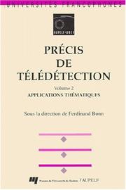
ISBN: 2760506134 2760508889 2760511456 9782760514850 9782760511453 9782760506138 2760514854 Year: 1992 Publisher: Sillery : Presses de l'Université du Québec,
Abstract | Keywords | Export | Availability | Bookmark
 Loading...
Choose an application
- Reference Manager
- EndNote
- RefWorks (Direct export to RefWorks)
Remote sensing. --- Environmental Sciences and Forestry. Remote Sensing and Geographical Information Systems --- Remote Sensing. --- Images de télédétection --- Remote-sensing images. --- Photo-interprétation --- Photographic interpretation --- Remote sensing --- methodology --- computer applications --- techniques --- Equipment --- Electromagnetic field --- Data analysis --- data collection --- Télédétection --- Remote-sensing images --- Traitement d'images --- Image processing --- Géographie (discipline) --- Information storage and retrieval systems --- Mathématiques --- Mathematics. --- Techniques numériques --- Digital techniques --- Systèmes d'information. --- Geography --- Images de télédétection. --- Mathématiques. --- Photo-interprétation. --- Techniques numériques. --- Images de télédétection. --- Images de télédétection --- Mathématiques. --- Rayonnement electromagnetique --- Photo-interprétation. --- Géographie (discipline) --- Techniques numériques. --- Systèmes d'information.

ISBN: 0471204897 9780471204893 Year: 2003 Publisher: Hoboken : Wiley,
Abstract | Keywords | Export | Availability | Bookmark
 Loading...
Choose an application
- Reference Manager
- EndNote
- RefWorks (Direct export to RefWorks)
Aerial photography. --- Photographic interpretation. --- Aerial photography in forestry --- Photographie aérienne --- Photo-interprétation --- Photographie --- Photography --- Photointerpretation --- Système d'information géographique --- Geographical information systems --- Traitement des données --- Data processing --- Analyse de données --- Data analysis --- Relevé aérien --- Aerial surveying --- Photographie aérienne --- Photo-interprétation --- Aerial photography --- Photographic interpretation
Book
ISBN: 3110021234 9783110021233 Year: 1974 Volume: 11 Publisher: Berlin : de Gruyter,
Abstract | Keywords | Export | Availability | Bookmark
 Loading...
Choose an application
- Reference Manager
- EndNote
- RefWorks (Direct export to RefWorks)
Aerial photography in geography --- Photographic interpretation --- Remote sensing --- Aerial photography in geography. --- Photographic interpretation. --- Remote sensing. --- Geografie --- Sociale en economische geografie --- Algemene handboeken en reeksen. --- Remote-sensing imagery --- Remote sensing systems --- Remote terrain sensing --- Sensing, Remote --- Terrain sensing, Remote --- Aerial photogrammetry --- Aerospace telemetry --- Detectors --- Space optics --- Geography, Aerial --- Geography --- Aerial photograph reading --- Interpretation, Photographic --- Photo interpretation --- Aerial photography --- Photogrammetric pictures --- Photographic reconnaissance systems --- Photographic surveying --- Photography --- Scientific applications --- Photographie aerienne --- Photointerpretation et teledetection
| Listing 1 - 10 of 11 | << page >> |
Sort by
|

 Search
 Feedback
 About UniCat
  Help
Help News
News