| Listing 1 - 10 of 15 | << page >> |
Sort by
|
Book
ISBN: 2910381404 9782910381400 Year: 1996 Publisher: Saint-Denis : Presses universitaires de Vincennes,
Abstract | Keywords | Export | Availability | Bookmark
 Loading...
Choose an application
- Reference Manager
- EndNote
- RefWorks (Direct export to RefWorks)
History of civilization --- anno 1200-1499 --- Geography, Medieval. --- Géographie médiévale --- Géographie médiévale --- Cultuurgeschiedenis --- Perception géographique --- Espace --- Géographie (discipline) --- Aspect symbolique. --- Aspect social. --- Histoire. --- Histoire

ISBN: 0801436265 Year: 2000 Publisher: Ithaca, N.Y. Cornell University Press
Abstract | Keywords | Export | Availability | Bookmark
 Loading...
Choose an application
- Reference Manager
- EndNote
- RefWorks (Direct export to RefWorks)
History of France --- anno 1400-1499 --- anno 1300-1399 --- Marseilles --- Cartography --- Geography, Medieval --- Cartographie --- Géographie médiévale --- History --- Histoire --- Marseille (France) --- Maps --- Cartes --- History. --- Géographie médiévale --- France --- Geography [Medieval ]

ISBN: 2271057442 9782271057440 Year: 2000 Volume: 31 Publisher: Paris : CNRS éditions,
Abstract | Keywords | Export | Availability | Bookmark
 Loading...
Choose an application
- Reference Manager
- EndNote
- RefWorks (Direct export to RefWorks)
Old French literature --- Geography, Medieval. --- Travel, Medieval. --- Géographie médiévale --- Voyage --- Histoire --- Mandeville, John, --- 091 JEAN DE MANDEVILLE --- Geography, Medieval --- Travel, Medieval --- Civilization, Medieval --- Geography --- Medieval geography --- Handschriftenkunde. Handschriftencatalogi--JEAN DE MANDEVILLE --- Mandeville, John Sir --- -Travel --- 091 JEAN DE MANDEVILLE Handschriftenkunde. Handschriftencatalogi--JEAN DE MANDEVILLE --- Géographie médiévale --- Mandeuile, Iohn, --- Mandevile, John, --- Mandevilla, Juan de, --- Mandevilla, Jean de, --- Mandeville, Johann von, --- Maundevile, John, --- Travel. --- Géographie historique --- Récits de voyages médiévaux --- Voyages --- Voyageurs --- Sources --- Mandeville, Jean de --- Critique et interprétation.
Book
ISBN: 3428066138 9783428066131 Year: 1989 Volume: 6 Publisher: Berlin : Duncker und Humblot,
Abstract | Keywords | Export | Availability | Bookmark
 Loading...
Choose an application
- Reference Manager
- EndNote
- RefWorks (Direct export to RefWorks)
History of civilization --- anno 1200-1299 --- anno 1300-1399 --- Geography, Medieval --- World Maps --- Géographie médiévale --- Maps --- Cartes --- 91 <09> "04/14" --- 912 <09> --- 91 <09> --- Aardrijkskunde. Geografie--Geschiedenis van ...--Middeleeuwen --- Cartografie. Kaarten. Plattegronden. Atlassen--Geschiedenis van ... --- Aardrijkskunde. Geografie--Geschiedenis van ... --- Géographie médiévale --- Cartografie. Kaarten. Plattegronden. Atlassen--Geschiedenis van .. --- Aardrijkskunde. Geografie--Geschiedenis van .. --- Cartografie. Kaarten. Plattegronden. Atlassen--Geschiedenis van . --- Aardrijkskunde. Geografie--Geschiedenis van . --- Cartografie. Kaarten. Plattegronden. Atlassen--Geschiedenis van --- Aardrijkskunde. Geografie--Geschiedenis van
Book
ISBN: 9782503567051 2503567053 Year: 2017 Publisher: Turnhout Brepols
Abstract | Keywords | Export | Availability | Bookmark
 Loading...
Choose an application
- Reference Manager
- EndNote
- RefWorks (Direct export to RefWorks)
L'ouvrage réunit trente-six articles offerts à Patrick Gautier Dalché par ses amis, ses élèves et ses collègues à l'occasion de son départ en retraite. Pour rendre hommage à ses travaux, qui ont renouvelé les recherches sur l'histoire des perceptions et représentations de l'espace, les éditeurs ont souhaité rassembler des contributions qui pour l'essentiel s'incrivent dans cette même perspective, traitant des représentations spatiales aussi bien textuelles que cartographiques, savantes ou empiriques, dans la longue période de lui-même étudie, allant de l'Antiquité tardive au XVIe siècle.
Painting --- Geography --- History of civilization --- Philosophy and psychology of culture --- anno 500-1499 --- anno 1600-1699 --- anno 1500-1599 --- 912 <082> --- 912 <082> Cartografie. Kaarten. Plattegronden. Atlassen--Feestbundels. Festschriften --- 912 <082> Cartography. Maps. Atlasses--Feestbundels. Festschriften --- Cartografie. Kaarten. Plattegronden. Atlassen--Feestbundels. Festschriften --- Cartography. Maps. Atlasses--Feestbundels. Festschriften --- Geography, Medieval --- Travelers' writings --- Géographie médiévale --- Ecrits de voyageurs --- Gautier Dalché, Patrick --- Géographie médiévale --- Gautier Dalché, Patrick

ISBN: 2503514723 9782503514727 Year: 2006 Volume: 4 Publisher: Turnhout Brepols
Abstract | Keywords | Export | Availability | Bookmark
 Loading...
Choose an application
- Reference Manager
- EndNote
- RefWorks (Direct export to RefWorks)
The territory discussed in this book represents the farthest northern and northeast regions of the world known to ancient and medieval geographers and corresponds to modern-day Scandinavia, Russia, Eastern Europe, and countries east of the Caspian Sea. They figured prominently in cartography of the Middle Ages. The mythical island of Scandza, the land of the Amazons, the apocalyptic tribes of Gog and Magog, and other traditional symbols of chaos and barbarity existed side by side and often merged with new knowledge about people, cities, and states. Originally published in Russian, this book offers an analysis of 198 western European and Byzantine maps that date between the eighth and thirteenth centuries and contain information about het north and northeast of the known world.
Geodesy. Cartography --- anno 500-1499 --- Geography, Medieval --- Cartography --- Géographie médiévale --- Cartographie --- History --- Histoire --- Eurasia --- Eurasie --- Maps --- Cartes --- Early maps. --- History. --- Europe, Eastern --- Geography, Medieval. --- 912 "04/14" --- 912 <09> <4-11> --- 912 <09> <4-17> --- Cartografie. Kaarten. Plattegronden. Atlassen--Middeleeuwen --- Cartografie. Kaarten. Plattegronden. Atlassen--Geschiedenis van ...--Oost-Europa --- Cartografie. Kaarten. Plattegronden. Atlassen--Geschiedenis van ...--Noord-Europa --- Géographie médiévale --- Early maps --- Atlases, Historical --- Historical atlases --- Middle Ages --- Geography --- Medieval geography --- Maps, Early --- East Europe --- Eastern Europe --- Cartography - History. --- Geography, Medieval - History. --- Geography, Medieval - Maps. --- Cartography - History --- Geography, Medieval - Maps --- Europe, Eastern - Maps

ISBN: 0712347607 Year: 2006 Publisher: London British Library
Abstract | Keywords | Export | Availability | Bookmark
 Loading...
Choose an application
- Reference Manager
- EndNote
- RefWorks (Direct export to RefWorks)
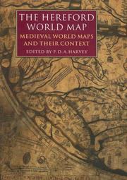
The famous Hereford world map dates from around 1300. Setting the Hereford map in context, P. D. A. Harvey and his 24 collaborators present many aspects of these maps for historians, geographers, students of art history, theologians, and everyone interested in the way medieval people thought and the way they saw their world.
Geodesy. Cartography --- anno 1200-1499 --- Geography, Medieval. --- World maps, Manuscript. --- World maps --- Early maps. --- Géographie médiévale --- Cartes du monde manuscrites --- Cartes du monde --- Cartes anciennes --- Early works to 1800. --- Ouvrages avant 1800 --- Ricardus, --- 912 "04/14" --- 091 <41 HEREFORD> --- 912 <100> --- Cartografie. Kaarten. Plattegronden. Atlassen--Middeleeuwen --- Handschriftenkunde. Handschriftencatalogi--Verenigd Koninkrijk van Groot-Brittannië en Noord-Ierland--HEREFORD --- Cartografie. Kaarten. Plattegronden. Atlassen--Wereld. Internationaal. Alle landen gezamenlijk --- 091 <41 HEREFORD> Handschriftenkunde. Handschriftencatalogi--Verenigd Koninkrijk van Groot-Brittannië en Noord-Ierland--HEREFORD --- Géographie médiévale --- Early maps --- Geography, Medieval --- World maps, Manuscript --- Manuscript maps --- Geography --- Medieval geography --- Maps, Early --- History --- Richard, --- Bataylle, Richard de la, --- Batayl, Richard de,
Multi
ISBN: 9782503520650 2503520650 Year: 2007 Volume: 7 Publisher: Turnhout : Brepols,
Abstract | Keywords | Export | Availability | Bookmark
 Loading...
Choose an application
- Reference Manager
- EndNote
- RefWorks (Direct export to RefWorks)
Cet ouvrage a pour but de montrer la survivance des idées médiévales dans la cartographie du XVIe siècle, sous plusieurs aspects originaux. Même si la découverte du Nouveau Monde introduisit d'évidents changements, l'influence de la description de l'orbis tripartitus médiéval reste sensible au XVIe siècle. Tandis que l'on aperçoit au seizième siècle la naissance de la cartographie scientifique, l'étude démontre la survivance des mirabilia (animaux exotiques et monstres humains) et de la figure de deux souverains fréquemment représentés sur les mappae mundi médiévales, Alexandre le Grand et Prêtre Jean.
Geodesy. Cartography --- anno 1400-1499 --- anno 1300-1399 --- anno 1200-1299 --- anno 1500-1599 --- Civilization, Medieval --- Geography, Medieval. --- Cartography --- Civilisation médiévale --- Géographie médiévale --- Cartographie --- Influence --- History. --- Histoire --- World maps --- Early maps --- 091:912 --- 912 <100> --- 912 "04/14" --- Handschriftenkunde. Handschriftencatalogi-:-Cartografie. Kaarten. Plattegronden. Atlassen --- Cartografie. Kaarten. Plattegronden. Atlassen--Wereld. Internationaal. Alle landen gezamenlijk --- Cartografie. Kaarten. Plattegronden. Atlassen--Middeleeuwen --- 091:912 Handschriftenkunde. Handschriftencatalogi-:-Cartografie. Kaarten. Plattegronden. Atlassen --- Civilisation médiévale --- Géographie médiévale --- Maps --- Globes --- Maps, Early --- Geography --- Cartography, Primitive --- Chartography --- Map-making --- Mapmaking --- Mapping (Cartography) --- Mathematical geography --- Surveying --- Map projection --- History --- Civilization [Medieval ] --- Geography [Medieval ] --- Cartography - Maps --- Influence médiévale --- 16e siècle

ISBN: 0851159370 0851156029 Year: 2001 Publisher: Woodbridge The Boydell Press
Abstract | Keywords | Export | Availability | Bookmark
 Loading...
Choose an application
- Reference Manager
- EndNote
- RefWorks (Direct export to RefWorks)
Geography, Medieval --- Cartography --- Art, Medieval. --- Géographie médiévale --- Cartographie --- Art médiéval --- Maps. --- History --- Cartes --- Histoire --- 091:912 --- 912 <09> <41> --- Handschriftenkunde. Handschriftencatalogi-:-Cartografie. Kaarten. Plattegronden. Atlassen --- Cartografie. Kaarten. Plattegronden. Atlassen--Geschiedenis van ...--Verenigd Koninkrijk van Groot-Brittannië en Noord-Ierland --- 091:912 Handschriftenkunde. Handschriftencatalogi-:-Cartografie. Kaarten. Plattegronden. Atlassen --- Géographie médiévale --- Art médiéval --- Art, Medieval --- Medieval art --- Atlases, Historical --- Historical atlases --- Middle Ages --- Cartography, Primitive --- Chartography --- Map-making --- Mapmaking --- Mapping (Cartography) --- Mathematical geography --- Surveying --- Map projection --- Maps --- History of civilization --- Geodesy. Cartography --- anno 500-1499
Book
ISBN: 0192192329 0192891235 Year: 1988 Publisher: Oxford New York Oxford University Press
Abstract | Keywords | Export | Availability | Bookmark
 Loading...
Choose an application
- Reference Manager
- EndNote
- RefWorks (Direct export to RefWorks)
Discoveries in geography. --- Geography, Medieval. --- Europe --- Civilization. --- Aardrijkskundige ontdekkingen --- Discoveries [Maritime ] --- Discoveries and exploration --- Découvertes géographiques --- Découvertes maritimes --- Exploration and discoveries --- Geografische ontdekkingen --- Grandes découvertes --- Géographie -- Découvertes --- Monde -- Découverte et exploration --- Ontdekkingen [Aardrijkskundige ] --- Voyages de découverte --- Découvertes géographiques --- History of Europe --- anno 500-1499 --- Discoveries in geography --- Geography, Medieval --- Geography --- Medieval geography --- Discoveries, Maritime --- Discovery and exploration --- Exploration and discovery --- Explorations in geography --- Exploring expeditions --- Geographical discoveries --- Geographical discovery --- Maritime discoveries --- Voyages and travels --- Explorers --- Geographical discoveries in literature --- Géographie médiévale
| Listing 1 - 10 of 15 | << page >> |
Sort by
|

 Search
 Feedback
 About
About Help
Help News
News