
 Search
 Feedback
 About
About Help
Help News
News
| Listing 1 - 6 of 6 |
Sort by
|
Book
Year: 2017 Publisher: Frontiers Media SA
Abstract | Keywords | Export | Availability | Bookmark
 Loading...
Choose an application
- Reference Manager
- EndNote
- RefWorks (Direct export to RefWorks)
In June 2015 we held a workshop on the beautiful island of Mallorca, Spain with a focus on sea level variability and change. Over 120 sea level experts from around the world attended this workshop, from a range of different disciplines. The main aims of the workshop were to: 1.) Evaluate the current state-of-knowledge of sea level science; 2.) Identify gaps and unresolved questions in any aspect of sea level science; and 3.) Design future research to address these issue. All aspects of sea level changes were covered, from global to regional, observations and modelling, processes driving mean sea level changes and extremes, from the geological scale to the instrumental era and future projections and including impacts on the coastal zones. This E-Book presents papers that came out of that workshop. Overall, these papers illustrate the multi-disciplinary nature of sea level research, cross-cutting many fields of research including: oceanography, meteorology, geology, coastal morphodynamics, engineering and the social-economic aspects. Collectively, theses articles represent an interesting range of perspectives and original studies that contribute to understanding the dynamic nature of sea level and its impacts across a wide range of time and space scales. Enjoy reading them!
Tide gauges --- Climate Change --- storm surge --- satellite altimetry --- Meteotsunamis --- Extreme sea levels --- Coastal morphology --- coastal flooding --- Tides --- sea level rise
ISBN: 1282771817 9786612771811 0520938674 9780520938670 0520244451 9780520244450 0520244478 9780520244474 9781282771819 661277181X Year: 2005 Publisher: Berkeley, Calif. : ©2005 University of California Press,
Abstract | Keywords | Export | Availability | Bookmark
Loading...Choose an application
- Reference Manager
- EndNote
- RefWorks (Direct export to RefWorks)
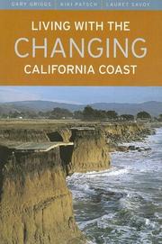
Crowded into the beautiful, narrow strip at the edge of the ocean, the large number of people who live near California's dynamic coastline often have little awareness of the hazards-waves, tides, wind, storms, rain, and runoff-that erode and impact the coast and claim property on a regular basis. This up-to-date, authoritative, and easy-to-use book, a geological profile of the California coast from Mexico to the Oregon border, describes the landforms and processes that shape the coastline and beaches, documents how erosion has affected development, and discusses the options that are available for dealing with coastal hazards and geologic instability. A completely revised and updated edition of Living with the California Coast (1985), this book features hundreds of new photographs and the latest data on human activity on the coast, on climate change, on rising seas levels, and on coastal erosion and protection. With its dramatic photographs and mile-by-mile maps, Living with the Changing California Coast will be an essential resource for those intending to buy or build along the coast, those who need specific information about various coastal regions, and those who are seeking information about how this remarkable coastline has evolved. *279 photographs portray natural coastal features and processes and illustrate many instances of what can happen to buildings on the coast *81 maps, covering the entire coast, detail types of coastal landforms, coastline erosion rates, locations of seawalls or armor, and other specific areas of interest *Offers specific advice for homebuyers,residents, and developers on which areas to avoid, on what safety measures should be taken, and on what danger signals should be heeded
Shore protection --- Coasts --- Coastal zone management --- america. --- california coast. --- california residents. --- california. --- climate change. --- coastal features. --- coastal hazards. --- coastal landscape. --- coastline. --- erosion. --- geologic change. --- geologic instability. --- geologic processes. --- geological profile. --- homebuyers. --- human impact. --- land developers. --- land development. --- landforms. --- maps. --- mexico. --- natural world. --- nonfiction. --- oregon border. --- photographs. --- practical guide. --- reference guide. --- regional geography. --- regional geology. --- regional history. --- sea levels. --- united states.
ISBN: 1281965995 9786611965990 0226534049 9780226534046 9781281965998 9780226534039 0226534030 6611965998 Year: 2008 Publisher: Chicago : ©2008 University of Chicago Press,
Abstract | Keywords | Export | Availability | Bookmark
Loading...Choose an application
- Reference Manager
- EndNote
- RefWorks (Direct export to RefWorks)
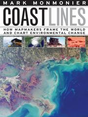
In the next century, sea levels are predicted to rise at unprecedented rates, causing flooding around the world, from the islands of Malaysia and the canals of Venice to the coasts of Florida and California. These rising water levels pose serious challenges to all aspects of coastal existence-chiefly economic, residential, and environmental-as well as to the cartographic definition and mapping of coasts. It is this facet of coastal life that Mark Monmonier tackles in Coast Lines. Setting sail on a journey across shifting landscapes, cartographic technology, and climate change, Monmonier reveals that coastlines are as much a set of ideas, assumptions, and societal beliefs as they are solid black lines on maps. Whether for sailing charts or property maps, Monmonier shows, coastlines challenge mapmakers to capture on paper a highly irregular land-water boundary perturbed by tides and storms and complicated by rocks, wrecks, and shoals. Coast Lines is peppered with captivating anecdotes about the frustrating effort to expunge fictitious islands from nautical charts, the tricky measurement of a coastline's length, and the contentious notions of beachfront property and public access. Combing maritime history and the history of technology, Coast Lines charts the historical progression from offshore sketches to satellite images and explores the societal impact of coastal cartography on everything from global warming to homeland security. Returning to the form of his celebrated Air Apparent, Monmonier ably renders the topic of coastal cartography accessible to both general readers and historians of science, technology, and maritime studies. In the post-Katrina era, when the map of entire regions can be redrawn by a single natural event, the issues he raises are more important than ever.
Coastal mapping. --- Environmental monitoring. --- Biomonitoring (Ecology) --- Ecological monitoring --- Environmental quality --- Monitoring, Environmental --- Applied ecology --- Environmental engineering --- Pollution --- Charting, Coastal --- Coast mapping --- Coastal charting --- Coastal zone mapping --- Coastline mapping --- Coasts --- Cartography --- Measurement --- Monitoring --- Charting --- Mapping --- mapmaking, cartography, geography, climate change, global warming, environment, nature, environmentalism, sea levels, flooding, natural disaster, extreme weather, malaysia, canals, venice, coasts, florida, california, coastline, technology, science, nonfiction, nautical charts, public access, beachfront property, tides, storms, shipwreck, shoals, satellite images, homeland security, maritime, environmental monitoring, coastal mapping.
Book
ISBN: 1283278014 9786613278012 0520948947 9780520948945 9780520268715 0520268717 9780520268722 0520268725 Year: 2011 Publisher: Berkeley : University of California Press,
Abstract | Keywords | Export | Availability | Bookmark
Loading...Choose an application
- Reference Manager
- EndNote
- RefWorks (Direct export to RefWorks)
Take this book to the beach; it will open up a whole new world. Illustrated throughout with color photographs, maps, and graphics, it explores one of the planet's most dynamic environments-from tourist beaches to Arctic beaches strewn with ice chunks to steaming hot tropical shores. The World's Beaches tells how beaches work, explains why they vary so much, and shows how dramatic changes can occur on them in a matter of hours. It discusses tides, waves, and wind; the patterns of dunes, washover fans, and wrack lines; and the shape of berms, bars, shell lags, cusps, ripples, and blisters. What is the world's longest beach? Why do some beaches sing when you walk on them? Why do some have dark rings on their surface and tiny holes scattered far and wide? This fascinating, comprehensive guide also considers the future of beaches, and explains how extensively people have affected them-from coastal engineering to pollution, oil spills, and rising sea levels.
Beaches. --- Seashore. --- Coasts. --- Coast changes. --- Coastal erosion --- Coasts --- Shore erosion --- Littoral drift --- Physical geography --- Coastal landforms --- Coastal zones --- Coastlines --- Landforms --- Seashore --- Sea shore --- Sea shores --- Seashores --- Shore, Sea --- Shores, Sea --- Beaches --- Erosion --- Coast changes --- arctic beaches. --- bars. --- beach ecosystems. --- beach environments. --- beach guides. --- beach variety. --- beaches. --- berms. --- blisters. --- coastal engineering. --- color photographs. --- cusps. --- dunes. --- earth sciences. --- global beaches. --- guidebook. --- illustrated. --- maps. --- natural sciences. --- natural variety. --- nonfiction. --- oceans. --- oil spills. --- pollution. --- ripples. --- rising sea levels. --- scientists. --- shell lags. --- shorelines. --- tides. --- tourist destinations. --- tropical shores. --- washover fans. --- waves. --- wind. --- wrack lines.
Book
ISBN: 0520957326 9780520957329 9780520276086 0520276086 Year: 2014 Publisher: Berkeley, California London, England
Abstract | Keywords | Export | Availability | Bookmark
Loading...Choose an application
- Reference Manager
- EndNote
- RefWorks (Direct export to RefWorks)
One of California's most remarkable wetlands, Suisun Marsh is the largest tidal marsh on the West Coast and a major feature of the San Francisco Estuary. This productive and unique habitat supports endemic species, is a nursery for native fishes, and is a vital link for migratory waterfowl. The 6,000-year-old marsh has been affected by human activity, and humans will continue to have significant impacts on the marsh as the sea level rises and cultural values shift in the century ahead. This study includes in-depth information about the ecological and human history of Suisun Marsh, its abiotic and biotic characteristics, agents of ecological change, and alternative futures facing this ecosystem.
NATURE / Environmental Conservation & Protection. --- NATURE / Ecology. --- Water quality --- Brackish water ecology --- Salinity --- Marsh ecology --- Brackish waters --- Aquatic ecology --- Salts --- Marshes --- Wetland ecology --- Freshwater --- Freshwater quality --- Marine water quality --- Quality of water --- Seawater --- Seawater quality --- Water --- Environmental quality --- Ecology --- Quality --- Composition --- Suisun Marsh (Calif.) --- History. --- alternative futures. --- american west. --- american wetlands. --- birds. --- brackish water march. --- california. --- californian wetlands. --- climate change. --- cultural values. --- ecological change. --- ecological history. --- ecosystem. --- endemic species. --- geomorphic features. --- human activity. --- human history. --- marsh. --- mirgratory waterfowl. --- native fishes. --- natural world. --- nature. --- northern california. --- nursery. --- phenomenon. --- rising sea levels. --- san francisco bay. --- scientists. --- suisun marsh. --- terrestrial vertebrates. --- tidal estuary. --- vegitation. --- west coast. --- wetlands. --- wildlife.
Book
ISBN: 0520966856 9780520966857 9780520293618 Year: 2017 Publisher: Berkeley, CA : University of California Press,
Abstract | Keywords | Export | Availability | Bookmark
Loading...Choose an application
- Reference Manager
- EndNote
- RefWorks (Direct export to RefWorks)
Coastal regions around the world have become increasingly crowded, intensively developed, and severely exploited. Hundreds of millions of people living in these low-lying areas are subject to short-term coastal hazards such as cyclones, hurricanes, and destruction due to El Niño, and are also exposed to the long-term threat of global sea-level rise. These massive concentrations of people expose often-fragile coastal environments to the runoff and pollution from municipal, industrial, and agricultural sources as well as the impacts of resource exploitation and a wide range of other human impacts. Can environmental impacts be reduced or mitigated and can coastal regions adapt to natural hazards? Coasts in Crisis is a comprehensive assessment of the impacts that the human population is having on the coastal zone globally and the diverse ways in which coastal hazards impact human settlement and development. Gary Griggs provides a concise overview of the individual hazards, risks, and issues threatening the coastal zone.
Coasts. --- Coastal zone management. --- Natural disasters. --- Climatic changes. --- Hazardous geographic environments. --- Disasters --- Human ecology --- Environments, Hazardous geographic --- Climatology --- Climate change mitigation --- Global environmental change --- Teleconnections (Climatology) --- Changes, Climatic --- Changes in climate --- Climate change --- Climate change science --- Climate changes --- Climate variations --- Climatic change --- Climatic changes --- Climatic fluctuations --- Climatic variations --- Global climate changes --- Global climatic changes --- Natural calamities --- Ecosystem management --- Natural resources --- Regional planning --- Coastal engineering --- Coast ecosystem management --- Coastal ecosystem management --- Coastal management --- Coastal resource management --- Coastal resources management --- Coastal zone ecosystem management --- Coasts --- CRM (Coastal resource management) --- Zone management, Coastal --- Landforms --- Seashore --- Coastal landforms --- Coastal zones --- Coastlines --- Environmental aspects --- Management --- climate change. --- costal zone. --- diverse preservation. --- ecologist. --- el nino. --- environmental impact. --- fragile ecosystem. --- global warming. --- long term threat. --- melting ice caps. --- ocean floor. --- sea levels. --- sea rising. --- tsunami. --- water crisis.
| Listing 1 - 6 of 6 |
Sort by
|