
 Search
 Feedback
 About
About Help
Help News
News
| Listing 1 - 8 of 8 |
Sort by
|
Periodical
ISSN: 24992674 Year: 2013 Publisher: Roma : Agenzia del Entrate
Abstract | Keywords | Export | Availability | Bookmark
 Loading...
Choose an application
- Reference Manager
- EndNote
- RefWorks (Direct export to RefWorks)
Land Administration --- Cadastre --- Real Estate --- Housing Market --- Valuation --- Public Administrations --- Land use --- Historic sites --- Conservation and restoration --- Economic aspects --- Heritage places, Historic --- Heritage sites, Historic --- Historic heritage places --- Historic heritage sites --- Historic places --- Historical sites --- Places, Historic --- Sites, Historic --- Archaeology --- History --- Historic buildings --- Monuments --- World Heritage areas --- Land use. --- Economic aspects. --- Land --- Land utilization --- Use of land --- Utilization of land --- Economics --- Land cover --- Landscape assessment --- NIMBY syndrome --- land administration --- cadastre --- real estate --- housing market --- valuation --- public administrations
Periodical
ISSN: 22407707 24992666 Year: 2011 Publisher: Italy : Agenzia delle Entrate.
Abstract | Keywords | Export | Availability | Bookmark
Loading...Choose an application
- Reference Manager
- EndNote
- RefWorks (Direct export to RefWorks)
Land Administration --- Cadastre --- Real Estate --- Housing Market --- Valuation --- Public Administration --- Land use --- Historic sites --- Conservation and restoration --- Economic aspects --- Heritage places, Historic --- Heritage sites, Historic --- Historic heritage places --- Historic heritage sites --- Historic places --- Historical sites --- Places, Historic --- Sites, Historic --- Archaeology --- History --- Historic buildings --- Monuments --- World Heritage areas --- Land use. --- Economic aspects. --- Land --- Land utilization --- Use of land --- Utilization of land --- Economics --- Land cover --- Landscape assessment --- NIMBY syndrome --- land administration --- cadastre --- real estate --- housing market --- valuation --- public administration
Book
Year: 2021 Publisher: Basel, Switzerland MDPI - Multidisciplinary Digital Publishing Institute
Abstract | Keywords | Export | Availability | Bookmark
Loading...Choose an application
- Reference Manager
- EndNote
- RefWorks (Direct export to RefWorks)
This Special Issue provides an insight, collated from 26 articles, focusing on various aspects of the Fit-For-Purpose Land Administration (FFPLA) concept and its application. It presents some influential and innovative trends and recommendations for designing, implementing, maintaining and further developing Fit-For-Purpose solutions for providing secure land rights at scale. The first group of 14 articles is published in Volume One and discusses various conceptual innovations related to spatial, legal and institutional aspects and its wider applications within land use management. The second group of 12 articles is published in Volume Two and focuses on case studies from various countries throughout the world, providing evidence and lessons learned from the FFPLA implementation process.
complete cadastre --- legal element --- fixing boundary --- eligible landowner --- agreement --- boundary marker --- fit-for-purpose land administration (FFP LA) --- violent conflict --- United Nations --- extra-legal --- transitional justice --- peace building --- land governance --- power relations --- securing land rights --- land registration --- development impacts --- fit-for-purpose land administration --- land administration --- decentralization --- India --- fit-for-purpose --- institutions --- governance --- politics --- Amazon --- deforestation --- Fit-For-Purpose land administration --- participatory mapping --- indigenous land conflict --- Cumaribo --- Colombia --- community-based land adjudication --- components of adjudication --- land tenure --- land rights --- good practices --- updating land records --- systematic land registration --- unconventional approach --- case study --- Benin --- cadaster --- land administration domain model --- LADM --- cadastre --- FFPLA --- customary tenure --- land inventory --- land management --- mobile-based applications --- pro-poor --- land surveying --- tenure security --- land rights and tenure --- fit-for-purpose approach --- human rights --- design science research --- design thinking --- fit for purpose --- spatial data quality --- spatial data quality assurance --- maintenance --- update --- upgrade --- upkeep --- renewal --- data quality --- spatial framework --- STDM --- technology --- UAV --- feature extraction --- rapid urbanization --- climate change --- pandemic --- urban resilience --- spatial --- legal --- and institutional frameworks --- land tenure security --- pro-poor land recordation --- land governance reform --- cost effectiveness --- innovative technology --- case studies --- Uganda --- customary land tenure --- land recordation tools --- semantic technologies --- land information system --- fit-for-purpose land management --- aerial and street level imagery --- machine learning --- integrated land programs --- land policy --- pilot study --- informal settlements --- urban development --- Brazil --- community-based crowdsourcing --- SiGIT --- Ecuador --- land and resources rights --- public-private partnerships --- corporate social responsibility --- poverty reduction --- business driven solutions --- social enterprises --- n/a
Book
ISBN: 3039210572 3039210564 Year: 2019 Publisher: MDPI - Multidisciplinary Digital Publishing Institute
Abstract | Keywords | Export | Availability | Bookmark
Loading...Choose an application
- Reference Manager
- EndNote
- RefWorks (Direct export to RefWorks)
The increasing complexity of infrastructures and densely built-up areas requires a proper registration of the legal status (private and public), which can only be provided to a limited extent by the existing 2D cadastral registrations. The registration of the legal status in complex 3D situations is investigated under the header of 3D Cadastres. This publication, containing 13 selected contributions on 3D Cadastre, addresses the following areas:
land management --- rights restrictions responsibilities --- n/a --- country profile --- legal framework --- private rights --- multistorey buildings --- constraints --- superficies --- LandXML --- marine information data model --- ISO 19152 --- navigation --- responsibilities --- RRR --- IDM --- Environs Act --- INTERLIS modelling language --- survey plans --- legal --- Serbian country profile --- LADM --- common rights --- Land Administration Domain Model (LADM) --- ISO 1952 --- workflow --- architectural models (BIM) --- spatial data infrastructure --- stratified legal interests --- restrictions --- marine cadastre (MC) --- spatial unit --- 3D cadastres --- institutional --- indoor --- legal view --- MVD --- spatial data modelling --- code lists --- party --- technical --- geographic information systems --- land administration domain model (LADM) --- 3D volumetric parcel --- Model Driven Architecture (MDA) --- InfraGML --- S-121 maritime limits and boundaries (MLB) --- 3D real property --- land administration --- rights --- PLR --- spatial data and functionalities --- 3D cadastral registration --- 3D cadastre --- restrictions and responsibilities (RRRs) --- 3D land administration --- 3D cadastral survey system --- 3D Cadastre --- spatial object --- GeoInfoStrategy --- marine rights --- BIM --- land registry map --- topographic signs --- building information modelling --- complex multi-use rights --- physical view --- legal and physical space --- 3D deed --- marine administration system (MAS) --- real property --- multi-level topology --- 3D parcel
Book
ISBN: 3039210734 3039210726 Year: 2019 Publisher: MDPI - Multidisciplinary Digital Publishing Institute
Abstract | Keywords | Export | Availability | Bookmark
Loading...Choose an application
- Reference Manager
- EndNote
- RefWorks (Direct export to RefWorks)
The book features contributions that report original research in the theoretical, technological, and social aspects of geoinformation methods, as applied to supporting citizen science. Specifically, the book focuses on the technological aspects of the field and their application toward the recruitment of volunteers and the collection, management, and analysis of geotagged information to support volunteer involvement in scientific projects. Internationally renowned research groups share research in three areas: First, the key methods of geoinformatics within citizen science initiatives to support scientists in discovering new knowledge in specific application domains or in performing relevant activities, such as reliable geodata filtering, management, analysis, synthesis, sharing, and visualization; second, the critical aspects of citizen science initiatives that call for emerging or novel approaches of geoinformatics to acquire and handle geoinformation; and third, novel geoinformatics research that could serve in support of citizen science.
education --- geoinformatics --- GIS education --- classification accuracy --- latent class analysis --- location-based social networks (LBSNs) --- geoinformation in citizen science --- toponym --- recruitment --- community mapping --- user preference --- land administration systems --- positional accuracy --- sample size --- spatial proximity --- crowdsourced geoinformation collection and analysis --- air quality estimation --- digital cartography --- crowdsourcing --- VGI in citizen science --- crowdsourced data collection --- social relationship effect --- analysis --- GIS --- data quality --- opportunistic data --- volunteer --- volunteered geographic information (VGI) --- VGI --- data fusion --- algorithms --- OpenStreetMap --- volunteer geographic information --- citizen science --- ensemble --- spatial bias --- projects survey --- Alaska --- marine mammal --- brown marmorated stink bug --- social media --- Environmental niche modeling --- data analysis --- Pentatomidae --- QGIS --- MaxEnt --- spatial accuracy --- clustering --- air pollution --- data import --- sky images
ISBN: 0520926889 1597348384 9780520926882 0585419779 9780585419770 9781597348386 9780520228627 0520228626 0520228626 Year: 2002 Publisher: Berkeley : University of California Press,
Abstract | Keywords | Export | Availability | Bookmark
Loading...Choose an application
- Reference Manager
- EndNote
- RefWorks (Direct export to RefWorks)
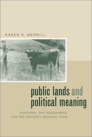
The history of the American West is a history of struggles over land, and none has inspired so much passion and misunderstanding as the conflict between ranchers and the federal government over public grazing lands. Drawing upon neglected sources from organized ranchers, this is the first book to provide a historically based explanation for why the relationship between ranchers and the federal government became so embattled long before modern environmentalists became involved in the issue. Reconstructing the increasingly contested interpretations of the meaning of public land administration, Public Lands and Political Meaning traces the history of the political dynamics between ranchers and federal land agencies, giving us a new look at the relations of power that made the modern West.Although a majority of organized ranchers supported government control of the range at the turn of the century, by midcentury these same organizations often used a virulently antifederal discourse that fueled many a political fight in Washington and that still runs deep in American politics today. In analyzing this shift, Merrill shows how profoundly people's ideas about property wove their way into the political language of the debates surrounding public range policy. As she unravels the meaning of this language, Merrill demonstrates that different ideas about property played a crucial role in perpetuating antagonism on both sides of the fence.In addition to illuminating the origins of the "sagebrush rebellions" in the American West, this book also persuasively argues that political historians must pay more attention to public land management issues as a way of understanding tensions in American state-building.
Public lands --- Government ownership --- Ranchers --- Pasture, Right of --- Agistment --- Grazing rights --- Pastures --- Right of pasture --- Animal industry --- Commons --- Natural resources, Communal --- Servitudes --- Ranchmen --- Stockmen (Animal industry) --- Farmers --- Nationalization --- Public ownership --- Socialization of industry --- State ownership --- Collectivism --- Economic policy --- Socialism --- Privatization --- History. --- Legal status, laws, etc. --- Law --- Law and legislation --- History --- Legal status, laws, etc --- E-books --- american history. --- american west. --- cattle. --- environment. --- federal government. --- federal land agencies. --- frontier. --- government control. --- grazing lands. --- history. --- land administration. --- land management. --- land rights. --- land use. --- modern west. --- nature. --- political science. --- politics. --- property rights. --- protest. --- public grazing. --- public lands. --- public range. --- ranchers. --- ranching. --- range. --- sagebrush rebellions. --- settlers. --- settling the west. --- social issues. --- state building. --- united states. --- wild west.
Book
Year: 2022 Publisher: Basel MDPI - Multidisciplinary Digital Publishing Institute
Abstract | Keywords | Export | Availability | Bookmark
Loading...Choose an application
- Reference Manager
- EndNote
- RefWorks (Direct export to RefWorks)
Good land administration and spatial enablement help to improve people’s living conditions in urban, peri-urban, and rural areas. They protect people’s land rights (including of individuals, communities, and the state) through good governance principles and practices. This makes research concerning land administration practices and geographic (spatial) sciences—whether in developed or developing countries—essential to developing tools or methods for securing natural resource rights for people. In the time of COVID-19, understanding the land and health or wellbeing nexus is also crucial for adequate living conditions for people in living urban, peri-urban, and rural areas. This Special Issue comprises 15 articles (including the editorial) that present insights on theories and practices on land administration and geographic (spatial) sciences in the context of land/water/forest–people–health–wellbeing nexus.
urban land --- urban cadaster --- performance evaluation --- land management --- Ethiopia --- women empowerment --- sustainable local development --- food-handling sector --- horticultural sector --- land dispute --- customary land tenure --- statutory land tenure --- tenure security --- Ghana --- sub-Saharan Africa --- new-type urbanization --- rural revitalization --- urban bias --- integration --- urban–rural relation --- research framework --- health --- urban health --- land tenure --- urban planning --- social determinants --- land tenure security and health nexus --- environmental justice --- land use --- rural development --- rural land use --- remote work --- coworking spaces --- digitization --- urban-rural divide --- town center revitalization --- cadastral system --- cadastral information --- institutional merger --- land right --- institutions --- values-led approaches --- values --- methodology --- land-use --- spatial planning --- land administration --- values-led planning --- spatial development --- land use change --- urbanization --- environmental pollution --- health risks --- agricultural land transition --- groundnut basin --- Senegal --- dispute resolution --- peri-urban --- geographical indication --- agrarian systems --- economic sociology --- cultural hegemony --- agri-food complexity --- critical theory --- market transition --- urban housing --- time factor --- resource allocation --- land register --- digitalization --- standardization --- service delivery --- governance --- structural equation model --- n/a --- urban-rural relation
| Listing 1 - 8 of 8 |
Sort by
|