| Listing 1 - 10 of 573 | << page >> |
Sort by
|
Book
Year: 2013 Publisher: [Place of publication not identified] : Firenze University Press,
Abstract | Keywords | Export | Availability | Bookmark
 Loading...
Choose an application
- Reference Manager
- EndNote
- RefWorks (Direct export to RefWorks)
The study examines a vast panorama of the policies on which depend the living and working conditions of young people. Measures were examined that can be enacted on a regional level starting from the concrete experience of 6 Regional Governments in as many European countries. The book shows that a true "Youth Guarantee" must guarantee support for the complexity of the transitions that characterise young person's life and shows how this must be adapted to the different conditions the various segments of young population live in. The wealth and variety of concrete experiences offered by regional policies show how it is possible to activate public ations that, having adequate ingredients, will be able to lessen the negative effects of the economic crisis and allow young people to take one step ahead at any time in their private and professional life.

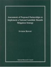
ISBN: 030908489X 9786610183425 128018342X 0309566207 9780309566209 9780309084895 0309183057 Year: 2002 Publisher: Washington, D.C. National Academy Press
Abstract | Keywords | Export | Availability | Bookmark
 Loading...
Choose an application
- Reference Manager
- EndNote
- RefWorks (Direct export to RefWorks)
Landslide hazard analysis --- Hazard mitigation --- Hazard analysis, Landslide --- Landslide hazard assessment --- Landslides --- Hazard assessment --- Soil mechanics
Multi
ISBN: 9780123964762 0123964768 9780123964533 0123964539 Year: 2015 Publisher: Amsterdam, Netherland ; Kidlington, England ; Waltham, Massachusetts : Elsevier,
Abstract | Keywords | Export | Availability | Bookmark
 Loading...
Choose an application
- Reference Manager
- EndNote
- RefWorks (Direct export to RefWorks)
Volcanic Hazards, Risks, and Disasters provides you with the latest scientific developments in volcano and volcanic research, including causality, impacts, preparedness, risk analysis, planning, response, recovery, and the economics of loss and remediation. It takes a geoscientific approach to the topic while integrating the social and economic issues related to volcanoes and volcanic hazards and disasters. Throughout the book case studies are presented of historically relevant volcanic and seismic hazards and disasters as well as recent catastrophes, such as Chile's Puyehue volcano eruption i
Book
Year: 2005 Publisher: Karlsruhe : KIT Scientific Publishing,
Abstract | Keywords | Export | Availability | Bookmark
 Loading...
Choose an application
- Reference Manager
- EndNote
- RefWorks (Direct export to RefWorks)
Der Lehrstuhl für Angewandte Geologie der Universität Karlsruhe (AGK) arbeitete in Kooperation mit der INATURA Dornbirn und der Vorarlberger Landesregierung am Projekt Georisikokarte Vorarlberg. Es wurde eine Methodik vorgeschlagen, um die Gefährdung für Hangrutschungen und Felsstürze regional auszuweisen. Die so erstellten Karten sind ein Instrument für die regionale Siedlungs- und Raumplanung und sollen nicht nur Ingenieuren und Raumplanern, sondern auch lokalen Behörden und der ansässigen Bevölkerung einen Einblick in die Naturgefahren geben.
Book
ISBN: 1784662682 9781784662684 9781784662677 1784662674 Year: 2019 Publisher: Southampton
Abstract | Keywords | Export | Availability | Bookmark
 Loading...
Choose an application
- Reference Manager
- EndNote
- RefWorks (Direct export to RefWorks)
Containing papers from the 11th International Conference on Computer Simulation in Risk Analysis and Hazard Mitigation 2018, this book will be of interest to those concerned with all aspects of risk management and hazard mitigation, associated with both natural and anthropogenic hazards.
Book
Year: 1996 Publisher: [Place of publication not identified] : Éditions de la Sorbonne,
Abstract | Keywords | Export | Availability | Bookmark
 Loading...
Choose an application
- Reference Manager
- EndNote
- RefWorks (Direct export to RefWorks)
Le séminaire de formation avancée qui s'est tenu à Delphes, du 25 au 27 mars 1990, prenait place dans la série des réunions organisées par le Centre Européen de Coordination, Recherche et Documentation en Sciences Sociales (Vienne, Autriche), sous le thème général « Interdisciplinarité dans les sciences sociales ». Dans ce cadre, à partir de 1987, un groupe de chercheurs de formations très variées, appartenant aussi bien à l'Europe de l'Est qu'à l'Europe de l'Ouest, avait mis au premier plan de ses objectifs l'application des méthodes de travail inter et transdisciplinaires dans le domaine de la « gestion des risques et des crises ». Les orientations de ces chercheurs, réunis ultérieurement dans un Groupe d'Études Européen sur le Risque et la Crise (G.E.E.R.C.) ont été illustrées à Delphes dans une étude de cas consacrée au risque sismique. Autour de sismologues et géophysiciens, spécialistes de la dynamique de l'écorce terrestre, des sociologues, géographes, géologues, économistes, juristes, historiens, administratifs, ont mis en évidence la nature multidimensionnelle de ce risque, dont une gestion efficace implique que soit établie une communication réelle entre de multiples experts, décideurs et gestionnaires.
Book
ISBN: 0870717332 9780870717338 9780870717321 0870717324 Year: 2014 Publisher: Corvallis Oregon State University Press
Abstract | Keywords | Export | Availability | Bookmark
 Loading...
Choose an application
- Reference Manager
- EndNote
- RefWorks (Direct export to RefWorks)
Book
Abstract | Keywords | Export | Availability | Bookmark
 Loading...
Choose an application
- Reference Manager
- EndNote
- RefWorks (Direct export to RefWorks)
Landslides - Investigation and Monitoring offers a comprehensive overview of recent developments in the field of mass movements and landslide hazards. Chapter authors use in situ measurements, modeling, and remotely sensed data and methods to study landslides. This book provides a thorough overview of the latest efforts by international researchers on landslides and opens new possible research directions for further novel developments.
Book
ISBN: 9819746809 Year: 2024 Publisher: Singapore : Springer,
Abstract | Keywords | Export | Availability | Bookmark
 Loading...
Choose an application
- Reference Manager
- EndNote
- RefWorks (Direct export to RefWorks)
This book explores a platform for insightful discussions and scientific discourse on various aspects of landslides and their risk management, with insights focused on the Himalayan states at a sub-regional level. A fundamental reference is thus provided for further research not only in landslides but also in associated natural hazards. The book is divided into four major parts, starting from conceptual models in approaching landslide risk, followed by evaluation of risk, management of landslide risk, end-to-end solutions for landslide risk assessment, and a synopsis. Included are topics such as the nature of landslide hazard impact, scale dependency in landslide hazard and risk analysis, and systematic procedures of landslide hazard mapping for risk assessment using spatial prediction models. The book also covers such important aspects as the response of the insurance industry to landslide risk and the role of administrative bodies in landslide risk assessment and sustainable management. Readers gain ample knowledge through case studies regarding the types of landslides in the Himalayan region, which will help them in their future research hypotheses.

ISBN: 128017644X 9786610176441 0309529956 9780309529952 0309091403 9780309091404 0309166322 Year: 2004 Publisher: Washington, D.C. : National Academies Press,
Abstract | Keywords | Export | Availability | Bookmark
 Loading...
Choose an application
- Reference Manager
- EndNote
- RefWorks (Direct export to RefWorks)
Landslide hazard analysis. --- Environmental sciences. --- Environmental science --- Science --- Hazard analysis, Landslide --- Landslide hazard assessment --- Landslides --- Soil mechanics --- Hazard assessment
| Listing 1 - 10 of 573 | << page >> |
Sort by
|

 Search
 Feedback
 About UniCat
  Help
Help News
News