| Listing 1 - 10 of 118 | << page >> |
Sort by
|
Book
ISBN: 9789021543390 Year: 2009 Publisher: Utrecht Kosmos
Abstract | Keywords | Export | Availability | Bookmark
 Loading...
Choose an application
- Reference Manager
- EndNote
- RefWorks (Direct export to RefWorks)
Regional documentation --- (084) --- Atlassen ; algemene --- (Atlassen) --- Maps (1946-)
Book
Abstract | Keywords | Export | Availability | Bookmark
 Loading...
Choose an application
- Reference Manager
- EndNote
- RefWorks (Direct export to RefWorks)
Cartografie ; atlassen ; naslagwerken --- 912 --- Geografie ; atlassen, globes --- Geodesy. Cartography --- anno 1500-1799 --- anno 1800-1999
Book
ISBN: 0852292929 Year: 1975 Publisher: Chicago Encyclopaedia Britannica
Abstract | Keywords | Export | Availability | Bookmark
 Loading...
Choose an application
- Reference Manager
- EndNote
- RefWorks (Direct export to RefWorks)
92-9
912 <031> --- Atlases. --- Atlassen ; algemene --- Britannica --- (084) --- atlassen --- 910 --- 912 --- Geographic atlases --- Geographical atlases --- Geography --- World atlases --- World geographic atlases --- Cartographic materials --- Reference books --- Cartografie. Kaarten. Plattegronden. Atlassen--Encyclopedieën. Lexica --- (Atlassen) --- afstandentabellen en atlassen --- Cartography. Maps. Atlasses --- Atlas --- Atlassen --- Aardrijkskunde --- Atlases
Book
ISBN: 9078131012 9078131020 9078130121 Year: 2005 Publisher: Gent Aquaterra
Abstract | Keywords | Export | Availability | Bookmark
 Loading...
Choose an application
- Reference Manager
- EndNote
- RefWorks (Direct export to RefWorks)
Belgium: coast --- Belgische kust --- Atlassen --- Luchtfotografie --- Land- en volkenkunde --- Cartografie --- 950.6 --- 912 <493> --- 77.047 --- 711.2 --- 711.45 --- 912(493) --- Luchtfotografie ; België ; de kust --- Atlassen en kaarten --- Cartografie. Kaarten. Plattegronden. Atlassen--België --- Fotografie ; landschappen, zeegezichten, panorama's, natuuropnamen --- Stedenbouw. Ruimtelijke ordening ; planningsinstrumenten ; streekplannen, atlassen, surveys --- Stedenbouw. Ruimtelijke ordening ; badplaatsen, handelssteden --- Geografie ; atlassen, globes ; België --- Atlas
Book
ISBN: 9026021585 Year: 1972 Publisher: Malle De Sikkel
Abstract | Keywords | Export | Availability | Bookmark
 Loading...
Choose an application
- Reference Manager
- EndNote
- RefWorks (Direct export to RefWorks)
912 --- 912 <493> --- Academic collection --- #BSCH: vak: aardrijkskunde --- #BSCH: vak: wetenschappen --- International Internationaal --- Belgique België --- Géographie Aardrijkskunde --- Atlas Atlassen --- 695 --- Cartografie. Kaarten. Plattegronden. Atlassen --- Cartografie. Kaarten. Plattegronden. Atlassen--België --- Algemene geschiedenis --- Schoolbooks - Didactic material --- 950.6 --- Aardrijkskunde --- Atlassen --- Atlassen en kaarten --- Physical geography
Book
ISBN: 9061134048 Year: 1981 Publisher: Alphen aan den Rijn Atrium
Abstract | Keywords | Export | Availability | Bookmark
 Loading...
Choose an application
- Reference Manager
- EndNote
- RefWorks (Direct export to RefWorks)
Dit fascinerende boek neemt u mee door de geschiedenis van 2.000 jaar cartografie. Het boek behandelt zowel de primitieve krassen in rendierbotten van de oude eskimo's waarmee zij hun tochten langs de kusten van het poolgebied vastlegden, als de moderne kaarten die zijn gebaseerd op exacte wetenschappelijke waarnemingen. Gaandeweg ontdekken wij hoe de mensheid zich in de eeuwen die achter ons liggen heeft ingespannen om onze aardbol te verkennen en als een soort legpuzzel, deeltje voor deeltje, aan elkaar te passen. Veel gevaarlijke ontdekkingsreizen zijn noodzakelijk geweest om te komen tot ons huidige niveau van kennis. Het bronnenmateriaal en de technieken van de cartografen zijn door de eeuwen heen aanzienlijk veranderd. Politieke, economische en religieuze ontwikkelingen hebben de cartografie als wetenschap in wording sterk beïnvloed. Hierdoor heeft de mens zijn beeld van zijn planeet meerdere keren moeten veranderen en bijstellen. Met andere woorden: de studie van de cartografie geeft ons een geheel ongewoon, maar zeer fascinerend perspectief op het totaal van de wereldgeschiedenis. Na het eerste hoofdstuk, dat ons een beeld geeft van de ontwikkeling van de cartografie, volgen chronologisch de afzonderlijke hoofdstukken over het in kaart brengen van Europa, Azië, Afrika, de beide Amerika's en het laatst ontdekte continent, Australië. Zoals blijkt uit het voorwoord van Gerald Roe Crone: dit is het meest volledige boek over oude kaarten van alle continenten. De tekst wordt ondersteund door meer dan 350 illustraties, waaronder zorgvuldig gereproduceerde kaarten, portretten van beroemde ontdekkingsreizigers en kaartemakers, fraaie titelpagina's en titelbladversieringen van contemporaine publicaties. Hiernaast treft de lezer facsimile-reprodukties van zeer bijzondere kaarten. Een optimaal register completeert het boek.
Geodesy. Cartography --- History --- 912 <09> --- 912 <09> Cartografie. Kaarten. Plattegronden. Atlassen--Geschiedenis van ... --- 912 <09> Cartography. Maps. Atlasses--Geschiedenis van ... --- Cartografie. Kaarten. Plattegronden. Atlassen--Geschiedenis van ... --- Cartography. Maps. Atlasses--Geschiedenis van ... --- Cartografie. Kaarten. Plattegronden. Atlassen--Geschiedenis van .

ISBN: 0801870909 9780801870903 Year: 2001 Publisher: Baltimore Johns Hopkins university press
Abstract | Keywords | Export | Availability | Bookmark
 Loading...
Choose an application
- Reference Manager
- EndNote
- RefWorks (Direct export to RefWorks)
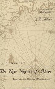
In this collection of essays J. B. Hartley (1932-1991) draws on ideas in art history, literature, philosophy, and the study of visual culture to subvert the traditional, "positivist" model of cartography, replacing it with one that is grounded in an iconological and semiotic theory of the nature of maps. Focusing on historical examples and the practises of modern cartography, J.B. Harley offers an alternative to the dominant view that Western cartography since the Renaissance has been a progressive technological, scientific and objective trajectory of development. This traditional view asserts that maps produce an accurate relational model of terrain and, as such, epitomize representational modernism, which is rooted in the project of the Enlightenment; in sum, maps banish subjectivity from the image. Accordingly, cartographers have promoted a standard scientific model for their discipline, one in which a mirror of nature can be projected through geometry and measurement. Cartographers often mistakenly assess early maps by this modern yardstick, excising from the accepted canon of mapping not only maps from the premodern era but also those from other cultures that do not match Western notions of accuracy. A central theme is the way in which power - whether military, political, religious or economic - becomes inscribed on the land through cartography.
Geodesy. Cartography --- 912 <09> --- cartografie --- aardrijkskunde --- 766.022 --- grafisch design --- grafisch ontwerp --- grafische vormgeving --- 7.01 --- kunsttheorie --- informatiedesign --- geografie --- Cartografie. Kaarten. Plattegronden. Atlassen--Geschiedenis van .. --- Cartografie. Kaarten. Plattegronden. Atlassen--Geschiedenis van . --- Cartografie. Kaarten. Plattegronden. Atlassen--Geschiedenis van

ISBN: 0807830003 9780807830000 080785672X 9780807856727 9781469601014 146960101X 0807838977 9798890878038 Year: 2006 Publisher: Chapel Hill, North Carolina : University of North Carolina Press,
Abstract | Keywords | Export | Availability | Bookmark
 Loading...
Choose an application
- Reference Manager
- EndNote
- RefWorks (Direct export to RefWorks)
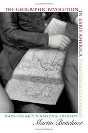
The rapid rise in popularity of maps and geography handbooks in the eighteenth century ushered in a new geographic literacy among non elite Americans. In a path breaking and richly illustrated examination of this transformation, Martin Brückner argues that geographic literacy as it was played out in popular literary genres significantly influenced the formation of identity in America from the 1680s to the 1820s. Drawing on historical geography, cartography, literary history, and material culture, Brückner recovers a vibrant culture of geography consisting of property plats and surveying manuals, decorative wall maps and school geographies, the nation's first atlases, and sentimental objects such as needlework samplers. By showing how this geographic revolution affected the production of literature, Brückner demonstrates that the internalization of geography as a kind of language helped shape the literary construction of the modern American subject.

ISBN: 9060929594 Year: 1996 Publisher: Alphen aan den Rijn Samsom Tjeenk Willink
Abstract | Keywords | Export | Availability | Bookmark
 Loading...
Choose an application
- Reference Manager
- EndNote
- RefWorks (Direct export to RefWorks)
Regional planning --- Urban policy --- 711.2 --- Planningsinstrumenten ; streekplannen ; atlassen ; surveys --- Ruimtelijke ordening ; bestemmingsplannen --- Stedenbouw. Ruimtelijke ordening ; planningsinstrumenten ; streekplannen, atlassen, surveys --- Environmental planning --- Netherlands

ISBN: 1281970220 9786611970222 1554882249 9781554882243 9781459712546 1459712544 1550025627 9781550025620 1903365643 9781903365649 Year: 2004 Publisher: Kew National archives
Abstract | Keywords | Export | Availability | Bookmark
 Loading...
Choose an application
- Reference Manager
- EndNote
- RefWorks (Direct export to RefWorks)
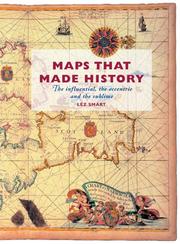
Even in these days of disposable mapping - from satellite navigation to customized road directions at the click of a mouse - the historical map continues to present a unique perspective on our changing world. Here we explore 25 glorious examples. The emphasis is on the story behind the map: what it reveals about its creator and users, from the first explorers to the railway builders. This thought-provoking collection features maps that chart societies as well as land, sea, and skies; maps that have influenced and inspired; and perhaps most revealing of all, maps that misrepresent. It includes the following intriguing historical maps: Ptolemy's Ancient World; The Peutinger Table of Roman Roads; The Psalter (Moses parts the Red Sea, Gog and magog, Noah's Ark); The Pilgrimage Route to Canterbury; Chertsey Abbey on the Thames; Tenochtitlán: Cortés and the Aztecs; The Coast of West Africa; Virginia: John Smith and Pocahontas; The Moluccan Spice Islands; Cook and the East Coast of Australia (Botany Bay); The British colonies in North America; The Red Line Map of North America; The Great Trigonometrical Survey of India; Charles Booths Poverty Map of London; Highways of the British Empire; The London Tube; The Battle of Culloden; The Battle of Waterloo; The American Civil War; The Battle of Mons; D-Day; Southern England from the 'Poly Olbion'; Leo Belgicus; The Mythical Island of California; The Garden of Eden; The Great River of Australia.
| Listing 1 - 10 of 118 | << page >> |
Sort by
|

 Search
 Feedback
 About UniCat
  Help
Help News
News