| Listing 1 - 10 of 15 | << page >> |
Sort by
|

ISBN: 9780122695452 0122695453 9786611059040 1281059048 0080516580 9780080516585 Year: 2001 Publisher: San Diego, CA : Academic,
Abstract | Keywords | Export | Availability | Bookmark
 Loading...
Choose an application
- Reference Manager
- EndNote
- RefWorks (Direct export to RefWorks)
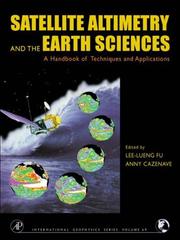
The new level of precision and global coverage provided by satellite altimetry is rapidly advancing studies of ocean circulation. It allows for new insights into marine geodesy, ice sheet movements, plate tectonics, and for the first time provides high-resolution bathymetry for previously unmapped regions of our watery planet and crucial information on the large-scale ocean features on intra-season to interannual time scales. Satellite Altimetry and Earth Sciences has integrated the expertise of the leading international researchers to demonstrate the techniques, missions, and accuracy
Altitudes --- Measurement --- Remote sensing --- Satellite geodesy --- Technique --- Earth sciences --- Artificial satellites in earth sciences. --- Satellite geodesy. --- Oceanography --- Artificial satellites in geodesy --- Geodesy --- Geodetic satellites --- Remote sensing.

ISBN: 0309057922 9786610210589 1280210583 0309538661 0585037108 9780585037103 9780309057929 0309174767 Year: 1997 Publisher: Washington, D.C. National Academy Press
Abstract | Keywords | Export | Availability | Bookmark
 Loading...
Choose an application
- Reference Manager
- EndNote
- RefWorks (Direct export to RefWorks)
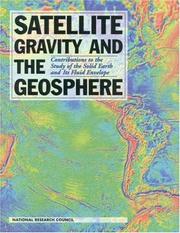
SCIENCE --- Physics / Astrophysics --- Satellite geodesy --- Gravity --- Physical geography --- Geodynamics --- Theoretical Astronomy --- Astronomy & Astrophysics --- Physical Sciences & Mathematics --- Measurement --- Satellite geodesy. --- Physical geography. --- Geodynamics. --- Measurement. --- Dynamic geology --- Tectonophysics --- Gravimetry --- Artificial satellites in geodesy --- Geophysics --- Geography --- Geodesy --- Geodetic satellites

ISBN: 1280743786 9786610743780 0387331859 0387297960 Year: 2005 Publisher: Dordrecht : Springer,
Abstract | Keywords | Export | Availability | Bookmark
 Loading...
Choose an application
- Reference Manager
- EndNote
- RefWorks (Direct export to RefWorks)
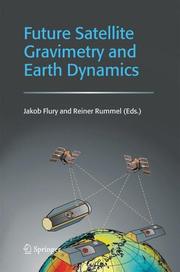
Currently, a first generation of dedicated satellite missions for the precise mapping of the Earth’s gravity field is in orbit (CHAMP, GRACE, and soon GOCE). The gravity data from these satellite missions provide us with very new information on the dynamics of planet Earth. In particular, on the mass distribution in the Earth’s interior, the entire water cycle (ocean circulation, ice mass balance, continental water masses, and atmosphere), and on changes in the mass distribution. The results are fascinating, but still rough with respect to spatial and temporal resolution. Technical progress in satellite-to-satellite tracking and in gravity gradiometry will allow more detailed results in the future. In this special issue, Earth scientists develop visions of future applications based on follow-on high-precision satellite gravimetry missions.
Satellite geodesy. --- Gravity --- Geodynamics. --- Measurement. --- Artificial satellites in geodesy --- Geodesy --- Geodetic satellites --- Dynamic geology --- Tectonophysics --- Geophysics --- Gravimetry
Book
ISBN: 1000086360 3731508567 Year: 2018 Publisher: KIT Scientific Publishing
Abstract | Keywords | Export | Availability | Bookmark
 Loading...
Choose an application
- Reference Manager
- EndNote
- RefWorks (Direct export to RefWorks)
The commemorative publication of the 150-year anniversary of the foundation of the Geodetic Institute Karlsruhe (GIK) presents the historical overview of the development of the GIK. Current research results are presented and innovations are shown.
Book
ISBN: 1000080324 3731507773 Year: 2018 Publisher: KIT Scientific Publishing
Abstract | Keywords | Export | Availability | Bookmark
 Loading...
Choose an application
- Reference Manager
- EndNote
- RefWorks (Direct export to RefWorks)
The commemorative publication in honor of Prof. Bernhard Heck contains 41 contributions written by friends, colleagues, co-workers and former PhD-students. The focus of the scientific articles is on Physical and Satellite Geodesy as well as on geodynamics. It reflects the wide range of academic and scientific research activities of Bernhard Heck. The volume is completed by articles about education at the Geodetic Institute of KIT as well as the importance of Geodesy for society.
Physikalische und Satellitengeodäsie --- Prof. Bernhard Heck --- Geodätisches Institut --- KIT --- commemorative publication --- Festschrift --- Physical and Satellite Geodesy --- Geodetic Institute

ISBN: 3110175495 9786612195082 1282195085 3110200082 9783110200089 9783110175493 Year: 2008 Publisher: Berlin Boston
Abstract | Keywords | Export | Availability | Bookmark
 Loading...
Choose an application
- Reference Manager
- EndNote
- RefWorks (Direct export to RefWorks)
This book covers the entire field of satellite geodesy and is intended to serve as a textbook for advanced undergraduate and graduate students, as well as a reference for professionals and scientists in the fields of engineering and geosciences such as geodesy, surveying engineering, geomatics, geography, navigation, geophysics and oceanography. The text provides a systematic overview of fundamentals including reference systems, time, signal propagation and satellite orbits, together with observation methods such as satellite laser ranging, satellite altimetry, gravity field missions, very long baseline interferometry, Doppler techniques, and Global Navigation Satellite Systems (GNSS). Particular emphasis is given to positioning techniques, such as the NAVSTAR Global Positioning System (GPS), and to applications. Numerous examples are included which refer to recent results in the fields of global and regional control networks; gravity field modeling; Earth rotation and global reference frames; crustal motion monitoring; cadastral and engineering surveying; geoinformation systems; land, air, and marine navigation; marine and glacial geodesy; and photogrammetry and remote sensing. This book will be an indispensable source of information for all concerned with satellite geodesy and its applications, in particular for spatial referencing, geoinformation, navigation, geodynamics, and operational positioning.
Satellite geodesy. --- Geografie --- Globale Navigatie. --- satellietgeodesie --- geodesie --- referentiesysteem --- doppler effect --- CCD camera --- aardsatelliet --- satelliet --- gps (global positioning system) (global position system) --- laseraltimetrie --- hoogtemeting --- satelliethoogtemeting --- (zie ook: vliegtuiglaseraltimetrie) --- Satellite geodesy --- Global positioning system. --- Satellite. --- Theoretical Astronomy --- Artificial satellites in geodesy --- Geodesy --- Geodetic satellites --- Satellites artificiels en géodésie.
Book
ISBN: 1628700777 1849951063 9781628700770 9781849951067 9781849950466 1849950466 9781439894446 1439894442 Year: 2012 Publisher: Caithness, Scotland : Whittles Publishing,
Abstract | Keywords | Export | Availability | Bookmark
 Loading...
Choose an application
- Reference Manager
- EndNote
- RefWorks (Direct export to RefWorks)
A comprehensive guide to the characteristics and use of high resolution optical images from satellite-borne sensors. It addresses the problems and issues surrounding the generation of high quality information and also provides a review of planned sensors. It is written by a team of acknowledged international experts and is the only comprehensive text on the subject.
Periodical
Abstract | Keywords | Export | Availability | Bookmark
 Loading...
Choose an application
- Reference Manager
- EndNote
- RefWorks (Direct export to RefWorks)
Devoted to research in surveying and mapping, positioning and navigation, satellite positioning, geodesy, photogrammetry, cartography and cadastral, hydrography, remote sensing, spatial data analysis, spatial information science, and geographic information systems.
geodesy --- land information systems (lis) --- digital mapping --- cartography --- geodetic and control surveys --- construction surveys --- Geomatics --- Surveying --- Satellite geodesy --- Remote-sensing maps --- Geographic information systems --- surveying and mapping --- spatial data analysis --- spatial information science --- Geographical information systems --- GIS (Information systems) --- Information storage and retrieval systems --- Maps --- Artificial satellites in geodesy --- Geodesy --- Geodetic satellites --- Cities and towns --- City surveying --- Land surveying --- Engineering --- Earth sciences --- Information science --- Geography --- Geomatics. --- Surveying. --- Satellite geodesy. --- Remote-sensing maps. --- Geographic information systems.
Book
ISBN: 3642102271 9786612926440 1282926446 364210228X Year: 2010 Publisher: New York : Springer,
Abstract | Keywords | Export | Availability | Bookmark
 Loading...
Choose an application
- Reference Manager
- EndNote
- RefWorks (Direct export to RefWorks)
The Earth’s gravity and magnetic gravity fields play an important role in global and regional geodynamics. Research satellites such as CHAMP, GRACE, and GOCE apply new measurement techniques to recover gravity and magnetic fields with unprecedented accuracy and resolution in space and time. Combined with terrestrial observations and numerical models, this data will significantly improve a detailed understanding of the Earth as a coupled system of atmosphere, hydrosphere and solid Earth. In Germany, many of the processing, modelling and interpreting methodologies for these new observation techniques have been developed under the umbrella of the R&D-programme GEOTECHNOLOGIEN. The research projects focus on a better understanding of the spatial and temporal variations in the magnetic and gravity field and their relationship to the dynmaics of the Earth's interior and global change processes close to its surface. This volume presents the results of all multidisciplinary studies covered by this programme for the period 2005-2008, including the following topics: - Static and time variable gravity field models from CHAMP, GRACE and GOCE - Applications of GRACE , altimetry, GPS and other data for geophysical analyses - Contributions to the Global Geodetic Observing System (GGOS) - Atmospheric sounding by GPS radio occultation technique with CHAMP and GRACE - Observation of the Earth's magnetic field with CHAMP Thus, it offers an up-to-date overview for a broad scientific community working in gravity field and Earth rotation research.
Geodetic satellites. --- Gravity -- Measurement. --- Satellite geodesy. --- Gravity --- Geomagnetism --- Satellite geodesy --- Geodetic satellites --- Geography --- Astronomy & Astrophysics --- Physical Sciences & Mathematics --- Earth & Environmental Sciences --- Geography-General --- Theoretical Astronomy --- Cartography --- Measurement --- Measurement. --- Satellites, Geodetic --- Artificial satellites in geodesy --- Gravimetry --- Earth sciences. --- Geophysics. --- Geographical information systems. --- Remote sensing. --- Physics. --- Earth Sciences. --- Geophysics/Geodesy. --- Physics, general. --- Remote Sensing/Photogrammetry. --- Geographical Information Systems/Cartography. --- Scientific satellites --- Geodesy --- Physical geography. --- Geographical information systems --- GIS (Information systems) --- Information storage and retrieval systems --- Natural philosophy --- Philosophy, Natural --- Physical sciences --- Dynamics --- Remote-sensing imagery --- Remote sensing systems --- Remote terrain sensing --- Sensing, Remote --- Terrain sensing, Remote --- Aerial photogrammetry --- Aerospace telemetry --- Detectors --- Space optics --- Geological physics --- Terrestrial physics --- Earth sciences --- Physics
Book
ISBN: 9783211730171 3211730125 9783211730126 3211730176 Year: 2008 Publisher: Wien : Springer,
Abstract | Keywords | Export | Availability | Bookmark
 Loading...
Choose an application
- Reference Manager
- EndNote
- RefWorks (Direct export to RefWorks)
“GNSS - GPS, GLONASS, Galileo and more” is the extension of the scientific bestseller “GPS - Theory and Practice” to Global Navigation Satellite Systems (GNSS) and includes the Russian GLONASS, the European system Galileo, and additional systems. The book refers to GNSS in the generic sense to describe the various existing reference systems for coordinates and time, the satellite orbits, the satellite signals, observables, mathematical models for positioning, data processing, and data transformation. With respect to the individual systems GPS, GLONASS, Galileo and more, primarily the specific reference systems, services, the space and the control segment, as well as satellite signals are described. Furthermore, augmentations by space- and ground-based systems are discussed. This book is a university-level introductory textbook and is intended to serve as a reference for students as well as for professionals and scientists in the fields of geodesy, surveying engineering, navigation, and related disciplines.
Geosciences. --- Geophysics/Geodesy. --- Physical geography. --- Géographie physique --- Geographic information systems. --- Global navigation. --- Global positioning system. --- Mobile geographic information sytems --- Global Positioning System --- Artificial satellites in navigation --- Satellite geodesy --- Galileo satellite navigation system --- Physics --- Mechanical Engineering --- Geography --- Engineering & Applied Sciences --- Earth & Environmental Sciences --- Physical Sciences & Mathematics --- Aeronautics Engineering & Astronautics --- Geography-General --- Cosmic Physics --- Mobile geographic information sytems. --- Global Positioning System. --- Artificial satellites in navigation. --- Satellite geodesy. --- Galileo satellite navigation system. --- Mobile geographic information systems. --- Artificial satellites in geodesy --- Global Navigation Satellite System --- GNSS (Navigational system) --- GPS (Navigational system) --- Navigation Satellite Timing and Ranging Global Positioning System --- NAVSTAR GPS --- Field geographic information systems --- Field GIS --- Mobile GIS --- Geography. --- Geophysics. --- Geographical information systems. --- Geographical Information Systems/Cartography. --- Geodesy --- Geodetic satellites --- Navigation --- Mobile geographic information systems --- Geographic information systems --- Location-based services --- Mobile computing --- Geographical information systems --- GIS (Information systems) --- Information storage and retrieval systems --- Geological physics --- Terrestrial physics --- Earth sciences
| Listing 1 - 10 of 15 | << page >> |
Sort by
|

 Search
 Feedback
 About UniCat
  Help
Help News
News