| Listing 1 - 7 of 7 |
Sort by
|
Book
ISBN: 1282618121 9786612618123 0080914462 0080452620 0080974848 9780080452623 9780080914466 Year: 2010 Publisher: Amsterdam : Elsevier,
Abstract | Keywords | Export | Availability | Bookmark
 Loading...
Choose an application
- Reference Manager
- EndNote
- RefWorks (Direct export to RefWorks)
Active geophysical monitoring is an important new method for studying time-evolving structures and states in the tectonically active Earth's lithosphere. It is based on repeated time-lapse observations and interpretation of rock-induced changes in geophysical fields periodically excited by controlled sources. In this book, the results of strategic systematic development and the application of new technologies for active geophysical monitoring are presented. The authors demonstrate that active monitoring may drastically change solid Earth geophysics, through the acquisition of substa
Geodynamics. --- Geophysics --- Geophysical observations --- Observations, Geophysical --- Dynamic geology --- Tectonophysics
Book
ISBN: 0470272392 0335100368 9780470272398 Year: 1989 Publisher: Milton Keynes Open University
Abstract | Keywords | Export | Availability | Bookmark
 Loading...
Choose an application
- Reference Manager
- EndNote
- RefWorks (Direct export to RefWorks)
Sedimentary rocks --- Petrology --- Fieldwork --- Sedimentary rocks. --- Fieldwork. --- Identification --- identification --- Sédiment --- Sediment --- Rocks. Minerals --- 550.8.04 --- 552.5 --- 552.5 Sedimentary rocks --- 550.8.04 Observations. Geophysical field survey --- Observations. Geophysical field survey --- identification. --- Sediment. --- Petrology - Fieldwork --- Guide de terrain
Book
ISBN: 0080220541 008022055X 1322263183 1483293130 Year: 1983 Publisher: Oxford Pergamon
Abstract | Keywords | Export | Availability | Bookmark
 Loading...
Choose an application
- Reference Manager
- EndNote
- RefWorks (Direct export to RefWorks)
The first book to cover geological excursions for the whole of the British Isles. Information on the best means of studying geology in the field in the British Isles is followed by descriptions of 194 geological itineraries based on a number of centres and a final chapter on the geology evident on 31 journeys by road, rail and coastal boat. Sketch maps indicate the routes of all the excursions with maps showing the geology of each region. These are detailed for those areas for which modern geological maps are not available.
55 <41> --- Geology --- -Geology --- -550.8.04 --- Geognosy --- Geoscience --- Earth sciences --- Natural history --- Earth sciences. Geology. Meteorology etc.--Verenigd Koninkrijk van Groot-Brittannië en Noord-Ierland --- Guidebooks --- Observations. Geophysical field survey --- Guidebooks. --- 550.8.04 Observations. Geophysical field survey --- 55 (41) Earth sciences. Geology. Meteorology etc.--Verenigd Koninkrijk van Groot-Brittannië en Noord-Ierland --- 550.8.04 --- 55 (41)

ISBN: 0471962155 9780471962151 Year: 1996 Publisher: New York, NY : John Wiley,
Abstract | Keywords | Export | Availability | Bookmark
 Loading...
Choose an application
- Reference Manager
- EndNote
- RefWorks (Direct export to RefWorks)
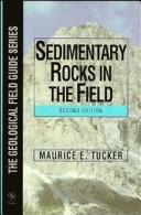
This handy pocket-sized guide shows how to achieve successful fieldwork on sedimentary rocks, paying particular detail to the precision and accuracy of recording detail. Various sedimentary rock-types, textures and all the basic field techniques required are clearly described. Thoroughly revised to incorporate up-to-date information, this 3rd edition will be of use to all students and professionals with a geological background. Features include: New sections on safety in the field, the use of GPS in sedimentary studies, core description, fossils as depth indicators and facies models. Improved illustrations and a new updated layout.
Rocks, Sedimentary. --- Petrology --- Fieldwork. --- 550.81 --- -Rocks, Sedimentary --- 550.8.04 --- 552.5 --- Rocks, Sedimentary --- Rocks --- Lithology --- Petrography --- Physical geology --- Geological prospecting. Simplest exploration methods. Geomorphological investigations while prospecting --- Fieldwork --- Observations. Geophysical field survey --- Sedimentary rocks --- 552.5 Sedimentary rocks --- 550.8.04 Observations. Geophysical field survey --- 550.81 Geological prospecting. Simplest exploration methods. Geomorphological investigations while prospecting --- Roches sédimentaires --- 551.3 --- External geodynamics (exogenous processes) --- 551.3 External geodynamics (exogenous processes) --- Roches sédimentaires --- Sedimentary rocks. --- Petrology - Fieldwork.
Book
ISSN: 03796566 ISBN: 9290923911 9789290923916 Year: 1997 Volume: 1198
Abstract | Keywords | Export | Availability | Bookmark
 Loading...
Choose an application
- Reference Manager
- EndNote
- RefWorks (Direct export to RefWorks)
Geophysical instruments. --- Geophysics --- Astronautics in cosmic physics. --- Observations. --- Cluster Mission (Spacecraft) --- 629.78 <066> --- Astronautics in cosmic physics --- -Geophysical instruments --- #TWER:WTCM --- Instruments, Geophysical --- Meteorological instruments --- Physical instruments --- Scientific apparatus and instruments --- Geological physics --- Terrestrial physics --- Earth sciences --- Physics --- Cosmic physics --- Ruimteschip--?<066> --- Observations --- Instruments --- Geophysical instruments --- Geophysical observations --- Observations, Geophysical --- Geophysics - Observations.
Book
ISBN: 9290925043 9789290925040 Year: 1998 Volume: 1227
Abstract | Keywords | Export | Availability | Bookmark
 Loading...
Choose an application
- Reference Manager
- EndNote
- RefWorks (Direct export to RefWorks)
Artificial satellites in earth sciences --- Earth sciences --- Geophysics --- Research --- Observations --- Living Planet Programme (European Space Agency) --- 629.78 <066> --- -Geophysics --- -Geological physics --- Terrestrial physics --- Physics --- Geosciences --- Environmental sciences --- Physical sciences --- Ruimteschip--?<066> --- -Observations --- European Space Agency. --- -Ruimteschip--?<066> --- Geophysical observations --- Observations, Geophysical --- Earth sciences - Research - Europe --- Geophysics - Observations

ISBN: 3540408827 366205440X 3662054388 Year: 2004 Publisher: Berlin : Springer,
Abstract | Keywords | Export | Availability | Bookmark
 Loading...
Choose an application
- Reference Manager
- EndNote
- RefWorks (Direct export to RefWorks)
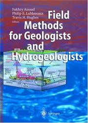
The authors describe project performance, methods for field study of rocks, soils, and outcrops and how to evaluate impacts of air pollution and water resources systems. Furthermore, they develop guidelines for graphic and text presentation of results of studies and describe superficial rock characteristics and subsurface geological mapping techniques. The text covers hydrogeologic methods, groundwater monitoring systems, contamination and waste management and discusses groundwater flow in fractured and granular aquifers, including a special reference to karstic aquifers. In addition to this, international waste management rules and regulations are listed. A glossary is provided of geological and hydrogeological terms, as well as a standard terminology for soils, rocks, and contained fluids.
Geology --- Hydrogeology --- Fieldwork. --- Fieldwork --- 550.8.04 --- 550.8.04 Observations. Geophysical field survey --- Observations. Geophysical field survey --- Geology. --- Geotechnical engineering. --- Geoecology. --- Environmental geology. --- Nature conservation. --- Regional planning. --- Urban planning. --- Water pollution. --- Geotechnical Engineering & Applied Earth Sciences. --- Geoecology/Natural Processes. --- Nature Conservation. --- Landscape/Regional and Urban Planning. --- Waste Water Technology / Water Pollution Control / Water Management / Aquatic Pollution. --- Aquatic pollution --- Fresh water --- Fresh water pollution --- Freshwater pollution --- Inland water pollution --- Lake pollution --- Lakes --- Reservoirs --- River pollution --- Rivers --- Stream pollution --- Water contamination --- Water pollutants --- Water pollution --- Pollution --- Waste disposal in rivers, lakes, etc. --- Cities and towns --- City planning --- Civic planning --- Land use, Urban --- Model cities --- Redevelopment, Urban --- Slum clearance --- Town planning --- Urban design --- Urban development --- Urban planning --- Land use --- Planning --- Art, Municipal --- Civic improvement --- Regional planning --- Urban policy --- Urban renewal --- Regional development --- State planning --- Human settlements --- Landscape protection --- Conservation of nature --- Nature --- Nature protection --- Protection of nature --- Conservation of natural resources --- Applied ecology --- Conservation biology --- Endangered ecosystems --- Natural areas --- Geoecology --- Environmental protection --- Physical geology --- Engineering, Geotechnical --- Geotechnics --- Geotechnology --- Engineering geology --- Geognosy --- Geoscience --- Earth sciences --- Natural history --- Government policy --- Management --- Conservation
| Listing 1 - 7 of 7 |
Sort by
|

 Search
 Feedback
 About UniCat
  Help
Help News
News