| Listing 1 - 3 of 3 |
Sort by
|

ISBN: 0198545630 0198545924 9780198545927 Year: 1987 Volume: 12 Publisher: Oxford : Clarendon press,
Abstract | Keywords | Export | Availability | Bookmark
 Loading...
Choose an application
- Reference Manager
- EndNote
- RefWorks (Direct export to RefWorks)
Geographical information systems are increasingly in demand by environmental resource and planning agencies, but the technical principles have been scattered throughout a wide range of disciplines, including cartography, spatial statistics, and computer science. The first study to gather together and explain these principles, this volume describes the major components of geographical information systems, including raster and vector data structures, modules for data input, digital terrain models, and methods of spatial analysis, classification, and interpolation. In addition, the book provides a much-needed critical review of the sources of error in geographical information processing.
Land use --- -Digital mapping --- Computer cartography --- Computer mapping --- Digitized mapping --- Cartography --- Land --- Land utilization --- Use of land --- Utilization of land --- Economics --- Land cover --- Landscape assessment --- NIMBY syndrome --- Maps --- -Data processing --- Digital mapping --- Land use mapping --- 681.3*H4 --- 681.3*H4 Information systems applications (GIS etc.) --- Information systems applications (GIS etc.) --- Data processing --- Mapping --- Land use mapping. --- Digital mapping. --- Data processing. --- Geografie --- Geografische Informatie Systemen --- Algemeen. --- Databanken. --- surveys --- Geography --- environment --- Natural resources --- Models --- Information processing --- computer applications --- cartography --- Satellites --- #TELE:MI2 --- #ABIB:altk --- Sol, Utilisation du --- Cartographie par ordinateur --- Map --- Informatique --- Cartes --- Utilisation du sol --- Land use - Data processing. --- Land use - Data processing --- Remote sensing --- Cartographie numerique
Book
ISBN: 9781782162360 9781782162377 1782162372 1782162364 Year: 2015 Publisher: Birmingham, England : Packt Publishing,
Abstract | Keywords | Export | Availability | Bookmark
 Loading...
Choose an application
- Reference Manager
- EndNote
- RefWorks (Direct export to RefWorks)
Whether you are a hobbyist or a professional web developer, if you wish to use maps on your website, then this book is for you. A basic understanding of JavaScript will be helpful, but is not necessary. If you've never worked with maps before, this book will introduce you to some common mapping topics and will guide you through the OpenLayers library. Experienced developers can also use this book as a reference to OpenLayers 3 components and to further enhance their knowledge.
Digital mapping. --- JavaScript (Computer program language) --- Web site development. --- Development of Web sites --- Web sites --- Internet programming --- Domain-specific programming languages --- Object-oriented programming languages --- Scripting languages (Computer science) --- Computer cartography --- Computer mapping --- Digitized mapping --- Cartography --- Development --- Adobe Acrobat. --- Acrobat (Computer file)

ISBN: 9780972969628 0972969624 Year: 2006 Publisher: Minneapolis, MN University of Minnesota Press
Abstract | Keywords | Export | Availability | Bookmark
 Loading...
Choose an application
- Reference Manager
- EndNote
- RefWorks (Direct export to RefWorks)
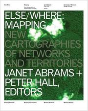
'ELSE/WHERE: MAPPING' explores the importance of maps as aids to navigation, understanding, and cultural representation. Traditionally written by history's victors, maps are gaining new currency in our information-saturated age as a means of making arguments and processes visible. Mapping technologies today are as diverse as the agendas driving them: the human body is mapped with 3-D software, buildings are mapped with lasers, and cities are mapped by satellite. 'ELSE/WHERE: MAPPING' proposes& by visual example and written analysis& that mapmaking is a fundamental design process, one that shapes the physical and conceptual dimensions of contemporary multicultural society. 'ELSE/WHERE: MAPPING' is the second installment in an international visual/verbal collaboration focusing on the design implications of new technologies. It follows the award-winning book 'IF/THEN: PLAY', published in 1999, and is designed by Amsterdam studio Mevis + van Deursen. Janet Abrams is director of the University of Minnesota Design Institute. She edited 'IF/THEN' while working at the Netherlands Design Institute, Amsterdam. Peter Hall is senior editor at the University of Minnesota Design Institute and a contributing writer to Metropolis magazine. Distributed for the University of Minnesota Design Institute
Digital mapping. --- Geographic information systems. --- Cartographie par ordinateur --- Systèmes d'information géographique --- 912 --- 528.9 --- 007 --- 528 --- 655 --- 766 --- Cartografie ; traditionele en digitale navigatiesystemen --- Geografie ; cartografie ; traditionele en digitale technieken --- Geografische en sociale virtuele netwerken --- 001.81 --- Geographical information systems --- GIS (Information systems) --- Information storage and retrieval systems --- Computer cartography --- Computer mapping --- Digitized mapping --- Cartography --- Cartografie. Kaarten. Plattegronden. Atlassen --- Cartography. Mapping (textual documents) --- Communicatie --- Visuele communicatie --- Cartografie --- GIS --- Geografisch Informatie Systeem --- Geographic Information System --- Grafische industrie --- Gebruiksgrafiek --- Grafische vormgeving --- Atlassen --- Kaarten --- techniek van de wetenschappelijke arbeid --- Geography --- 528.9 Cartography. Mapping (textual documents) --- Systèmes d'information géographique --- Digital mapping --- Geographic information systems --- Ruimtelijke ordening --- stadsplanning --- stadsontwikkeling --- stedenbouwkunde --- Environmental planning --- urban planning --- urban development --- urban design
| Listing 1 - 3 of 3 |
Sort by
|

 Search
 Feedback
 About UniCat
  Help
Help News
News