| Listing 1 - 10 of 11 | << page >> |
Sort by
|
ISBN: 1280612584 9786610612581 1402039689 1402039670 9781402039676 9781402039683 9401784256 Year: 2006 Publisher: Dordrecht : Springer,
Abstract | Keywords | Export | Availability | Bookmark
 Loading...
Choose an application
- Reference Manager
- EndNote
- RefWorks (Direct export to RefWorks)
The aquatic coastal zone is one of the most challenging targets for environmental remote sensing. Properties such as bottom reflectance, spectrally diverse suspended sediments and phytoplankton communities, diverse benthic communities, and transient events that affect surface reflectance (coastal blooms, runoff, etc.) all combine to produce an optical complexity not seen in terrestrial or open ocean systems. Despite this complexity, remote sensing is proving to be an invaluable tool for "Case 2" waters. This book presents recent advances in coastal remote sensing with an emphasis on applied science and management. Case studies of the operational use of remote sensing in ecosystem studies, monitoring, and interfacing remote sensing/science/management are presented. Spectral signatures of phytoplankton and suspended sediments are discussed in detail with accompanying discussion of why blue water (Case 1) algorithms cannot be applied to Case 2 waters. Audience This book is targeted for scientists and managers interested in using remote sensing in the study or management of aquatic coastal environments. With only limited discussion of optics and theory presented in the book, such researchers might benefit from the detailed presentations of aquatic spectral signatures, and to operational management issues. While not specifically written for remote sensing scientists, it will prove to be a useful reference for this community for the current status of aquatic coastal remote sensing.
Remote sensing. --- Ecology. --- Remote-sensing imagery --- Remote sensing systems --- Remote terrain sensing --- Sensing, Remote --- Terrain sensing, Remote --- Aerial photogrammetry --- Aerospace telemetry --- Detectors --- Space optics --- Balance of nature --- Biology --- Bionomics --- Ecological processes --- Ecological science --- Ecological sciences --- Environment --- Environmental biology --- Oecology --- Environmental sciences --- Population biology --- Ecology --- Coastal ecology --- Aquatic biology. --- Environmental management. --- Algorithms. --- Remote Sensing/Photogrammetry. --- Freshwater & Marine Ecology. --- Environmental Management. --- Optics, Lasers, Photonics, Optical Devices. --- Algorism --- Algebra --- Arithmetic --- Environmental stewardship --- Stewardship, Environmental --- Management --- Hydrobiology --- Water biology --- Aquatic sciences --- Foundations --- Aquatic ecology . --- Lasers. --- Photonics. --- New optics --- Optics --- Light amplification by stimulated emission of radiation --- Masers, Optical --- Optical masers --- Light amplifiers --- Light sources --- Optoelectronic devices --- Nonlinear optics --- Optical parametric oscillators --- Aquatic biology
Book
ISBN: 9789048187997 9789048188109 9789048187980 9789400790193 9400790198 Year: 2014 Publisher: New York Springer
Abstract | Keywords | Export | Availability | Bookmark
 Loading...
Choose an application
- Reference Manager
- EndNote
- RefWorks (Direct export to RefWorks)
Hydrogeology is a topical and growing subject as the earth's water resources become scarcer and more vulnerable. More than half of the surface area of continents is covered with hard rocks of low permeability. This book deals comprehensively with the fundamental principles for understanding the hydrogeological characteristics of rocks, as well as exploration techniques and assessment. It also provides in depth discussion on structural mapping, remote sensing, geophysical exploration, GIS, groundwater flow modelling and contaminant transportfield hydraulic testing including tracer tests, groundwater quality, geothermal reservoirs, managed aquifer recharge, and resources assessment and management. Hydrogeological aspects of various lithology groups, including crystalline rocks, volcanic rocks, carbonate rocks and clastic formations have been dealt with separately, using and discussing examples from all over the world.-- from back cover.
Space research --- Geodesy. Cartography --- Hydrosphere --- Rocks. Minerals --- Geology. Earth sciences --- Mining industry --- Geography --- hydrologie --- geodesie --- fotogrammetrie --- GIS (geografisch informatiesysteem) --- economie --- mijnbouw --- geologie --- sensoren --- Hydrogeology --- Hydrology --- Groundwater --- Aquifers --- Hydraulic engineering --- Remote sensing --- Earth sciences --- Geosciences --- Environmental sciences --- Physical sciences --- Remote-sensing imagery --- Remote sensing systems --- Remote terrain sensing --- Sensing, Remote --- Terrain sensing, Remote --- Aerial photogrammetry --- Aerospace telemetry --- Detectors --- Space optics --- Engineering, Hydraulic --- Engineering --- Fluid mechanics --- Hydraulics --- Shore protection --- Cosmography --- World history --- Aquafers --- Water-bearing formations --- Aquitards --- Ground water --- Subterranean water --- Underground water --- Water, Underground --- Water --- Aquatic sciences --- Hydrography --- Geohydrology --- Geology
ISBN: 1280283335 9786610283330 1402031025 9781402031014 1402031017 9781402031021 9401783306 Year: 2005 Publisher: Dordrecht : Springer,
Abstract | Keywords | Export | Availability | Bookmark
 Loading...
Choose an application
- Reference Manager
- EndNote
- RefWorks (Direct export to RefWorks)
A new discipline of hydrogeophysics has evolved, aimed at improved simultaneous use of geophysical and hydrogeological measurements for hydrogeological investigations. By combining measurements made from hydrologic instruments with geophysical methods, accurate subsurface characterization and monitoring can be achieved, with high temporal and spatial resolution over a range of spatial scales. This helps to estimate parameters and monitor processes that are important to hydrological studies, such as those associated with water resources, contaminant transport, ecological and climate investigations. This book covers the fundamentals of the discipline from both the hydrogeological and geophysical perspectives, provides guidelines for application of different approaches and methods, and includes extensive examples of hydrogeophysical applications through case studies. Thirty five authors from nine countries, who are leaders in their respective areas, contributed to Hydrogeophysics. The book is intended to provide an introduction to new researchers to the field, to be used as a resource for researchers already active in the field, and to serve as a springboard for advances in the field that are needed to improve our understanding and management of the earth’s shallow subsurface.
Hydrogeology --- Geophysics --- Hydraulic engineering. --- Physical geography. --- Environmental pollution. --- Hydrogeology. --- Hydrology/Water Resources. --- Geophysics/Geodesy. --- Remote Sensing/Photogrammetry. --- Waste Water Technology / Water Pollution Control / Water Management / Aquatic Pollution. --- Chemical pollution --- Chemicals --- Contamination of environment --- Environmental pollution --- Pollution --- Contamination (Technology) --- Asbestos abatement --- Bioremediation --- Environmental engineering --- Environmental quality --- Factory and trade waste --- Hazardous waste site remediation --- Hazardous wastes --- In situ remediation --- Lead abatement --- Pollutants --- Refuse and refuse disposal --- Geography --- Engineering, Hydraulic --- Engineering --- Fluid mechanics --- Hydraulics --- Shore protection --- Environmental aspects --- Hydrology. --- Geophysics. --- Remote sensing. --- Water pollution. --- Aquatic pollution --- Fresh water --- Fresh water pollution --- Freshwater pollution --- Inland water pollution --- Lake pollution --- Lakes --- Reservoirs --- River pollution --- Rivers --- Stream pollution --- Water contamination --- Water pollutants --- Water pollution --- Waste disposal in rivers, lakes, etc. --- Remote-sensing imagery --- Remote sensing systems --- Remote terrain sensing --- Sensing, Remote --- Terrain sensing, Remote --- Aerial photogrammetry --- Aerospace telemetry --- Detectors --- Space optics --- Geological physics --- Terrestrial physics --- Earth sciences --- Physics --- Aquatic sciences --- Hydrography --- Water --- Geohydrology --- Geology --- Hydrology --- Groundwater
Book
ISSN: 15673200 ISBN: 9789048137510 9789048137503 9048137500 9400731728 9048137519 9048137616 128292639X 9786612926396 Year: 2010 Volume: 15 Publisher: Dordrecht : Springer Verlag,
Abstract | Keywords | Export | Availability | Bookmark
 Loading...
Choose an application
- Reference Manager
- EndNote
- RefWorks (Direct export to RefWorks)
This book presents a unique collection of state-of-the-art contributions by international remote sensing experts focussing on methodologies to extract information about urban areas from Synthetic Aperture Radar (SAR) data. SAR is an active remote sensing technique capable to gather data independently from sun light and weather conditions. Emphasizing technical and geometrical issues the potential and limits of SAR are addressed in focussed case studies, for example, the detection of buildings and roads, traffic monitoring, surface deformation monitoring, and urban change. These studies can be sorted into two groups: the mapping of the current urban state and the monitoring of change. The former covers, for instance, methodologies for the detection and reconstruction of individual buildings and road networks; the latter, for example, surface deformation monitoring and urban change. This includes also investigations related to the benefit of SAR Interferometry, which is useful to determine either digital elevation models and surface deformation or the radial velocity of objects (e.g. cars), and the Polarization of the signal that comprises valuable information about the type of soil and object geometry. Furthermore, the features of modern satellite and airborne sensor devices which provide high-spatial resolution of the urban scene are discussed. Audience: This book will be of interest to scientists and professionals in geodesy, geography, architecture, engineering and urban planning.
Earth Sciences. --- Remote Sensing/Photogrammetry. --- Pattern Recognition. --- Image Processing and Computer Vision. --- Computer Applications in Earth Sciences. --- Simulation and Modeling. --- Geography. --- Mathematical geography. --- Remote sensing. --- Computer simulation. --- Computer vision. --- Optical pattern recognition. --- Géographie --- Géographique mathématique --- Télédétection --- Simulation par ordinateur --- Vision par ordinateur --- Reconnaissance optique des formes (Informatique) --- GG Cartography --- RMCA --- Synthetic aperture radar --- Urban geography --- SAR (Synthetic aperture radar) --- Remote sensing --- Geography --- Coherent radar --- Geographical information systems. --- Urban geography. --- Geophysics. --- Pattern recognition. --- Optical data processing. --- Geographical Information Systems/Cartography. --- Urban Geography / Urbanism (inc. megacities, cities, towns). --- Geophysics/Geodesy. --- Optical computing --- Visual data processing --- Bionics --- Electronic data processing --- Integrated optics --- Photonics --- Computers --- Design perception --- Pattern recognition --- Form perception --- Perception --- Figure-ground perception --- Remote-sensing imagery --- Remote sensing systems --- Remote terrain sensing --- Sensing, Remote --- Terrain sensing, Remote --- Aerial photogrammetry --- Aerospace telemetry --- Detectors --- Space optics --- Geological physics --- Terrestrial physics --- Earth sciences --- Physics --- Geographical information systems --- GIS (Information systems) --- Information storage and retrieval systems --- Optical equipment --- Urban geography - Remote sensing --- Synthetic aperture radar.
Book
ISSN: 15673200 ISBN: 9781402094286 9781402094279 1402094272 9048181259 9786612127281 1282127284 1402094280 Year: 2009 Volume: 14 Publisher: [Dordrecht] : Springer,
Abstract | Keywords | Export | Availability | Bookmark
 Loading...
Choose an application
- Reference Manager
- EndNote
- RefWorks (Direct export to RefWorks)
This book covers a unique combination of scientific research and the practical demand for subsidence monitoring techniques focused on the satellite radar interferometry technique (InSAR). It covers the topic in a generic way: both precision and reliability of InSAR as a measurement technique, and the estimation of earth surface deformation in the presence of multiple deformation causes are addressed. It provides a review of existing subsidence estimation methodologies using geodetic measurements, explains Persistent Scatterer InSAR (PSI), and proposes a new method for reliability assessment: multi-track datum connection. The presented methodologies are demonstrated for the entire northern part of the Netherlands and a part of Germany (covering ~15.000 km2), using multi-track SAR observations from ESA’s ERS and Envisat satellites. The capability of PSI for wide-scale monitoring of subsidence rates of several millimeters per year in a rural area (which implies a low PS density) is shown. Additionally, methodologies for a better discrimination of the deformation signal of interest, subsidence due to hydrocarbon production, are assessed. Essential for operational use, the performance of PSI with respect to the leveling technique is quantified. It is shown that the high spatial and temporal observation density of PSI moreover contributes to the understanding of subsurface processes. For example, subsidence due to gas extraction and subsequent uplift due to underground gas storage is clearly detected. Audience: This book will be of interest to scientists and professionals in geodesy and geophysics working with Radar Interferometry, studying displacements, subsidence, earthquakes, or volcanoes.
geofysica --- geografie --- Geophysics --- Geodesy. Cartography --- radars --- geophysics --- fotogrammetrie --- Geology. Earth sciences --- Subsidences (Earth movements) --- Space interferometry. --- Imaging systems in geophysics. --- Interférométrie stellaire optique --- Imagerie en géophysique --- Remote sensing. --- EPUB-LIV-FT LIVECOLO LIVTERRE SPRINGER-B --- Imaging systems in geophysics --- Space interferometry --- Land subsidences --- Earth movements --- Astrophysics --- Interferometry --- Geophysical imaging systems --- Geophysical instruments --- Remote sensing --- Signal processing. --- Image processing. --- Speech processing systems. --- Geophysics. --- Geotechnical engineering. --- Signal, Image and Speech Processing. --- Geophysics/Geodesy. --- Geotechnical Engineering & Applied Earth Sciences. --- Remote Sensing/Photogrammetry. --- Remote-sensing imagery --- Remote sensing systems --- Remote terrain sensing --- Sensing, Remote --- Terrain sensing, Remote --- Aerial photogrammetry --- Aerospace telemetry --- Detectors --- Space optics --- Engineering, Geotechnical --- Geotechnics --- Geotechnology --- Engineering geology --- Geological physics --- Terrestrial physics --- Earth sciences --- Physics --- Computational linguistics --- Electronic systems --- Information theory --- Modulation theory --- Oral communication --- Speech --- Telecommunication --- Singing voice synthesizers --- Pictorial data processing --- Picture processing --- Processing, Image --- Imaging systems --- Optical data processing --- Processing, Signal --- Information measurement --- Signal theory (Telecommunication) --- Subsidences (Earth movements) - Remote sensing --- Interferometry. --- Physical geography.
ISBN: 1281981702 9786611981709 3540927255 3540927247 3642445179 9783642445170 9783540927242 9783540927259 3540291520 9783540291527 9786610609598 1280609591 3540291539 Year: 2006 Publisher: Berlin : Springer,
Abstract | Keywords | Export | Availability | Bookmark
 Loading...
Choose an application
- Reference Manager
- EndNote
- RefWorks (Direct export to RefWorks)
1.1 Basic idea and main task of photogrammetry If you want to measure the size of an object, let’s say the length, width and height of a house, then normally you will carry this out directly at the object. Now imagine that the house didn’t exist anymore – it was destroyed, but some historic photos exist. Then, if you can determine the scale of the photos, it must be possible to get the desired data. Of course you can use photos to get information about objects. This kind of - formation is different: So, for example, you may receive qualitative data (the house seems to be old, the walls are coloured light yellow) from photo interpretation, or quantitative data like mentioned before (the house has a base size of 8 by 6 meters) from photo measurement, or information in addition to your background knowledge (the house has elements of the “art nouveau” style, so may be c- th structed at the beginning of the 20 century), and so on.
Photogrammetry --- Image processing --- Digital techniques. --- Digital image processing --- Digital electronics --- Digital photogrammetric systems --- Digital photogrammetry --- DP (Digital photogrammetry) --- DPS (Digital photogrammetric systems) --- Geographical information systems. --- Physical geography. --- Information systems. --- Regional planning. --- Geographical Information Systems/Cartography. --- Remote Sensing/Photogrammetry. --- Geophysics/Geodesy. --- Information Systems and Communication Service. --- Landscape/Regional and Urban Planning. --- Geography --- Geographical information systems --- GIS (Information systems) --- Information storage and retrieval systems --- Regional development --- Regional planning --- State planning --- Human settlements --- Land use --- Planning --- City planning --- Landscape protection --- Government policy --- Photogrammetry. --- Photography --- Digital photography --- Photographic measurements --- Stereophotogrammetry --- Image analysis --- Digital techniques --- Remote sensing. --- Geophysics. --- Computers. --- Urban planning. --- Cities and towns --- Civic planning --- Land use, Urban --- Model cities --- Redevelopment, Urban --- Slum clearance --- Town planning --- Urban design --- Urban development --- Urban planning --- Art, Municipal --- Civic improvement --- Urban policy --- Urban renewal --- Automatic computers --- Automatic data processors --- Computer hardware --- Computing machines (Computers) --- Electronic brains --- Electronic calculating-machines --- Electronic computers --- Hardware, Computer --- Computer systems --- Cybernetics --- Machine theory --- Calculators --- Cyberspace --- Geological physics --- Terrestrial physics --- Earth sciences --- Physics --- Remote-sensing imagery --- Remote sensing systems --- Remote terrain sensing --- Sensing, Remote --- Terrain sensing, Remote --- Aerial photogrammetry --- Aerospace telemetry --- Detectors --- Space optics --- Management --- Fotogrammetrie --- Aerial photogrammetry.
Book
ISBN: 9789048188598 9789048188581 904818858X 9048188598 Year: 2010 Publisher: Dordrecht : Springer,
Abstract | Keywords | Export | Availability | Bookmark
 Loading...
Choose an application
- Reference Manager
- EndNote
- RefWorks (Direct export to RefWorks)
This book reports on developments in Proximal Soil Sensing (PSS) and high resolution digital soil mapping. PSS has become a multidisciplinary area of study that aims to develop field-based techniques for collecting information on the soil from close by, or within, the soil. Amongst others, PSS involves the use of optical, geophysical, electrochemical, mathematical and statistical methods. This volume, suitable for undergraduate course material and postgraduate research, brings together ideas and examples from those developing and using proximal sensors and high resolution digital soil maps for applications such as precision agriculture, soil contamination, archaeology, peri-urban design and high land-value applications, where there is a particular need for high spatial resolution information. The book in particular covers soil sensor sampling, proximal soil sensor development and use, sensor calibrations, prediction methods for large data sets, applications of proximal soil sensing, and high-resolution digital soil mapping. Key themes: soil sensor sampling – soil sensor calibrations – spatial prediction methods – reflectance spectroscopy – electromagnetic induction and electrical resistivity – radar and gamma radiometrics – multi-sensor platforms – high resolution digital soil mapping - applications Raphael A. Viscarra Rossel is a scientist at the Commonwealth Scientific and Industrial Research Organisation (CSIRO) of Australia. Alex McBratney is Pro-Dean and Professor of Soil Science in the Faculty of Agriculture Food & Natural Resources at the University of Sydney in Australia. Budiman Minasny is a Senior Research Fellow in the Faculty of Agriculture Food & Natural Resources at the University of Sydney in Australia.
Environment. --- Soil Science & Conservation. --- Remote Sensing/Photogrammetry. --- Geographical Information Systems/Cartography. --- Geophysics/Geodesy. --- Environmental sciences. --- Physical geography. --- Remote sensing. --- Geographical information systems. --- Soil conservation. --- Sciences de l'environnement --- Géographie physique --- Télédétection --- Systèmes d'information --- Sols --- Noms géographiques --- Conservation --- Soils --- Digital soil mapping --- Remote sensing --- Propriété physicochimique du sol --- soil chemicophysical properties --- Relevé (des données) --- surveying --- Capteur --- Sensors --- Traitement d'images --- Image processing --- Spectrométrie --- Spectrometry --- Radar --- Système d'information géographique --- Geographical information systems --- Méthode statistique --- Statistical methods --- Digital soil mapping. --- Environmental Sciences and Forestry. Soil Science --- Soil Science (General) --- Agriculture -- Remote sensing. --- Soils -- Remote sensing. --- Agriculture - General --- Ecology --- Earth & Environmental Sciences --- Agriculture --- Soil Science (General). --- Predictive soil mapping --- Earth (Soils) --- Mold, Vegetable --- Mould, Vegetable --- Soil --- Vegetable mold --- Earth sciences. --- Sedimentology. --- Geophysics. --- Soil science. --- Earth Sciences. --- Soil mapping --- Agricultural resources --- Plant growing media --- Regolith --- Land capability for agriculture --- Conservation of soil --- Erosion control, Soil --- Soil erosion --- Soil erosion control --- Agricultural conservation --- Soil management --- GIS (Information systems) --- Information storage and retrieval systems --- Petrology --- Geography --- Control --- Prevention --- Geological physics --- Terrestrial physics --- Earth sciences --- Physics --- Remote-sensing imagery --- Remote sensing systems --- Remote terrain sensing --- Sensing, Remote --- Terrain sensing, Remote --- Aerial photogrammetry --- Aerospace telemetry --- Detectors --- Space optics --- Pedology (Soil science) --- Soils - Remote sensing
ISBN: 9780387357676 038735767X 1441942068 9786611087463 1281087467 038768574X 9780387685748 Year: 2008 Publisher: New York : Springer,
Abstract | Keywords | Export | Availability | Bookmark
 Loading...
Choose an application
- Reference Manager
- EndNote
- RefWorks (Direct export to RefWorks)
With this third edition of Open Source GIS: A GRASS GIS Approach, we enter the new era of GRASS6, the first release that includes substantial new code developed by the International GRASS Development Team. The dramatic growth in open source software libraries has made GRASS6 development more efficient, and has enhanced GRASS interoperability with a wide range of open source and proprietary geospatial tools. Thoroughly updated with material related to GRASS6, the third edition includes new sections on attribute database management and SQL support, vector networks analysis, lidar data processing and new graphical user interfaces. All chapters are updated with numerous practical examples using the first release of a comprehensive, state-of-the-art geospatial data set. Open Source GIS: A GRASS GIS Approach, Third Edition preserves the continuity of previous editions by maintaining the book's proven structure. This volume is structured for a professional audience composed of researchers and practitioners in government and industry, as well as graduate students interested in geospatial analysis and modeling.
Geographic information systems --- GRASS (Electronic computer system) --- Open source software --- Systèmes d'information géographique --- GRASS (Système informatique) --- Logiciels libres --- Geographic information systems. --- GRASS (Electronic computer system). --- Open source software. --- Geography --- Earth & Environmental Sciences --- Geography-General --- Cartography --- Systèmes d'information géographique --- GRASS (Système informatique) --- EPUB-LIV-FT LIVGEOGR SPRINGER-B --- Free software (Open source software) --- Open code software --- Opensource software --- Graphical Remote Access Support System --- Geographical information systems --- GIS (Information systems) --- Geography. --- Earth sciences. --- Image processing. --- Geographical information systems. --- Remote sensing. --- Geographical Information Systems/Cartography. --- Earth Sciences, general. --- Remote Sensing/Photogrammetry. --- Information Systems Applications (incl. Internet). --- Image Processing and Computer Vision. --- Environmental Monitoring/Analysis. --- Computer software --- Computer graphics --- Online data processing --- Information storage and retrieval systems --- Computer vision. --- Monitoring/Environmental Analysis. --- Machine vision --- Vision, Computer --- Artificial intelligence --- Image processing --- Pattern recognition systems --- Cosmography --- Earth sciences --- World history --- Application software. --- Optical data processing. --- Environmental monitoring. --- Optical computing --- Visual data processing --- Bionics --- Electronic data processing --- Integrated optics --- Photonics --- Computers --- Application computer programs --- Application computer software --- Applications software --- Apps (Computer software) --- Remote-sensing imagery --- Remote sensing systems --- Remote terrain sensing --- Sensing, Remote --- Terrain sensing, Remote --- Aerial photogrammetry --- Aerospace telemetry --- Detectors --- Space optics --- Geosciences --- Environmental sciences --- Physical sciences --- Biomonitoring (Ecology) --- Ecological monitoring --- Environmental quality --- Monitoring, Environmental --- Applied ecology --- Environmental engineering --- Pollution --- Optical equipment --- Measurement --- Monitoring
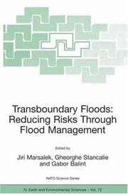
ISBN: 9781402049026 1402049005 9781402049002 1402049013 9786610625338 1280625333 1402049021 Year: 2006 Volume: v. 72 Publisher: Dordrecht, The Netherlands : Springer,
Abstract | Keywords | Export | Availability | Bookmark
 Loading...
Choose an application
- Reference Manager
- EndNote
- RefWorks (Direct export to RefWorks)
Flood damages are increasing as a result of frequent occurrence of large floods in many parts of the world, existing and continuing encroachment of development onto flood plains and aging flood protection structures. Under such circumstances, there is an ongoing search for better ways of protecting human life, land, property and the environment by improved flood management. Many flood management measures have been practiced in various jurisdictions, including living with floods, non-structural measures (e.g., regulations, flood defence by flood forecasting and warning, evacuations, and flood insurance), and structural measures (e.g., land drainage modifications, reservoirs, dykes and polders). Such flood management is difficult in river basins controlled by a single authority, and becomes even more challenging when dealing with transboundary floods, which may originate in one country or jurisdiction and then propagate downstream to another country, or jurisdiction. Under such circumstances, the demands on communications, information and data sharing, compatibility of forecasting methodologies, and close collaboration in all aspects of flood management are particularly strong and important. These issues are addressed in the edited proceedings of this NATO Advanced Research Workshop.
milieutechnologie --- Computer. Automation --- informatica --- milieubeleid --- Geodesy. Cartography --- Physical geography --- geologie --- fysische geografie --- fotogrammetrie --- Geology. Earth sciences --- Environmental protection. Environmental technology --- Flood control --- Floodplain management --- Inondations --- Plaines inondables --- Congresses. --- Congresses --- Maîtrise --- Congrès --- Gestion --- EPUB-LIV-FT LIVECOLO LIVTERRE SPRINGER-B --- Hydraulic engineering. --- Physical geography. --- Environmental management. --- Geoengineering, Foundations, Hydraulics. --- Geotechnical Engineering & Applied Earth Sciences. --- Physical Geography. --- Environmental Management. --- Monitoring/Environmental Analysis. --- Remote Sensing/Photogrammetry. --- Environmental stewardship --- Stewardship, Environmental --- Environmental sciences --- Management --- Geography --- Engineering, Hydraulic --- Engineering --- Fluid mechanics --- Hydraulics --- Shore protection --- Engineering geology. --- Engineering—Geology. --- Foundations. --- Hydraulics. --- Geotechnical engineering. --- Environmental monitoring. --- Remote sensing. --- Remote-sensing imagery --- Remote sensing systems --- Remote terrain sensing --- Sensing, Remote --- Terrain sensing, Remote --- Aerial photogrammetry --- Aerospace telemetry --- Detectors --- Space optics --- Biomonitoring (Ecology) --- Ecological monitoring --- Environmental quality --- Monitoring, Environmental --- Applied ecology --- Environmental engineering --- Pollution --- Engineering, Geotechnical --- Geotechnics --- Geotechnology --- Engineering geology --- Architecture --- Building --- Structural engineering --- Underground construction --- Caissons --- Earthwork --- Masonry --- Soil consolidation --- Soil mechanics --- Walls --- Civil engineering --- Geology, Economic --- Flow of water --- Water --- Hydraulic engineering --- Jets --- Measurement --- Monitoring --- Details --- Geology --- Flow --- Distribution
Book
ISBN: 9781402085048 1402085036 9781402085031 9048178959 9786611772758 1281772755 1402085044 Year: 2008 Publisher: Dordrecht : Springer,
Abstract | Keywords | Export | Availability | Bookmark
 Loading...
Choose an application
- Reference Manager
- EndNote
- RefWorks (Direct export to RefWorks)
Increasing evidence suggests that the composition and spatial configuration – the pattern – of forest landscapes affect many ecological processes, including the movement and persistence of particular species, the susceptibility and spread of disturbances such as fires or pest outbreaks, and the redistribution of matter and nutrients. Understanding these issues is key to the successful management of complex, multifunctional forest landscapes, and landscape ecology, based on a foundation of island bio-geography and meta-population dynamic theories, provides the rationale to deal with this pattern-to-process interaction at different spatial and temporal scales. This carefully edited volume represents a stimulating addition to the international literature on landscape ecology and resource management. It provides key insights into some of the applicable landscape ecological theories that underlie forest management, with a specific focus on how forest management can benefit from landscape ecology, and how landscape ecology can be advanced by tackling challenging problems in forest (landscape) management. It also presents a series of case studies from Europe, Asia, North America, Africa and Australia exploring the issues of disturbance, diversity, management, and scale, and with a specific focus on how human intervention affects forest landscapes and, in turn, how landscapes influence humans and their culture. An important reference for advanced students and researchers in landscape ecology, conservation biology, forest ecology, natural resource management and ecology across multiple scales, the book will also appeal to researchers and practitioners in reserve design, ecological restoration, forest management, landscape planning and landscape architecture.
General ecology and biosociology --- bossen --- biodiversiteit --- Nature protection --- landschapsecologie --- natuurbescherming --- Forestry --- fotogrammetrie --- Geodesy. Cartography --- Forest landscape management --- Paysages forestiers --- Gestion --- EPUB-LIV-FT LIVBIOLO LIVBIOMO LIVMEDEC SPRINGER-B --- Landscape ecology. --- Forests and forestry. --- Biodiversity. --- Nature Conservation. --- Landscape Ecology. --- Forestry Management. --- Remote Sensing/Photogrammetry. --- Ecology --- Conservation of nature --- Nature --- Protection of nature --- Conservation of natural resources --- Applied ecology --- Conservation biology --- Endangered ecosystems --- Natural areas --- Biological diversification --- Biological diversity --- Biotic diversity --- Diversification, Biological --- Diversity, Biological --- Biology --- Biocomplexity --- Ecological heterogeneity --- Numbers of species --- Forest land --- Forest lands --- Forest planting --- Forest production --- Forest sciences --- Forestation --- Forested lands --- Forestland --- Forestlands --- Forestry industry --- Forestry sciences --- Land, Forest --- Lands, Forest --- Silviculture --- Sylviculture --- Woodlands --- Woods (Forests) --- Agriculture --- Natural resources --- Afforestation --- Arboriculture --- Logging --- Timber --- Tree crops --- Trees --- Conservation --- Forestry management. --- Nature conservation. --- Remote sensing. --- Remote-sensing imagery --- Remote sensing systems --- Remote terrain sensing --- Sensing, Remote --- Terrain sensing, Remote --- Aerial photogrammetry --- Aerospace telemetry --- Detectors --- Space optics --- Forest administration --- Forest plants --- Forest resource administration --- Forest resource management --- Forest stewardship --- Forest vegetation management --- Forestry management --- Forests and forestry --- Stewardship, Forest --- Vegetation management, Forest --- Ecosystem management --- Management --- Administration --- Control --- Forest landscape management.
| Listing 1 - 10 of 11 | << page >> |
Sort by
|

 Search
 Feedback
 About UniCat
  Help
Help News
News