| Listing 1 - 10 of 49 | << page >> |
Sort by
|
Book
ISBN: 9060721187 Year: 1977 Publisher: Amsterdam Nico Israel
Abstract | Keywords | Export | Availability | Bookmark
 Loading...
Choose an application
- Reference Manager
- EndNote
- RefWorks (Direct export to RefWorks)
Hondius, Jodocus --- Blaeu, Willem Jansz. --- Early maps. --- World maps --- Early works to 1800.

ISBN: 9022199975 Year: 1976 Publisher: Amsterdam Theatrvm Orbis Terrarvm Ltd.
Abstract | Keywords | Export | Availability | Bookmark
 Loading...
Choose an application
- Reference Manager
- EndNote
- RefWorks (Direct export to RefWorks)
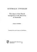
Explorers --- -Discoverers --- Navigators --- Voyagers --- Adventure and adventurers --- Heroes --- Discoveries in geography --- Australia --- Discovery and exploration. --- -Australia --- Discoverers --- History of the Netherlands --- History of Oceania with Australia --- maritime history --- Tasman, Abel Jansz.
Book
ISBN: 9004338020 9789004338029 Year: 2017 Volume: 17 Publisher: Leiden Brill
Abstract | Keywords | Export | Availability | Bookmark
 Loading...
Choose an application
- Reference Manager
- EndNote
- RefWorks (Direct export to RefWorks)
This book fills a void, existing currently in the knowledge of early Dutch Maritime Cartography. Before Amsterdam developed into Europe?s most important commercial hub in the seventeenth century, demanding and controlling manufacture of maps and sea-charts, a major School of Cartography already flourished in the so-called 'Kop van Noord-Holland', the region just north of Amsterdam. This School specialised in the production of small-scale charts of larger areas, like European coastlines, the Indian Ocean and the Atlantic Ocean. Its representatives used to call themselves 'çaert-schrijvers' or 'map-scribes' when clarifying their profession. The cities of Enkhuizen and Edam were important trading ports and as such provided an ideal environment for developing into centres of cartography, serving sea-borne navigation. 0Apart from the well-known printed pilot guides by Lucas Jansz. Waghenaer, the output of these 'caert-schrijvers' consists mainly of manuscript charts on vellum. Copies, although few, are nowadays to be found all over the world. Charts were actually used on board for their application in navigation; another category, however, may also be distinguished. These were to serve in offices of rich ship owners and merchants as wall-decoration and source of information. They feature a decorative lay-out and are magnificently coloured. In view of the miniature paintings they sometimes contain, they surely rate among the most beautiful sea-charts ever produced by Dutch Cartography in the Golden Age.
Nautical charts --- Cartography --- Cartography, Primitive --- Chartography --- Map-making --- Mapmaking --- Mapping (Cartography) --- Mathematical geography --- Surveying --- Map projection --- Maps --- Charts, Nautical --- Hydrographic charts --- Inland navigation --- Navigation --- Navigation charts --- Navigation maps --- Pilot charts --- Aids to navigation --- Nautical paraphernalia --- Notices to mariners --- History --- 912 "15/16" --- 912 <492> --- 912.1 <26> --- 912:551.46 --- 912:551.46 Kaarten. Atlassen: oceanen --- Kaarten. Atlassen: oceanen --- 912 <492> Cartografie. Kaarten. Plattegronden. Atlassen--Nederland --- 912 <492> Cartography. Maps. Atlasses--Nederland --- Cartografie. Kaarten. Plattegronden. Atlassen--Nederland --- Cartography. Maps. Atlasses--Nederland --- Geodesy. Cartography --- anno 1600-1699 --- anno 1500-1599 --- Netherlands --- cartography [discipline] --- Book history --- maritime history --- Bibliography --- Catalogs
Book
ISBN: 9064695733 906469561X 9064696519 9064696608 9064697043 9064697593 9064697655 9064698330 9789061946212 9789061946212 9064697493 9789064698330 9789064695735 9789064695612 Year: 1986 Publisher: Alphen aan den Rijn Canaletto
Abstract | Keywords | Export | Availability | Bookmark
 Loading...
Choose an application
- Reference Manager
- EndNote
- RefWorks (Direct export to RefWorks)
912 <09> <492>
---
912 <09> <493>
---
912 "15"
---
912 "16"
---
Cartografie. Kaarten. Plattegronden. Atlassen--Geschiedenis van ...--Nederland
---
Cartografie. Kaarten. Plattegronden. Atlassen--Geschiedenis van ...--België
---
Cartografie. Kaarten. Plattegronden. Atlassen--16e eeuw. Periode 1500-1599
---
Cartografie. Kaarten. Plattegronden. Atlassen--17e eeuw. Periode 1600-1699
---
Cartographie
---
Cartes du monde
---
Cartes anciennes
---
Cartouches (ornements)
---
Cartographes
---
Histoire
---
Blaeu, Willem Jansz,
---
Blaeu, Joan,
---
Hondius, Jodocus I,
---
Pays-Bas
---
Europe
---
Espagne
---
Asie
---
Afrique
---
Amérique
---
Allemagne
---
Cartes ancienns
---
912 <100>
---
094.1 <492 AMSTERDAM>
---
094.1 <492 AMSTERDAM> Oude drukken: bibliografie--
Book
ISBN: 9064696624 Year: 1993 Publisher: Alphen aan den Rijn Canaletto
Abstract | Keywords | Export | Availability | Bookmark
 Loading...
Choose an application
- Reference Manager
- EndNote
- RefWorks (Direct export to RefWorks)
912 <09> <492>
---
912 <09> <493>
---
912 "16"
---
094.1 <492 AMSTERDAM>
---
094.1 <492 AMSTERDAM> Oude drukken: bibliografie--
Book
ISBN: 9060721403 Year: 1982 Publisher: Amsterdam Israel
Abstract | Keywords | Export | Availability | Bookmark
 Loading...
Choose an application
- Reference Manager
- EndNote
- RefWorks (Direct export to RefWorks)
Book history --- Geodesy. Cartography --- cartography [discipline]
Book
Year: 1983 Publisher: Tring Map Collector
Abstract | Keywords | Export | Availability | Bookmark
 Loading...
Choose an application
- Reference Manager
- EndNote
- RefWorks (Direct export to RefWorks)
Book
Year: 1998 Publisher: 't Goy-Houten Hes
Abstract | Keywords | Export | Availability | Bookmark
 Loading...
Choose an application
- Reference Manager
- EndNote
- RefWorks (Direct export to RefWorks)
Book
Year: 1991 Publisher: London
Abstract | Keywords | Export | Availability | Bookmark
 Loading...
Choose an application
- Reference Manager
- EndNote
- RefWorks (Direct export to RefWorks)
Book
Year: 1976 Publisher: Amsterdam Theatrum Orbis terrarum
Abstract | Keywords | Export | Availability | Bookmark
 Loading...
Choose an application
- Reference Manager
- EndNote
- RefWorks (Direct export to RefWorks)
| Listing 1 - 10 of 49 | << page >> |
Sort by
|

 Search
 Feedback
 About UniCat
  Help
Help News
News