
 Search
 Feedback
 About UniCat
  Help
Help News
News
| Listing 1 - 4 of 4 |
Sort by
|
Book
ISBN: 303097314X 3030973158 Year: 2022 Publisher: Cham, Switzerland : Springer,
Abstract | Keywords | Export | Availability | Bookmark
 Loading...
Choose an application
- Reference Manager
- EndNote
- RefWorks (Direct export to RefWorks)
Beaches --- Coastal mapping. --- Charting, Coastal --- Coast mapping --- Coastal charting --- Coastal zone mapping --- Coastline mapping --- Coasts --- Cartography --- Charting --- Mapping
Book
ISBN: 9400730764 1402097190 9786612833663 1402097204 1282833669 Year: 2010 Publisher: Dordrecht : Springer,
Abstract | Keywords | Export | Availability | Bookmark
Loading...Choose an application
- Reference Manager
- EndNote
- RefWorks (Direct export to RefWorks)
This international collection of papers represents a selected and up-to-date overview of some of the main areas of research into the application of the geospatial technologies, including geographical information systems (GIS), remote sensing, digital mapping, global positioning systems (GPS), databases, Internet technology, and mobile field-data collection and mapping, to coastal and marine environments around the World. Aimed at the researcher, editor, practitioner and student, this volume seeks to expand the available literature in a rapidly expanding and evolving area, namely the coastal and marine environment. The book comes at a time when there is growing concern about global warming, climate change, and sea level rise, all of which will have an impact upon coastal areas. These geospatial technologies offer the possibility to gather unique environmental data to study the coast, to process the data into information, to visualise data and landscapes, to gather data in the field, and to involve stakeholders in coastal management amongst other things. Considerable potential now exists to raise awareness, to educate and to embrace these technologies as one way to promote greater knowledge and understanding of our marine and coastal environments.
Coastal mapping -- Technological innovations -- Congresses. --- Coastal zone management -- Congresses. --- Geographic information systems -- Congresses. --- Geospatial data -- Congresses. --- Coastal mapping --- Geographic information systems --- Coastal zone management --- Geospatial data --- Earth & Environmental Sciences --- Geography --- Marine Science --- Physical Geography --- Technological innovations --- Data, Geospatial --- Charting, Coastal --- Coast mapping --- Coastal charting --- Coastal zone mapping --- Coastline mapping --- Coasts --- Charting --- Mapping --- Earth sciences. --- Oceanography. --- Coasts. --- Geographical information systems. --- Remote sensing. --- Environment. --- Earth Sciences. --- Coastal Sciences. --- Geographical Information Systems/Cartography. --- Earth Sciences, general. --- Remote Sensing/Photogrammetry. --- Environment, general. --- Cartography
ISBN: 1281965995 9786611965990 0226534049 9780226534046 9781281965998 9780226534039 0226534030 6611965998 Year: 2008 Publisher: Chicago : University of Chicago Press,
Abstract | Keywords | Export | Availability | Bookmark
Loading...Choose an application
- Reference Manager
- EndNote
- RefWorks (Direct export to RefWorks)
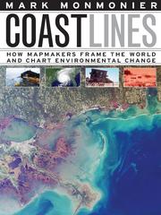
In the next century, sea levels are predicted to rise at unprecedented rates, causing flooding around the world, from the islands of Malaysia and the canals of Venice to the coasts of Florida and California. These rising water levels pose serious challenges to all aspects of coastal existence-chiefly economic, residential, and environmental-as well as to the cartographic definition and mapping of coasts. It is this facet of coastal life that Mark Monmonier tackles in Coast Lines. Setting sail on a journey across shifting landscapes, cartographic technology, and climate change, Monmonier reveals that coastlines are as much a set of ideas, assumptions, and societal beliefs as they are solid black lines on maps. Whether for sailing charts or property maps, Monmonier shows, coastlines challenge mapmakers to capture on paper a highly irregular land-water boundary perturbed by tides and storms and complicated by rocks, wrecks, and shoals. Coast Lines is peppered with captivating anecdotes about the frustrating effort to expunge fictitious islands from nautical charts, the tricky measurement of a coastline's length, and the contentious notions of beachfront property and public access. Combing maritime history and the history of technology, Coast Lines charts the historical progression from offshore sketches to satellite images and explores the societal impact of coastal cartography on everything from global warming to homeland security. Returning to the form of his celebrated Air Apparent, Monmonier ably renders the topic of coastal cartography accessible to both general readers and historians of science, technology, and maritime studies. In the post-Katrina era, when the map of entire regions can be redrawn by a single natural event, the issues he raises are more important than ever.
Coastal mapping. --- Environmental monitoring. --- Biomonitoring (Ecology) --- Ecological monitoring --- Environmental quality --- Monitoring, Environmental --- Applied ecology --- Environmental engineering --- Pollution --- Charting, Coastal --- Coast mapping --- Coastal charting --- Coastal zone mapping --- Coastline mapping --- Coasts --- Cartography --- Measurement --- Monitoring --- Charting --- Mapping --- mapmaking, cartography, geography, climate change, global warming, environment, nature, environmentalism, sea levels, flooding, natural disaster, extreme weather, malaysia, canals, venice, coasts, florida, california, coastline, technology, science, nonfiction, nautical charts, public access, beachfront property, tides, storms, shipwreck, shoals, satellite images, homeland security, maritime, environmental monitoring, coastal mapping.
Book
ISBN: 1315181525 1498731554 148223047X 9781482230475 9781498731553 9781315181523 9781498731546 9781351722308 1351722301 9781351722551 1351722557 Year: 2017 Publisher: Boca Raton : CRC Press,
Abstract | Keywords | Export | Availability | Bookmark
Loading...Choose an application
- Reference Manager
- EndNote
- RefWorks (Direct export to RefWorks)
Oceanography --- Coastal zone management --- Coastal mapping. --- Geoinformatics. --- Oceanography, Physical --- Oceanology --- Physical oceanography --- Thalassography --- Earth sciences --- Marine sciences --- Ocean --- Computer science --- Charting, Coastal --- Coast mapping --- Coastal charting --- Coastal zone mapping --- Coastline mapping --- Coasts --- Cartography --- Coast ecosystem management --- Coastal ecosystem management --- Coastal management --- Coastal resource management --- Coastal resources management --- Coastal zone ecosystem management --- CRM (Coastal resource management) --- Zone management, Coastal --- Ecosystem management --- Natural resources --- Regional planning --- Coastal engineering --- Remote sensing. --- Geographic information systems. --- Data processing --- Charting --- Mapping --- Management
| Listing 1 - 4 of 4 |
Sort by
|