
 Search
 Feedback
 About UniCat
  Help
Help News
News
| Listing 1 - 10 of 25 | << page >> |
Sort by
|
ISBN: 0226534200 0226534219 Year: 1996 Publisher: Chicago (Ill.) University of Chicago Press
Abstract | Keywords | Export | Availability | Bookmark
 Loading...
Choose an application
- Reference Manager
- EndNote
- RefWorks (Direct export to RefWorks)
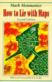
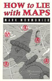
Originally published to wide acclaim, this illustrated essay on the use and abuse of maps teaches us how to evaluate maps critically and promotes a healthy skepticism about these easy-to-manipulate models of reality. To show how maps distort, Monmonier introduces basic principles of mapmaking, gives entertaining examples of the misuse of maps in situations from zoning disputes to census reports, and covers all the typical kinds of distortions from deliberate oversimplifications to the misleading use of color.
Cartography. --- Deception. --- Geodesy. Cartography --- Maps --- Cartography --- Deception --- Cartes --- Cartographie --- Tromperie --- Analysis --- Analyse --- Aardrijkskunde --- Manipulatie --- Beïnvloeding --- Cartografie --- 528.22 --- 528.9 --- 528.22 Methods of determining the figure of the Earth --- Methods of determining the figure of the Earth --- Chicanery --- Deceit --- Subterfuge --- Truthfulness and falsehood --- Intrigue --- 528.9 Cartography. Mapping (textual documents) --- Cartography. Mapping (textual documents) --- Cartography, Primitive --- Chartography --- Map-making --- Mapmaking --- Mapping (Cartography) --- Mathematical geography --- Surveying --- Map projection
Book
ISBN: 3319510401 3319510398 Year: 2017 Publisher: Cham : Springer International Publishing : Imprint: Palgrave Macmillan,
Abstract | Keywords | Export | Availability | Bookmark
Loading...Choose an application
- Reference Manager
- EndNote
- RefWorks (Direct export to RefWorks)
This book explores the US patent system, which helped practical minded innovators establish intellectual property rights and fulfill the need for achievement that motivates inventors and scholars alike. In this sense, the patent system was a parallel literature: a vetting institution similar to the conventional academic-scientific-technical journal insofar as the patent examiner was both editor and peer reviewer, while the patent attorney was a co-author or ghost writer. In probing evolving notions of novelty, non-obviousness, and cumulative innovation, Mark Monmonier examines rural address guides, folding schemes, world map projections, diverse improvements of the terrestrial globe, mechanical route-following machines that anticipated the GPS navigator, and the early electrical you-are-here mall map, which opened the way for digital cartography and provided fodder for patent trolls, who treat the patent largely as a license to litigate. .
Social sciences. --- Geographical information systems. --- Technology --- Social Sciences. --- Science and Technology Studies. --- Geographical Information Systems/Cartography. --- History of Technology. --- History. --- Cartography --- Patents --- Intellectual property --- Cartography, Primitive --- Chartography --- Map-making --- Mapmaking --- Mapping (Cartography) --- Mathematical geography --- Surveying --- Map projection --- Maps --- Technology—Sociological aspects. --- Technology-History. --- Geographical information systems --- GIS (Information systems) --- Information storage and retrieval systems --- Geography --- Technology—History.
ISBN: 1281430463 0226534294 0226534189 0226534197 9780226534299 9780226534183 9781281430465 Year: 2008 Publisher: Chicago : University of Chicago Press,
Abstract | Keywords | Export | Availability | Bookmark
Loading...Choose an application
- Reference Manager
- EndNote
- RefWorks (Direct export to RefWorks)
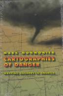
No place is perfectly safe, but some places are more dangerous than others. Whether we live on a floodplain or in "Tornado Alley," near a nuclear facility or in a neighborhood poorly lit at night, we all co-exist uneasily with natural and man-made hazards. As Mark Monmonier shows in this entertaining and immensely informative book, maps can tell us a lot about where we can anticipate certain hazards, but they can also be dangerously misleading. California, for example, takes earthquakes seriously, with a comprehensive program of seismic mapping, whereas Washington has been comparatively lax about earthquakes in Puget Sound. But as the Northridge earthquake in January 1994 demonstrated all too clearly to Californians, even reliable seismic-hazard maps can deceive anyone who misinterprets "known fault-lines" as the only places vulnerable to earthquakes. Important as it is to predict and prepare for catastrophic natural hazards, more subtle and persistent phenomena such as pollution and crime also pose serious dangers that we have to cope with on a daily basis. Hazard-zone maps highlight these more insidious hazards and raise awareness about them among planners, local officials, and the public. With the help of many maps illustrating examples from all corners of the United States, Monmonier demonstrates how hazard mapping reflects not just scientific understanding of hazards but also perceptions of risk and how risk can be reduced. Whether you live on a faultline or a coastline, near a toxic waste dump or an EMF-generating power line, you ignore this book's plain-language advice on geographic hazards and how to avoid them at your own peril. "No one should buy a home, rent an apartment, or even drink the local water without having read this fascinating cartographic alert on the dangers that lurk in our everyday lives. . . . Who has not asked where it is safe to live? Cartographies of Danger provides the answer."-H. J. de Blij, NBC News "Even if you're not interested in maps, you're almost certainly interested in hazards. And this book is one of the best places I've seen to learn about them in a highly entertaining and informative fashion."-John Casti, New Scientist
Maps. --- Natural disasters. --- Natural disasters --- Hazardous geographic environments --- Geography --- Earth & Environmental Sciences --- Physical Geography --- Maps --- Environments, Hazardous geographic --- Natural calamities --- Geografie --- Cartografie --- Toepassingen. --- Disasters --- Human ecology --- cartography, map, mapmaker, mapmaking, maps, geography, american, united states, usa, regional, academic, scholarly, research, dangerous, hazard, risk, risky, natural, manmade, disaster, seismic, nuclear, puget sound, earthquake, fault line, phenomena, pollution, coastline, geographic, safety, flooding, floodplain, crime, criminal, safe.
Digital
ISBN: 9783319510408 Year: 2017 Publisher: Cham Springer International Publishing :Imprint: Palgrave Macmillan
Abstract | Keywords | Export | Availability | Bookmark
Loading...Choose an application
- Reference Manager
- EndNote
- RefWorks (Direct export to RefWorks)
This book explores the US patent system, which helped practical minded innovators establish intellectual property rights and fulfill the need for achievement that motivates inventors and scholars alike. In this sense, the patent system was a parallel literature: a vetting institution similar to the conventional academic-scientific-technical journal insofar as the patent examiner was both editor and peer reviewer, while the patent attorney was a co-author or ghost writer. In probing evolving notions of novelty, non-obviousness, and cumulative innovation, Mark Monmonier examines rural address guides, folding schemes, world map projections, diverse improvements of the terrestrial globe, mechanical route-following machines that anticipated the GPS navigator, and the early electrical you-are-here mall map, which opened the way for digital cartography and provided fodder for patent trolls, who treat the patent largely as a license to litigate. .
Sociology of knowledge --- Higher education --- Geodesy. Cartography --- Pure sciences. Natural sciences --- Engineering sciences. Technology --- Geography --- History --- HO (hoger onderwijs) --- geodesie --- GIS (geografisch informatiesysteem) --- geschiedenis --- technologie --- wetenschappen
Book
ISBN: 9780226534695 9780226534701 9780226534718 0226534715 0226534693 0226534707 Year: 2015 Volume: 6/1-2 Publisher: Chicago: University of Chicago press,
Abstract | Keywords | Export | Availability | Bookmark
Loading...Choose an application
- Reference Manager
- EndNote
- RefWorks (Direct export to RefWorks)
Geodesy. Cartography --- anno 1900-1999 --- Cartography --- History --- 912 "19" --- 912 <09> --- Cartography. Maps. Atlasses--20e eeuw. Periode 1900-1999 --- Cartografie. Kaarten. Plattegronden. Atlassen--Geschiedenis van ... --- Cartografie. Kaarten. Plattegronden. Atlassen--Geschiedenis van .. --- Cartografie. Kaarten. Plattegronden. Atlassen--Geschiedenis van --- Cartography - History - 20th century
ISBN: 0299100707 Year: 1985 Publisher: Madison, Wis.
Abstract | Keywords | Export | Availability | Bookmark
Loading...Choose an application
- Reference Manager
- EndNote
- RefWorks (Direct export to RefWorks)
ISBN: 0226534111 Year: 1989 Publisher: Chicago London University of Chicago Press
Abstract | Keywords | Export | Availability | Bookmark
Loading...Choose an application
- Reference Manager
- EndNote
- RefWorks (Direct export to RefWorks)
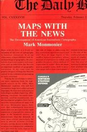
'Maps with the News' is a lively assessment of the role of cartography in American journalism. Tracing the use of maps in American news reporting from the eighteenth century to the 1980s, Mark Monmonier explores why and how journalistic maps have achieved such importance. "A most welcome and thorough investigation of a neglected aspect of both the history of cartography and modern cartographic practice."--'Mapline' "A well-written, scholarly treatment of journalistic cartography. . . . It is well researched, thoroughly indexed and referenced . . . amply illustrated."--Judith A. Tyner, 'Imago Mundi' "There is little doubt that 'Maps with the News' should be part of the training and on the desks of all those concerned with producing maps for mass consumption, and also on the bookshelves of all journalists, graphic artists, historians of cartography, and geographic educators."--W. G. V. Balchin, 'Geographical Journal' "A definitive work on journalistic cartography."--Virginia Chipperfield, 'Society of University Cartographers Bulletin'
Maps in journalism --- Geografie --- History. --- Cartografie --- Kaartgebruik. --- United States --- History
ISBN: 0226534170 0226534162 9780226534176 Year: 1993 Volume: *5 Publisher: Chicago (Ill.): University of Chicago press,
Abstract | Keywords | Export | Availability | Bookmark
Loading...Choose an application
- Reference Manager
- EndNote
- RefWorks (Direct export to RefWorks)
Writers know only too well how long it can take--and how awkward it can be--to describe spatial relationships with words alone. And while a map might not always be worth a thousand words, a good one can help writers communicate an argument or explanation clearly, succinctly, and effectively. In his acclaimed 'How to Lie with Maps,' Mark Monmonier showed how maps can distort facts. In 'Mapping it Out: Expository Cartography for the Humanities and Social Sciences,' he shows authors and scholars how they can use expository cartography--the visual, two-dimensional organization of information--to heighten the impact of their books and articles. This concise, practical book is an introduction to the fundamental principles of graphic logic and design, from the basics of scale to the complex mapping of movement or change. Monmonier helps writers and researchers decide when maps are most useful and what formats work best in a wide range of subject areas, from literary criticism to sociology. He demonstrates, for example, various techniques for representing changes and patternsdifferent typefaces and how they can either clarify or confuse informationand the effectiveness of less traditional map forms, such as visibility base maps, frame-rectangle symbols, and complementary scatterplot designs for conveying complex spatial relationships. There is also a wealth of practical information on map compilation, cartobibliographies, copyright and permissions, facsimile reproduction, and the evaluation of source materials. Appendixes discuss the benefits and limitations of electronic graphics and pen-and-ink drafting, and how to work with a cartographic illustrator. Clearly written, and filled with real-world examples, 'Mapping it Out' demystifies mapmaking for anyone writing in the humanities and social sciences. "A useful guide to a subject most people probably take too much for granted. It shows how map makers translate abstract data into eye-catching cartograms, as they are
Cartografie --- Cartographie --- Cartography --- Cartography [Primitive ] --- Chartography --- Mapping (Cartography) --- 528 --- 655.28.026 --- 528.9 --- Geodesy. Surveying. Photogrammetry. Cartography --- Zetten van specifiek drukwerk. Krantzetten. Zetten van commercieel drukwerk. Zetten van postzegels --- Cartography. Mapping (textual documents) --- Cartography. --- Humanities --- Social sciences --- Geografie --- Graphic methods. --- Algemeen. --- 528.9 Cartography. Mapping (textual documents) --- 528 Geodesy. Surveying. Photogrammetry. Cartography --- Behavioral sciences --- Human sciences --- Sciences, Social --- Social science --- Social studies --- Civilization --- Learning and scholarship --- Classical education --- Cartography, Primitive --- Map-making --- Mapmaking --- Mathematical geography --- Surveying --- Map projection --- Maps --- Graphic methods --- Humanities - Graphic methods --- Social sciences - Graphic methods
ISBN: 0226534146 0226534154 9780226534145 9780226534152 Year: 1991 Publisher: Chicago (Ill.): University of Chicago press,
Abstract | Keywords | Export | Availability | Bookmark
Loading...Choose an application
- Reference Manager
- EndNote
- RefWorks (Direct export to RefWorks)
Cartography --- Deception. --- Cartography. --- Geografie --- Cartografie --- Kaartgebruik.
Book
ISBN: 0131653083 9780131653085 Year: 1982 Publisher: Englewood Cliffs (NJ): Prentice Hall,
Abstract | Keywords | Export | Availability | Bookmark
Loading...Choose an application
- Reference Manager
- EndNote
- RefWorks (Direct export to RefWorks)
| Listing 1 - 10 of 25 | << page >> |
Sort by
|