| Listing 1 - 8 of 8 |
Sort by
|
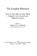
ISBN: 0520035224 9780520035225 Year: 1978 Volume: 3 Publisher: Berkeley (Calif.): University of California press,
Abstract | Keywords | Export | Availability | Bookmark
 Loading...
Choose an application
- Reference Manager
- EndNote
- RefWorks (Direct export to RefWorks)
Geodesy. Cartography
---
anno 1500-1799
---
Great Britain
---
Cartography
---
History
---
912 <09> <41>
---
912 "16"
---
912 "17"
---
912 <26>
---
912:551.46
---
912.643
---
094.1 <41 LONDON>
---
Cartografie. Kaarten. Plattegronden. Atlassen--Geschiedenis van ...--Verenigd Koninkrijk van Groot-Brittannië en Noord-Ierland
---
Cartografie. Kaarten. Plattegronden. Atlassen--17e eeuw. Periode 1600-1699
---
Cartografie. Kaarten. Plattegronden. Atlassen--18e eeuw. Periode 1700-1799
---
Cartografie. Kaarten. Plattegronden. Atlassen--Oceanen. Zeeën. Zeestraten en zeeverbindingen
---
Kaarten. Atlassen: oceanen
---
Globes
---
Oude drukken: bibliografie--
Book
ISBN: 0520048768 Year: 1984 Volume: vol 11 Publisher: Berleley Los Angeles London University of California Press
Abstract | Keywords | Export | Availability | Bookmark
 Loading...
Choose an application
- Reference Manager
- EndNote
- RefWorks (Direct export to RefWorks)
Voyages around the world --- Circumnavigation --- Journeys --- Tours around the world --- Travel books --- Travels --- Trips around the world --- International travel --- Voyages and travels --- Drake, Francis Sir --- -Travel --- History --- Drake, Francis, --- Draeck, Franciscus, --- Draque, Francisco, --- Dreĭk, Frėnsis, --- Travel. --- Drake (Francis). Voyage autour du monde, 1577-1580. --- Drake (Francis). Wereldreis, 1577-1580. --- Дрейк, Фрэнсис, --- Drake, Francis --- Draeck, Franciscus --- Draque, Francisco --- Dreĭk, Frėnsis --- Дрейк, Фрэнсис

ISBN: 1282005014 9786612005015 0226799751 9780226799759 9780226799742 0226799743 Year: 2007 Publisher: Chicago : University of Chicago Press,
Abstract | Keywords | Export | Availability | Bookmark
 Loading...
Choose an application
- Reference Manager
- EndNote
- RefWorks (Direct export to RefWorks)
In this concise introduction to the history of cartography, Norman J. W. Thrower charts the intimate links between maps and history from antiquity to the present day. A wealth of illustrations, including the oldest known map and contemporary examples made using Geographical Information Systems (GIS), illuminate the many ways in which various human cultures have interpreted spatial relationships. The third edition of Maps and Civilization incorporates numerous revisions, features new material throughout the book, and includes a new alphabetized bibliography. Praise for previous editions of Maps and Civilization: "A marvelous compendium of map lore. Anyone truly interested in the development of cartography will want to have his or her own copy to annotate, underline, and index for handy referencing."-L. M. Sebert, Geomatica
Cartography --- Maps --- History. --- History --- Geografie --- Cartografie --- Algemeen. --- mapmaking, civics, cartographer, cartography, culture, cultural, social studies, communication, history, historical, antiquity, ancient world, modern, contemporary, academic, scholarly, research, illustrated, illustrations, geography, geographical, gis, spatial, asia, south, east, eastern, western, southern, europe, islam, middle ages, renaissance, time period, era, enlightenment, 19th century.
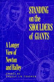
ISBN: 0520065891 Year: 1990 Publisher: Berkeley Los Angeles Oxford University of California Press
Abstract | Keywords | Export | Availability | Bookmark
 Loading...
Choose an application
- Reference Manager
- EndNote
- RefWorks (Direct export to RefWorks)
Book
Year: 1978 Publisher: Berkeley, CA ; Los Angeles, CA : University of California Press,
Abstract | Keywords | Export | Availability | Bookmark
 Loading...
Choose an application
- Reference Manager
- EndNote
- RefWorks (Direct export to RefWorks)
Cartographie --- Histoire --- Angleterre --- 17e-18e siecles
Book
ISBN: 1280491566 9786613586797 0820343595 9780820343594 9781280491566 0820321575 9780820321578 661358679X Year: 2000 Publisher: Athens London The University of Georgia Press
Abstract | Keywords | Export | Availability | Bookmark
 Loading...
Choose an application
- Reference Manager
- EndNote
- RefWorks (Direct export to RefWorks)
This detailed study of the 1513 Piri Reis world map offers commentary and explication of a major milestone in cartography. It aims to disprove dubious conclusions drawn and clarify longstanding mysteries in order to open up new ways of looking at the history of exploration.
World maps --- Pirı̂ Reis, --- Pirî Reis, --- Ahmet Muhiddin Piri, --- Pı̄rı̄ Muḥyi ʼl-Dīn Reʼis, --- Pirî, --- Piri
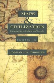
ISBN: 0226799735 Year: 1999 Publisher: Chicago ; London University of Chicago Press
Abstract | Keywords | Export | Availability | Bookmark
 Loading...
Choose an application
- Reference Manager
- EndNote
- RefWorks (Direct export to RefWorks)
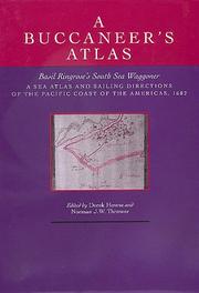
ISBN: 0520054105 058521316X Year: 1992 Publisher: Berkeley : University of California Press,
Abstract | Keywords | Export | Availability | Bookmark
 Loading...
Choose an application
- Reference Manager
- EndNote
- RefWorks (Direct export to RefWorks)
Nautical charts --- Pilot guides --- Geography --- Earth & Environmental Sciences --- Atlases & Maps --- Early works to 1800 --- Facsimiles. --- Charts, Nautical --- Hydrographic charts --- Inland navigation --- Navigation --- Navigation charts --- Navigation maps --- Pilot charts --- Coast-pilot guides --- Aids to navigation --- Maps --- Nautical paraphernalia --- Notices to mariners --- Pilots and pilotage --- Air-pilot guides
| Listing 1 - 8 of 8 |
Sort by
|

 Search
 Feedback
 About UniCat
  Help
Help News
News