| Listing 1 - 10 of 13 | << page >> |
Sort by
|
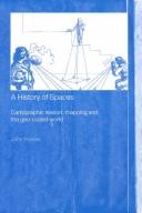
ISBN: 0415144981 0415144973 9781135104849 1135104840 9780203351437 0203351436 9780415144971 9780415144988 9781135104986 1135104980 9781135104917 1135104913 1283841266 9780415144981 Year: 2004 Publisher: London Routledge
Abstract | Keywords | Export | Availability | Bookmark
 Loading...
Choose an application
- Reference Manager
- EndNote
- RefWorks (Direct export to RefWorks)
This book provides an essential insight into the practices and ideas of maps and map-making. It draws on a wide range of social theorists, and theorists of maps and cartography, to show how maps and map-making have shaped the spaces in which we live.Going beyond the focus of traditional cartography, the book draws on examples of the use of maps from the sixteenth century to the present, including their role in projects of the national and colonial state, emergent capitalism and the planetary consciousness of the natural sciences. It also considers the use of maps for military purposes, ma
Physical geography --- Geodesy. Cartography --- Cartography --- Cartography. --- Geografie --- Cartografie --- Historische Cartografie. --- Maps. --- Plans --- Cartographic materials --- Geography --- Cartography, Primitive --- Chartography --- Map-making --- Mapmaking --- Mapping (Cartography) --- Mathematical geography --- Surveying --- Map projection --- Maps
Multi
ISBN: 393035764X Year: 2004 Volume: 23 Publisher: Berlin ; München : Universitätsbibliothek Erlangen-Nürnberg,
Abstract | Keywords | Export | Availability | Bookmark
 Loading...
Choose an application
- Reference Manager
- EndNote
- RefWorks (Direct export to RefWorks)
Astronomy --- Cartography --- Earth sciences --- Geosciences --- Environmental sciences --- Physical sciences --- Cartography, Primitive --- Chartography --- Map-making --- Mapmaking --- Mapping (Cartography) --- Mathematical geography --- Surveying --- Map projection --- Maps --- Space sciences --- Boerner, Wolfgang-Martin. --- Keydel, Wolfgang.

ISBN: 0415967910 9780415967914 0203505425 9780203505427 9786610224098 6610224099 1280224096 9781280224096 1135884951 113588496X 9781135884918 9781135884956 9781135884963 9780415803427 Year: 2004 Volume: 22 Publisher: New York Routledge
Abstract | Keywords | Export | Availability | Bookmark
 Loading...
Choose an application
- Reference Manager
- EndNote
- RefWorks (Direct export to RefWorks)
This book chronicles the specific technologies, material and epistemological, by which the map - a peculiar artefact, part image and part treatise - shows itself capable of accessing, organizing and reorienting a tremendous range of information.
Cartography --- Cartographie --- History --- Social aspects --- Histoire --- Aspect social --- 912 "04/14" --- 912 <09> <41> --- Cartografie. Kaarten. Plattegronden. Atlassen--Middeleeuwen --- Cartografie. Kaarten. Plattegronden. Atlassen--Geschiedenis van ...--Verenigd Koninkrijk van Groot-Brittannië en Noord-Ierland --- Cartography, Primitive --- Chartography --- Map-making --- Mapmaking --- Mapping (Cartography) --- Mathematical geography --- Surveying --- Map projection --- Maps --- Great Britain
Book
ISSN: 00719234 ISBN: 3980888800 Year: 2004 Volume: 66 Publisher: Frankfurt am Main Frankfürter Geographische Gesellschaft
Abstract | Keywords | Export | Availability | Bookmark
 Loading...
Choose an application
- Reference Manager
- EndNote
- RefWorks (Direct export to RefWorks)
Geography. --- Géographie --- Cartographers --- Cartography --- Early maps --- Maps, Early --- Geography --- Cartography, Primitive --- Chartography --- Map-making --- Mapmaking --- Mapping (Cartography) --- Mathematical geography --- Surveying --- Map projection --- Maps --- Mapmakers --- Earth scientists --- History --- Majorca (Spain) --- Balearis Major (Spain) --- Isla de Mallorca (Spain) --- Majorica (Spain) --- Mallorca (Spain : Island) --- Majorque (Spain)
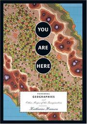
ISBN: 1568984308 9781568984308 Year: 2004 Publisher: New York, N.Y. Princeton Archetectural Press
Abstract | Keywords | Export | Availability | Bookmark
 Loading...
Choose an application
- Reference Manager
- EndNote
- RefWorks (Direct export to RefWorks)
Cartography. --- Cartographie --- Thema's in de kunst ; cartografie ; imaginaire geografische kaarten --- 7.049 --- cartografie --- grafisch design --- grafisch ontwerp --- kunst --- 766.022 --- grafische vormgeving --- informatiedesign --- Iconografie ; verschillende onderwerpen --- scientific illustrations [images] --- illustratieve vormgeving --- Graphic arts --- wetenschappelijke illustraties --- visuele communicatie --- Cartography --- Thematic maps --- Single-topic maps --- Special-purpose maps --- Maps --- Cartography, Primitive --- Chartography --- Map-making --- Mapmaking --- Mapping (Cartography) --- Mathematical geography --- Surveying --- Map projection
Periodical
ISSN: 18365655 14498596 Year: 2004 Publisher: East Perth Spatial Science Institute
Abstract | Keywords | Export | Availability | Bookmark
 Loading...
Choose an application
- Reference Manager
- EndNote
- RefWorks (Direct export to RefWorks)
Environmental planning --- Geography --- Geographic information systems --- Cartography --- Surveying --- Geodesy --- Photogrammetry --- Systèmes d'information géographique --- Cartographie --- Arpentage --- Géodésie --- Photogrammétrie --- Cartography. --- Geodesy. --- Geographic information systems. --- Photogrammetry. --- Surveying. --- Cities and towns --- City surveying --- Land surveying --- Photographic measurements --- Stereophotogrammetry --- Geographical information systems --- GIS (Information systems) --- Degrees of latitude and longitude --- Geodetics --- Cartography, Primitive --- Chartography --- Map-making --- Mapmaking --- Mapping (Cartography) --- Engineering --- Geomatics --- Information storage and retrieval systems --- Geophysics --- Mathematical geography --- Map projection --- Maps --- Image analysis

ISBN: 9061942497 9789061942498 9789004475281 9004475281 Year: 2004 Volume: 3 Publisher: 't Goy-Houten Hes & De Graaf
Abstract | Keywords | Export | Availability | Bookmark
 Loading...
Choose an application
- Reference Manager
- EndNote
- RefWorks (Direct export to RefWorks)
Petermann's Maps focuses on the maps published in the famous German journal Petermanns Geographische Mitteilungen . This journal, which still exists today, greatly influenced the development of scientific geography and cartography in Germany in the nineteenth century. Numerous articles have been published by recognized experts in this field, along with a multitude of illustrations, showing maps, prints and photographs. The journal developed into an important publication, setting the standard in the history of the great expeditions and discoveries, and European colonial matters. Petermann's Maps contains a bibliography of over 3400 maps, the complete series of maps published in Petermanns Geographische Mitteilungen between the year of its foundation, 1855, to the end of the Second World War. Besides the bibliography 160 of the most attractive geographical and thematic coloured maps are included in Petermann's Maps . These maps can also be viewed on the CD-ROM accompanying the book.An extensive introduction precedes the cartobibliography proper, placing Petermanns Geographische Mitteilungen in its historical context. The introduction describes the history of geography from the eighteenth century onwards, outlining the development of the study of the science of cartography in Germany. The major role the founder of the journal, Augustus Petermann (1822-1878), and the publishing house Justus Perthes in Gotha played in these developments is discussed at length.
Geodesy. Cartography --- anno 1800-1999 --- 912 <01> --- 912 <05> --- 655.41 <43 GOTHA> --- 655.3.026 --- Cartografie. Kaarten. Plattegronden. Atlassen--Bibliografieën. Catalogi --- Cartografie. Kaarten. Plattegronden. Atlassen--Tijdschriften --- Uitgeverij--algemeen--Duitsland voor 1945 en na 1989--GOTHA --- Drukken van specifiek drukwerk. Drukken van kranten, postzegels, kaarten, commercieel drukwerk --- Cartography --- Geography --- Maps --- History --- Petermann, A. --- Petermanns geographische Mitteilungen --- Plans --- Cartographic materials --- Cosmography --- Earth sciences --- World history --- Cartography, Primitive --- Chartography --- Map-making --- Mapmaking --- Mapping (Cartography) --- Mathematical geography --- Surveying --- Map projection --- Petermann, August Heinrich, --- Petermann, Augustus,

ISBN: 0007100809 9780007100804 Year: 2004 Publisher: London HarperCollins
Abstract | Keywords | Export | Availability | Bookmark
 Loading...
Choose an application
- Reference Manager
- EndNote
- RefWorks (Direct export to RefWorks)
912 <09> <493> --- 912 "15" --- 929 MERCATOR, GERARDUS --- Cartografie. Kaarten. Plattegronden. Atlassen--Geschiedenis van ...--België --- Cartografie. Kaarten. Plattegronden. Atlassen--16e eeuw. Periode 1500-1599 --- Biografie. Genealogie. Heraldiek--MERCATOR, GERARDUS --- 929 MERCATOR, GERARDUS Biografie. Genealogie. Heraldiek--MERCATOR, GERARDUS --- Cartographers --- Cartography --- Cartography, Primitive --- Chartography --- Map-making --- Mapmaking --- Mapping (Cartography) --- Mathematical geography --- Surveying --- Map projection --- Maps --- Mapmakers --- Earth scientists --- History --- Mercator, Gerhard, --- Merkator, Gerard, --- Kremer, Gerhard, --- Cremer, Gérard de, --- Cremers, Gerardus, --- Mercator, Gerardus, --- Mercator, Gerard, --- Mercatore, Gerardo, --- Mercator, Gerard
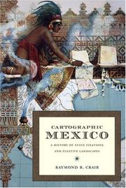
ISBN: 0822334054 082233416X 0822385945 Year: 2004 Publisher: Durham Duke university press
Abstract | Keywords | Export | Availability | Bookmark
 Loading...
Choose an application
- Reference Manager
- EndNote
- RefWorks (Direct export to RefWorks)
Cartography --- Geographical perception --- Land tenure --- Political geography --- Cartography, Primitive --- Chartography --- Map-making --- Mapmaking --- Mapping (Cartography) --- Mathematical geography --- Surveying --- Map projection --- Maps --- Geography, Political --- Human geography --- Environmental perception --- Maps, Mental --- Mental maps --- Perceptual cartography --- Perceptual maps --- Perception --- Orientation (Psychology) --- Space perception --- History --- Political aspects --- Mexico --- Anáhuac --- Estados Unidos Mexicanos --- Maxico --- Méjico --- Mekishiko --- Meḳsiḳe --- Meksiko --- Meksyk --- Messico --- Mexique (Country) --- República Mexicana --- Stany Zjednoczone Meksyku --- United Mexican States --- United States of Mexico --- מקסיקו --- メキシコ --- Historical geography.
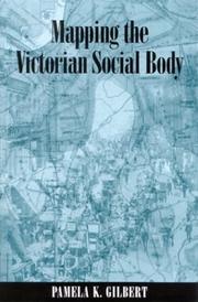
ISBN: 0791485331 1417575840 9781417575848 0791460266 9780791460269 0791460258 9780791460252 9780791485330 Year: 2004 Publisher: Albany State University of New York Press
Abstract | Keywords | Export | Availability | Bookmark
 Loading...
Choose an application
- Reference Manager
- EndNote
- RefWorks (Direct export to RefWorks)
Explores how medical and social maps helped shape modern perceptions of space.
AIDS (Disease) --- Cholera --- Cartography --- Medical geography --- Acquired immune deficiency syndrome --- Acquired immunodeficiency syndrome --- Acquired immunological deficiency syndrome --- HIV infections --- Immunological deficiency syndromes --- Virus-induced immunosuppression --- Asiatic cholera --- Cholera, Asiatic --- Vibrio infections --- Cartography, Primitive --- Chartography --- Map-making --- Mapmaking --- Mapping (Cartography) --- Mathematical geography --- Surveying --- Map projection --- Maps --- Diseases --- Geographical distribution of diseases --- Geographical pathology --- Geography, Medical --- Geomedicine --- Medical topography --- Pathology, Geographic --- Topography, Medical --- Geography --- Medical climatology --- World health --- History --- Geographical distribution
| Listing 1 - 10 of 13 | << page >> |
Sort by
|

 Search
 Feedback
 About UniCat
  Help
Help News
News