| Listing 1 - 10 of 129 | << page >> |
Sort by
|

ISBN: 9780080541501 008054150X 9780080428505 0080428509 1281058661 9786611058661 Year: 1997 Publisher: [Amsterdam] : Pergamon,
Abstract | Keywords | Export | Availability | Bookmark
 Loading...
Choose an application
- Reference Manager
- EndNote
- RefWorks (Direct export to RefWorks)
This volume contains the proceedings from the COSPAR Colloquium on ""Space Remote Sensing of Subtropical Oceans"" which took place between 12 and 16 September, 1996, at the Institute of Oceanography of the National Taiwan University. Included are contributions addressing the issue, from scientific points of views, of why the first scientific satellite of Taiwan, ROCSAT-1, should be equipped with the Ocean Colour Imager (OCI) for oceanographic investigations.
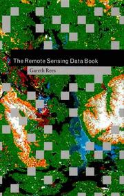
ISBN: 052148040X Year: 1999 Publisher: Cambridge Cambridge University Press
Abstract | Keywords | Export | Availability | Bookmark
 Loading...
Choose an application
- Reference Manager
- EndNote
- RefWorks (Direct export to RefWorks)
The Remote Sensing Data Book provides a unique resource of all aspects of remote sensing for the expert and non-expert alike. Organised as a dictionary, it contains over 700 alphabetically-arranged and cross-referenced entries on how remote sensing works, what kinds of data are available, and the large number of satellites and instruments from which the information is obtained. As well as short technical definitions, it also includes longer essays and reviews to give an overview of the subject. Although not a textbook in itself, the data book will serve as a valuable addition to existing textbooks for undergraduates and graduate students on geography, environmental and earth science courses that include an element of remote sensing. It will also be an essential reference for researchers and research managers at all levels using spaceborne remote sensing methods to obtain information about the earth's land, sea, ice and atmosphere.
Book
ISBN: 9781420055122 Year: 2009 Publisher: Boca Raton, Fla CRC Press
Abstract | Keywords | Export | Availability | Bookmark
 Loading...
Choose an application
- Reference Manager
- EndNote
- RefWorks (Direct export to RefWorks)
Book
ISBN: 3110072785 3111089282 3111456706 Year: 1977 Publisher: Berlin de Gruyter
Abstract | Keywords | Export | Availability | Bookmark
 Loading...
Choose an application
- Reference Manager
- EndNote
- RefWorks (Direct export to RefWorks)
To celebrate the 270th anniversary of the De Gruyter publishing house, the company is providing permanent open access to 270 selected treasures from the De Gruyter Book Archive. Titles will be made available to anyone, anywhere at any time that might be interested. The DGBA project seeks to digitize the entire backlist of titles published since 1749 to ensure that future generations have digital access to the high-quality primary sources that De Gruyter has published over the centuries.
Hydrosphere --- Coasts --- Oceanography --- Remote sensing.
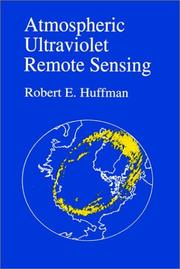
ISBN: 9780080918808 0080918808 1282168401 9781282168404 9786612168406 0123603900 9780123603906 Year: 1992 Publisher: Boston : Academic Press,
Abstract | Keywords | Export | Availability | Bookmark
 Loading...
Choose an application
- Reference Manager
- EndNote
- RefWorks (Direct export to RefWorks)
This book is an introduction to the use of the ultraviolet for remote sensing of the Earth's atmosphere. It covers the Earth's UV radiative environment, experimental techniques, and current applications. it is my intention to provide the information needed to ""make a first approximation"" concerning the use of the ultraviolet and to provide access through the literature for a more thorough study.* Contains recent UV applications not previously available in book form such as ozone, auroral images, and ionospheric sensing* Features broad coverage of fundamentals of atmospheric geo
Book
ISBN: 0412299305 0442313470 Year: 1991 Publisher: London Chapmann & Hall
Abstract | Keywords | Export | Availability | Bookmark
 Loading...
Choose an application
- Reference Manager
- EndNote
- RefWorks (Direct export to RefWorks)
Biological techniques --- Forestry --- Phanerogams --- Forests --- Forests and forestry --- Environmental Sciences and Forestry. Remote Sensing and Geographical Information Systems --- Remote sensing --- Remote sensing. --- Remote Sensing --- Remote Sensing.
ISBN: 9781566706544 1566706548 9780429138386 9781138747180 Year: 2008 Publisher: Boca Raton (Fla.) : CRC press,
Abstract | Keywords | Export | Availability | Bookmark
 Loading...
Choose an application
- Reference Manager
- EndNote
- RefWorks (Direct export to RefWorks)
ISBN: 0250402033 9780250402038 Year: 1978 Publisher: Ann Arbor: Ann Arbor science,
Abstract | Keywords | Export | Availability | Bookmark
 Loading...
Choose an application
- Reference Manager
- EndNote
- RefWorks (Direct export to RefWorks)
Biological techniques --- Electromagnetism. Ferromagnetism --- Remote sensing
Multi
ISBN: 0128181125 9780128181126 0128181117 9780128181119 Year: 2020 Publisher: Cambridge, MA : Gulf Professional Publishing, an imprint of Elsevier,
Abstract | Keywords | Export | Availability | Bookmark
 Loading...
Choose an application
- Reference Manager
- EndNote
- RefWorks (Direct export to RefWorks)
"Synthetic Aperture Radar Imaging Mechanism for Oil Spills delivers the critical tool needed to understand the latest technology in radar imaging of oil spills, particularly microwave radar as a main source to understand analysis and applications in the field of marine pollution. Filling the gap between modern physics quantum theory and applications of radar imaging of oil spills, this reference is packed with technical details associated with the potentiality of synthetic aperture radar (SAR) and the key methods used to extract the value-added information necessary such as location, size, perimeter, and chemical details of the oil slick from SAR measurements. Rounding out with practical simulation trajectory movements of oil spills using radar images, Synthetic Aperture Radar Imaging Mechanism for Oil Spills brings an effective new source of technology and applications for today's oil and marine pollution engineers"--
Oil spills --- Synthetic aperture radar. --- Remote sensing.
Multi
ISBN: 9780128207314 0128207310 0128207302 9780128207307 Year: 2020 Publisher: Amsterdam, Netherlands : Elsevier,
Abstract | Keywords | Export | Availability | Bookmark
 Loading...
Choose an application
- Reference Manager
- EndNote
- RefWorks (Direct export to RefWorks)
Urban Ecology covers the latest theoretical and applied concepts in urban ecological research. This book covers the key environmental issues of urban ecosystems as well as the human-centric issues, particularly those of governance, economics, sociology and human health. The goal of Urban Ecology is to challenge readers' thinking around urban ecology from a resource-based approach to a holistic and applied field for sustainable development. There are seven major themes of the book: emerging urban concepts and urbanization, land use/land cover change, urban social-ecological systems, urban environment, urban material balance, smart, healthy and sustainable cities and sustainable urban design. Within each section, key concepts such as monitoring the urbanization phenomena, land use cover, urban soil fluxes, urban metabolism, pollution and human health and sustainable cities are covered. Urban Ecology serves as a comprehensive and advanced book for students, researchers, practitioners and policymakers in urban ecology and urban environmental research, planning and practice. --
Urban ecology (Sociology) --- Remote sensing. --- Research --- Methodology.
| Listing 1 - 10 of 129 | << page >> |
Sort by
|

 Search
 Feedback
 About UniCat
  Help
Help News
News