| Listing 1 - 8 of 8 |
Sort by
|
Book
Year: 2003 Publisher: Gaithersburg, MD : U.S. Dept. of Commerce, National Institute of Standards and Technology,
Abstract | Keywords | Export | Availability | Bookmark
 Loading...
Choose an application
- Reference Manager
- EndNote
- RefWorks (Direct export to RefWorks)
Book
Year: 2003 Publisher: [Emmitsburg, Md.] : Federal Emergency Management Agency, U.S. Fire Administration, National Fire Data Center,
Abstract | Keywords | Export | Availability | Bookmark
 Loading...
Choose an application
- Reference Manager
- EndNote
- RefWorks (Direct export to RefWorks)
Fire extinction --- Fire fighters --- Accidents. --- Mortality
Book
Year: 2003 Publisher: [Emmitsburg, MD] : Gaithersburg, MD : Dept. of Homeland Security, Federal Emergency Management Agency, U.S. Fire Administration ; U.S. Dept. of Commerce, Technology Administration, National Institute of Standards and Technology,
Abstract | Keywords | Export | Availability | Bookmark
 Loading...
Choose an application
- Reference Manager
- EndNote
- RefWorks (Direct export to RefWorks)
Ceilings. --- Fire sprinklers. --- Fire extinction --- Equipment and supplies.
Book
Year: 2003 Publisher: Washington, D.C. : National Wildfire Coordinating Group,
Abstract | Keywords | Export | Availability | Bookmark
 Loading...
Choose an application
- Reference Manager
- EndNote
- RefWorks (Direct export to RefWorks)
Forest fires --- Fire extinction --- Prevention and control --- Equipment and supplies
Book
Year: 2003 Publisher: [Emmitsburg, Md.] : Federal Emergency Management Agency, U.S. Fire Administration, National Fire Data Center,
Abstract | Keywords | Export | Availability | Bookmark
 Loading...
Choose an application
- Reference Manager
- EndNote
- RefWorks (Direct export to RefWorks)
Command and control at fires. --- Fire extinction --- Rescue work. --- Teams in the workplace. --- Fire fighters. --- Safety measures.
Book
Year: 2003 Publisher: [Washington, D.C.] : U.S. Department of Homeland Security,
Abstract | Keywords | Export | Availability | Bookmark
 Loading...
Choose an application
- Reference Manager
- EndNote
- RefWorks (Direct export to RefWorks)
Hazardous substances --- Flammable materials --- Command and control at fires --- Fire extinction --- Fire fighters --- Study and teaching --- Safety measures --- Training of

ISBN: 1421412500 9781421412504 0801867916 9780801867910 1421407620 9781421407623 Year: 2003 Publisher: Baltimore
Abstract | Keywords | Export | Availability | Bookmark
 Loading...
Choose an application
- Reference Manager
- EndNote
- RefWorks (Direct export to RefWorks)
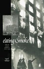
By comparing the simple skills employed by firefighters--climbing ladders and manipulating hoses--with the mundane technologies--maps and accounting charts--of insurers, the author demonstrates that the daily routines of both groups were instrumental in making intense urban and industrial expansion a less precarious endeavor.
Fire extinction --- Buildings --- Extinction of fires --- Fighting of fires --- Fire fighting --- Fire suppression --- Firefighting --- Fire prevention --- Public safety --- Insurance engineering --- History. --- Fires and fire prevention --- Fire safety --- Fires --- Prevention of fires --- Fire protection engineering --- Prevention

ISBN: 1281933716 9786611933715 9812791175 9789812791177 981238569X 9789812385697 Year: 2003 Publisher: River Edge, N.J. World Scientific
Abstract | Keywords | Export | Availability | Bookmark
 Loading...
Choose an application
- Reference Manager
- EndNote
- RefWorks (Direct export to RefWorks)
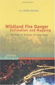
The book presents a wide range of techniques for extracting information from satellite remote sensing images in forest fire danger assessment. It covers the main concepts involved in fire danger rating, and analyses the inputs derived from remotely sensed data for mapping fire danger at both the local and global scale. The questions addressed concern the estimation of fuel moisture content, the description of fuel structural properties, the estimation of meteorological danger indices, the analysis of human factors associated with fire ignition, and the integration of different risk factors in
Fire risk assessment. --- Forest fire forecasting. --- Remote sensing. --- Vegetation mapping. --- Wildfires --- Remote-sensing imagery --- Remote sensing systems --- Remote terrain sensing --- Sensing, Remote --- Terrain sensing, Remote --- Aerial photogrammetry --- Aerospace telemetry --- Detectors --- Space optics --- Fire extinction --- Fire prevention --- Plant mapping --- Plants --- Cartography --- Fire hazard analysis --- Fire hazard assessment --- Fire risk analysis --- Fires --- Hazard analysis, Fire --- Hazard assessment, Fire --- Risk analysis, Fire --- Risk assessment --- Forecasting, Forest fire --- Forest fires --- Wildfire forecasting --- Prevention and control. --- Mapping --- Forecasting --- Prevention and control
| Listing 1 - 8 of 8 |
Sort by
|

 Search
 Feedback
 About UniCat
  Help
Help News
News